
Oak Bluffs, Massachusetts facts for kids
Quick facts for kids
Oak Bluffs, Massachusetts
Ogkeshkuppe
|
|||
|---|---|---|---|

A row of cottages in the Campground area
|
|||
|
|||

Location in Dukes County in Massachusetts
|
|||
| Country | United States | ||
| State | Massachusetts | ||
| County | Dukes | ||
| Settled by Europeans | 1642 | ||
| Incorporated | February 17, 1880 | ||
| Name Change | January 25, 1907 | ||
| Government | |||
| • Type | Open town meeting | ||
| Area | |||
| • Total | 26.0 sq mi (67.2 km2) | ||
| • Land | 7.4 sq mi (19.1 km2) | ||
| • Water | 18.6 sq mi (48.1 km2) | ||
| Elevation | 30 ft (9 m) | ||
| Population
(2020)
|
|||
| • Total | 5,341 | ||
| • Density | 205.4/sq mi (79.48/km2) | ||
| Time zone | UTC−5 (Eastern) | ||
| • Summer (DST) | UTC−4 (Eastern) | ||
| ZIP Code |
02557
|
||
| Area code(s) | 508/774 | ||
| FIPS code | 25-50390 | ||
| GNIS feature ID | 0619442 | ||
| Website | www.oakbluffsma.gov | ||


Oak Bluffs is a town located on Martha's Vineyard island in Dukes County, Massachusetts, United States. In 2020, about 5,341 people lived there. It is a main spot for summer visitors coming to the island.
Oak Bluffs is famous for its unique "gingerbread cottages." These are old buildings from the mid-to-late 1800s that are very well-preserved. The town has also been an important place for African American culture for a long time.
Contents
History of Oak Bluffs
The first people to live in the area now called Oak Bluffs were the Wampanoag people. They have lived on Martha's Vineyard for about 10,000 years. The Wampanoag name for this area was "Ogkeshkuppe." This means "damp or wet thicket or woods."
How Oak Bluffs Started
Europeans settled here in 1642. The area was part of Edgartown until 1880. Then, it became its own town called Cottage City. In 1907, the town changed its name to Oak Bluffs. It was named for the oak trees growing on the bluffs (cliffs) overlooking Nantucket Sound.
Oak Bluffs was special because it was the only town on the island that was planned from the start. It was designed specifically for tourism.
African American History in Oak Bluffs
People of African descent first came to Martha's Vineyard in the 1600s. They were enslaved people from West Africa who worked on farms. In the 1700s, the Oak Bluffs harbor attracted freed slaves, workers, and sailors. White locals even sold them land.
After slavery ended, many Black people came to work in the fishing industry. This brought more Black residents from mainland Massachusetts. They started businesses to serve the growing island population. In the 1800s, some Black workers also worked in hotels or as servants.
Later, in the late 1800s and 1900s, middle-class Black families bought or rented summer homes. Many of their children and grandchildren still visit every year. People who were formerly enslaved, or their families, bought land near Baptist Temple Park in the early 1900s. They were drawn by the religious services held there. Teachers, politicians, lawyers, doctors, artists, musicians, and business owners lived there for many years.
Wealthy African Americans from New York, Boston, and Washington came to Oak Bluffs. It was the only town on Martha's Vineyard that welcomed Black tourists. Other towns on the island did not allow Black guests in inns and hotels until the 1960s. Many bought houses in an area called the Oval or the Highlands.
The famous writer Dorothy West wrote about this area in her 1995 novel, The Wedding. By the 1930s, local Black landowners made the town a well-known and special vacation spot for African Americans. Famous people like Adam Clayton Powell Jr. owned a cottage there. The Shearer Cottage was the first inn for African American vacationers. It was built by Charles Shearer because Black visitors could not stay in other places due to segregation. Guests included Madame CJ Walker, Paul Robeson, Ethel Waters, and Harry T. Burleigh.
Planned Community and Gingerbread Cottages
In 1866, Robert Morris Copeland was hired to design a planned neighborhood in Martha's Vineyard. This area was next to a very popular Methodist camp meeting called Wesleyan Grove. This camp had narrow streets lined with charming "Carpenter's Gothic" cottages.
Developers created the Oak Bluffs Land and Wharf Company. They quickly sold many lots. Copeland made three plans as the community grew. Oak Bluffs is one of the earliest planned neighborhoods in the United States. It helped shape how later suburbs were built.
Some of the first visitors to the area were Methodists. They met each summer in the oak grove for religious "camp meetings." At first, they used tents. Over time, these tents were replaced by small wooden cottages.

These cottages became more detailed over time. They added porches, balconies, and fancy door and window frames. They also had complex wooden decorations on the roof edges. This unique "gingerbread" or "Carpenter's Gothic" style was often painted in bright colors. This made the cottages look like something from a storybook. They became a tourist attraction in the late 1800s.
The Tabernacle was also built in the late 1880s. It is a circular, open-sided building with a metal roof. It became a place for church services and community events. Today, the gingerbread cottages are cherished historic landmarks and very valuable homes. Many are still owned by the same families for generations. The cottages and the Tabernacle are listed on the National Register of Historic Places. They were also named a National Historic Landmark in 2005.
Attractions and Landmarks
In the 1800s, tourists arrived by steamboat from the mainland. They could enjoy many fun things. There were shops, restaurants, ice cream parlors, and dance halls. People could listen to band concerts or swim in Nantucket Sound.
Many resort hotels lined the waterfront. The Wesley House is the only one left today. For a while, a small railway took travelers from the steamship dock to Edgartown.
In 1884, the Flying Horses Carousel was brought to Oak Bluffs from Coney Island. It is still running today, a few blocks from the ocean. Built in 1876, it is the oldest platform carousel still in use. Like the Campground cottages, the Flying Horses were named a National Historic Landmark.
The Martha's Vineyard Summer Institute started in 1878. It was the first summer school for teachers in the U.S.
Geography of Oak Bluffs


Oak Bluffs covers about 26 square miles (67 square kilometers). Most of this area is water. The town is bordered by Nantucket Sound to the north and east. Edgartown is to the south, and Tisbury is to the west.
The northernmost point of the town is East Chop. It is just over five miles from the mainland. Oak Bluffs shares Sengekontacket Pond with Edgartown.

There are four public beaches in Oak Bluffs:
- Eastville Beach, facing Vineyard Haven Harbor.
- Oak Bluffs Town Beach, also known as "The Inkwell." This beach was popular with African Americans starting in the late 1800s. The name "Inkwell" was once used to be mean, but now it is a symbol of pride.
- Hart Haven Beach, further south.
- Joseph Sylvia State Beach, which is shared with Edgartown. This beach separates Sengekontacket Pond from Nantucket Sound. It has two inlets connecting the pond to the ocean. The smaller one is called "Little Bridge" and the larger one is "Big Bridge."
Oak Bluffs has a small, busy harbor. Many recreational boats use it. It is also home to a few fishing boats year-round. Ferries to Falmouth, Hyannis, and Nantucket dock here in the summer. A car and truck ferry also docks at a long pier in Nantucket Sound. Sometimes, strong winds make ferries go to Vineyard Haven instead. Oak Bluffs also has a private grass airstrip called Trade Winds Airport.
Climate in Oak Bluffs
Oak Bluffs has a mild oceanic climate. This means it has cool summers and mild winters. It gets rain throughout the year.
Population and People
| Historical population | ||
|---|---|---|
| Year | Pop. | ±% |
| 1880 | 672 | — |
| 1890 | 1,080 | +60.7% |
| 1900 | 1,100 | +1.9% |
| 1910 | 1,084 | −1.5% |
| 1920 | 1,047 | −3.4% |
| 1930 | 1,333 | +27.3% |
| 1940 | 1,584 | +18.8% |
| 1950 | 1,521 | −4.0% |
| 1960 | 1,419 | −6.7% |
| 1970 | 1,385 | −2.4% |
| 1980 | 1,984 | +43.2% |
| 1990 | 2,804 | +41.3% |
| 2000 | 3,713 | +32.4% |
| 2010 | 4,527 | +21.9% |
| 2020 | 5,341 | +18.0% |
| 2022* | 5,379 | +0.7% |
| * = population estimate. Source: United States Census records and Population Estimates Program data. | ||
In 2020, Oak Bluffs had 5,341 residents. Most people living there were White (73.36%). About 7.23% were Black or African American. Other groups included Native American, Asian, Pacific Islander, and people of mixed races. About 2.51% of the population was Hispanic or Latino.
Oak Bluffs has had a large Portuguese-American population since the late 1800s. Many of them came from Faial in the Azores. The neighborhood where many lived was even called Fayal. Today, you can see the town's Portuguese heritage at the Annual Portuguese Feast. This event is held at the Portuguese-American Club in mid-July.
The average age in Oak Bluffs was 39 years old. About 22.6% of the population was under 18. The median income for a household was about $42,044.
Famous People from Oak Bluffs
Many notable people have lived in or visited Oak Bluffs:
- Edward W. Brooke: A former Massachusetts Senator. He was the first Black senator after the Reconstruction period.
- Bebe Moore Campbell: A well-known writer.
- Stephen L. Carter: A Yale law professor and writer. His first novel, The Emperor of Ocean Park, is set in Oak Bluffs.
- Suzzanne Douglas Cobb: An actress, singer, and dancer.
- Henry Louis Gates Jr.: A professor, author, and filmmaker.
- Charlayne Hunter-Gault: A journalist and author.
- Sunny Hostin: A lawyer, author, and TV host. Her first novel, Summer on the Bluffs, is set in Oak Bluffs.
- Reggie Hudlin: A filmmaker.
- Valerie Jarrett: A senior advisor to President Obama.
- Vernon Jordan: A lawyer and former presidential advisor.
- Martin Luther King Jr.: A famous civil rights movement activist and Nobel Peace Prize laureate.
- Spike Lee: A famous filmmaker. His wife, Tonya Lewis Lee, is a lawyer and TV producer.
- Helen Manning: A Native American historian, activist, and writer. She taught at Oak Bluffs School.
- Peter Norton: The founder of Peter Norton Computing, which made Norton Utilities.
- Charles Ogletree: A professor and lawyer.
- Adam Clayton Powell Jr.: A congressman.
- Paul Robeson: A famous actor.
- Carole Simpson: A former ABC News anchor.
- Louis Wade Sullivan: A former U.S. Secretary of Health and Human Services.
- Ethel Waters: A famous singer.
- Dorothy West: A well-known author.
Images for kids
-
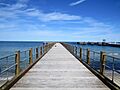
Oak Bluffs Fishing Pier
See also
 In Spanish: Oak Bluffs para niños
