Falmouth, Massachusetts facts for kids
Quick facts for kids
Falmouth, Massachusetts
|
|||
|---|---|---|---|
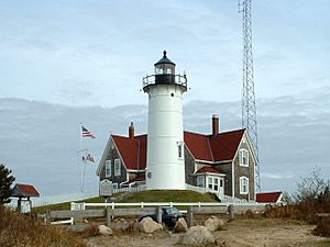
Nobska Lighthouse, Falmouth
|
|||
|
|||
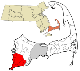
Location in Barnstable County and the state of Massachusetts.
|
|||
| Country | United States | ||
| State | Massachusetts | ||
| County | Barnstable | ||
| Settled | 1660 | ||
| Incorporated | 1686 | ||
| Government | |||
| • Type | Representative town meeting | ||
| Area | |||
| • Total | 54.4 sq mi (141.0 km2) | ||
| • Land | 44.1 sq mi (114.1 km2) | ||
| • Water | 10.3 sq mi (26.8 km2) | ||
| Elevation | 10 ft (3 m) | ||
| Population
(2020)
|
|||
| • Total | 32,517 | ||
| • Density | 738/sq mi (285.0/km2) | ||
| Time zone | UTC-5 (Eastern) | ||
| • Summer (DST) | UTC-4 (Eastern) | ||
| ZIP code |
02540
|
||
| Area code(s) | 508 / 774 | ||
| FIPS code | 25-23105 | ||
| GNIS feature ID | 0618253 | ||
Falmouth is a town located in Barnstable County, Massachusetts, in the United States. It's a popular spot on Cape Cod, known for its beautiful coastline. In 2020, about 32,517 people lived here, making it the second-largest town on Cape Cod.
Falmouth is home to Woods Hole, a village where you can catch ferries to Martha's Vineyard. Woods Hole also has important science places. These include the Woods Hole Oceanographic Institution (WHOI) and the Marine Biological Laboratory (MBL). You can also find the Woodwell Climate Research Center and the Woods Hole Science Aquarium here.
The town of Falmouth includes several smaller villages. These are East Falmouth, Falmouth Village, North Falmouth, Teaticket, West Falmouth, and Woods Hole. Other villages like Hatchville and Waquoit are also part of Falmouth.
Contents
History of Falmouth
Falmouth was first settled by people from England in 1660. It officially became a town in 1686. Bartholomew Gosnold named the area after Falmouth, England, which was his home port.
In the early days, people in Falmouth focused on farming and making salt. They also worked in shipping and whaling. Raising sheep was very popular, especially after Merino sheep were brought in. Water-powered mills helped process the wool.
During the War of 1812, British ships briefly attacked the Falmouth Heights area. Local soldiers quickly got ready to defend the beaches, but the British never landed.
By 1872, trains reached Falmouth and Woods Hole. This led to some of the first summer homes being built. Later, people started growing cranberries and strawberries for markets in Boston. After highways improved and Camp Edwards (now Joint Base Cape Cod) was used a lot during World War II, more people moved to Falmouth. There were big building booms in the 1970s, 1980s, and 1990s.
In the late 1800s, James Madison Beebe bought a large area of land. He built Highfield Hall, which is now a museum. Much of his land is now a protected area called Beebe Woods. In 1965, Robert Manry sailed from Falmouth in a small sailboat. He reached Falmouth, Great Britain, 78 days later!
Historic Places in Falmouth
Falmouth has seven historic districts, which are special areas with old buildings. Four of these are listed on the National Register of Historic Places:
- Falmouth Village Green
- North Falmouth Village
- Waquoit
- West Falmouth Village
The other three historic districts are in Woods Hole, Davisville, and Quissett.
Besides these districts, ten individual places in Falmouth are also on the National Register:
- Central Fire Station
- Crowell-Bourne Farm
- Elnathan Nye House
- Falmouth Pumping Station
- Josiah Tobey House
- Lawrence Academy
- Nobska Light
- Poor House and Methodist Cemetery
- Teaticket School
- Woods Hole School
Just offshore from Falmouth, in Buzzards Bay, the Cleveland East Ledge Light is also a historic site.
Geography of Falmouth
Falmouth covers about 141 square kilometers (54.4 square miles). Most of this is land, and about 26.8 square kilometers (10.3 square miles) is water. Like the rest of Cape Cod, Falmouth sits on sandy soil left behind by glaciers. However, the southwestern part of town has rockier, denser soil. You can also see many large rocks, called glacial erratics, that were dropped by the melting glaciers.
Falmouth is located at the southwestern tip of Cape Cod. It shares borders with Bourne and Sandwich to the north. To the east is Mashpee. To the south is Vineyard Sound, and to the west is Buzzards Bay. Falmouth is very close to Martha's Vineyard, a popular island.
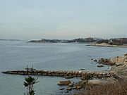
Falmouth's landscape has many small ponds, creeks, and inlets. These are surrounded by the pine and oak trees common on Cape Cod. The beaches are often rocky. The southern coast of Falmouth has many ponds and rivers that stretch inland. These include Falmouth Inner Harbor, Little Pond, Great Pond, Green Pond, Bourne's Pond, Eel Pond, and Waquoit Bay. The Buzzards Bay side of town has many bays and peninsulas. The largest bay is Megansett Cove.
Climate in Falmouth
Falmouth has a climate with warm summers and rain throughout the year. The average snowfall from November to April is about 30 inches (76 cm). February is usually the snowiest month. This is when big winter storms called "nor'easters" are most common. The area is suitable for many plants, with an average coldest temperature of about 1.3°F (-17°C).
Transportation in Falmouth
The main road in Falmouth is Massachusetts Route 28. It runs south from Bourne and then heads east through downtown Falmouth. This road can get very busy, especially since it's one of the main routes on Cape Cod. Route 151 runs through the northern part of town.
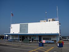
Falmouth is home to The Woods Hole, Martha's Vineyard and Nantucket Steamship Authority. This company provides daily ferry service from Woods Hole. These ferries take people and supplies to the islands of Nantucket and Martha's Vineyard. Another ferry, the Island Queen, runs seasonally from Falmouth Harbor to Martha's Vineyard.
The Massachusetts Coastal Railroad offers freight train service to North Falmouth. There are plans to bring back passenger train service to North Falmouth for tourists. However, part of the old train track has been turned into a bike path called the Shining Sea Bikeway.
For air travel, there's a small private airport in East Falmouth. Larger airports for national and international flights are in Boston (Logan International Airport) and near Providence (T. F. Green Airport). There's also a regional airport in nearby Hyannis. Falmouth also has bus routes provided by the Cape Cod Regional Transit Authority.
Education in Falmouth
Falmouth has a public school system that serves about 4,500 students each year. There are four elementary schools for students from pre-kindergarten to fourth grade: East Falmouth, Mullen-Hall, North Falmouth, and Teaticket.
Students in fifth and sixth grade attend Morse Pond Middle School. Lawrence Junior High School is for seventh and eighth graders. Falmouth High School serves grades 9 through 12. The high school sports teams are called the Clippers, and their colors are maroon and white. They often compete against Barnstable High School. Many parent and community groups help support the public schools.
Falmouth also has a private school called Falmouth Academy, which serves grades 7 through 12. High school students can also choose to attend the Upper Cape Cod Regional Technical High School in Bourne. Another option is the Sturgis Charter Public School in Hyannis, if they are accepted through a lottery.
Sports and Recreation
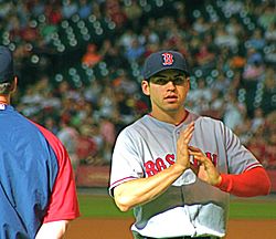
Falmouth is home to the Falmouth Commodores. This is an amateur collegiate summer baseball team that plays in the Cape Cod Baseball League. Many players from the Commodores have gone on to play in Major League Baseball, like Tino Martinez, Darin Erstad, and Jacoby Ellsbury. The team plays at Arnie Allen Diamond at Guv Fuller Field.
Falmouth also hosts the famous Falmouth Road Race every year. This race started in 1973 and attracts over 10,000 runners from all over the world. The race is 7 miles (11 km) long and goes from Woods Hole to Falmouth Heights Beach.
Arts and Entertainment
Falmouth has a lively theatre community. The College Light Opera Company performs at the Highfield Theatre every summer. Other theatre groups include the Falmouth Theatre Guild and the Cape Cod Theatre Project.
You can also find the Cape Cod Conservatory and the Falmouth Arts Guild here.
Every December, Falmouth holds a yearly Christmas parade along Main Street. In late July, the Woods Hole Film Festival takes place. It shows local and international films for a week and is the oldest independent film festival on Cape Cod.
Notable People from Falmouth
- Peter Abrahams, author
- Ben Affleck, actor
- Casey Affleck, actor
- Katharine Lee Bates, writer of "America the Beautiful"
- Steve Cishek, baseball pitcher
- Colleen Coyne, 1998 Olympic gold medalist in ice hockey
- Wesley Dennis, children's book illustrator
- Pete Doherty "The Duke of Dorchester"
- Jessica Dubroff, young pilot trainee
- Jacob Sloat Fassett, U.S. congressman
- Melissa Febos, writer
- Paul Harney, professional golfer
- Edward Hopkins Jenkins, agricultural chemist
- Mark Lachs, physician and author
- Julia Marden, Wampanoag artist
- Frederick E. Olmsted, artist and scientist
- Julia O'Malley-Keyes, fine artist
- Joseph Rago, journalist
- Charles Bennett Ray Abolitionist journalist
- Greg Dean Schmitz, online film journalist
- Sunita Williams, astronaut and Navy officer
Military Presence
Camp Edwards is a U.S. military training camp located in western Barnstable County. It is the largest part of Joint Base Cape Cod. This base is important for both the local economy and the environment.
Environmental Cleanup Efforts
In the 1970s and 1980s, it was discovered that some of Falmouth's underground water (groundwater) had been affected by chemicals. These chemicals came from things like jet fuel and industrial cleaners that were disposed of at the Massachusetts Military Reservation (now Joint Base Cape Cod). This caused problems for some household water wells and led to the town closing a public water well in 1975.
Since 1996, the Air Force has been working to clean up the affected areas. They are treating the soil and using special wells to help contain the contaminated water.
More recently, in 2010, tests found certain chemicals called PFCs in some public water supplies. In 2015, the Air Force began testing private wells in certain neighborhoods. Since 2016, some homes have been receiving bottled water because of elevated levels of these chemicals, following new national safety standards. Cleanup efforts continue to protect the town's water supply.
See also
 In Spanish: Falmouth (Massachusetts) para niños
 | Charles R. Drew |
 | Benjamin Banneker |
 | Jane C. Wright |
 | Roger Arliner Young |


