
West Falmouth, Massachusetts facts for kids
Quick facts for kids
West Falmouth, Massachusetts
|
|
|---|---|

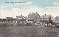
West Falmouth Market
|
|

Location in Barnstable County and the state of Massachusetts.
|
|
| Country | United States |
| State | Massachusetts |
| County | Barnstable |
| Town | Falmouth |
| Area | |
| • Total | 4.36 sq mi (11.28 km2) |
| • Land | 3.08 sq mi (7.98 km2) |
| • Water | 1.28 sq mi (3.31 km2) |
| Elevation | 7 ft (2 m) |
| Population
(2020)
|
|
| • Total | 1,812 |
| • Density | 588.12/sq mi (227.08/km2) |
| Time zone | UTC-5 (Eastern (EST)) |
| • Summer (DST) | UTC-4 (EDT) |
| ZIP code |
02574
|
| Area code(s) | 508 |
| FIPS code | 25-75960 |
| GNIS feature ID | 0616149 |
West Falmouth is a small community located in the town of Falmouth, in Massachusetts, USA. It's a special kind of area called a census-designated place (CDP). This means it's a place with a name and borders, but it's not officially a city or town. In 2020, about 1,812 people lived here.
The heart of West Falmouth is its historic village. Here you can find old buildings like the West Falmouth Library. There is also the Quaker Meeting House and its Carriage Sheds. Other important buildings include the Emerson House and the West Falmouth Fire Station. Many historic homes are also found here.
West Falmouth offers many fun places to visit. You can enjoy the Shining Sea Bikeway, which is great for biking. Chapoquoit Beach is a public beach perfect for swimming. West Falmouth Harbor is a beautiful spot by the water. Other natural areas include Bourne Farm and Great Sippewissett Marsh. For outdoor fun, there's Swift Playground and the Mock Moraine conservation area. The community also has restaurants, markets, inns, and a post office.
Contents
Exploring West Falmouth's Location
West Falmouth is found in the western part of the town of Falmouth. Its exact location is 41°35′59″N 70°38′16″W / 41.59972°N 70.63778°W. To the north, it borders North Falmouth. To the east, you'll find Massachusetts Route 28. South of West Falmouth is Little Sippewisset Marsh. To the west, it meets Buzzards Bay.
The United States Census Bureau measures the size of places. West Falmouth CDP covers a total area of about 11.3 square kilometers (4.36 square miles). Most of this area, about 8.0 square kilometers (3.08 square miles), is land. The rest, about 3.3 square kilometers (1.28 square miles), is water. This means about 29% of West Falmouth's area is water.
People of West Falmouth
| Historical population | |||
|---|---|---|---|
| Census | Pop. | %± | |
| 2020 | 1,812 | — | |
| U.S. Decennial Census | |||
In the year 2000, West Falmouth had 1,867 residents. There were 835 households living in the area. The average household had about 2.21 people.
The population of West Falmouth is made up of people of all ages. In 2000, about 17.5% of the people were under 18 years old. About 24.4% of the population was 65 years old or older. The average age of people living in West Falmouth was 50 years.
Arts and Entertainment in West Falmouth
Since 1975, West Falmouth has been home to a special group. This group is called The College Light Opera Company. It is a non-profit organization that provides summer theater. They perform at Bridgefields Hall. This company helps young people learn about theater.
Images for kids
-
Little Island Road in West Falmouth, Massachusetts, around 1910.

See also
 In Spanish: West Falmouth (Massachusetts) para niños
