Dukes County, Massachusetts facts for kids
Quick facts for kids
Dukes County
|
||
|---|---|---|
| County of Dukes County | ||

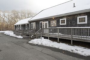
County Administration Building at the Martha's Vineyard Airport
|
||
|
||

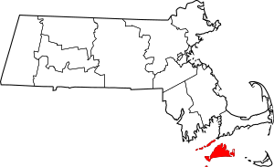
Location within the U.S. state of Massachusetts
|
||
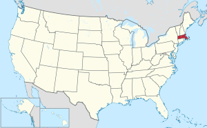
 Massachusetts's location within the U.S. |
||
| Country | ||
| State | ||
| Founded | 1695 | |
| Named for | James, Duke of York | |
| Seat | Edgartown | |
| Largest town | Oak Bluffs | |
| Area | ||
| • Total | 491 sq mi (1,270 km2) | |
| • Land | 103 sq mi (270 km2) | |
| • Water | 388 sq mi (1,000 km2) 79%% | |
| Population
(2020)
|
||
| • Total | 20,600 | |
| • Density | 199.6/sq mi (77.1/km2) | |
| Time zone | UTC−5 (Eastern) | |
| • Summer (DST) | UTC−4 (EDT) | |
| Congressional district | 9th | |
Dukes County is a special area called a county in the state of Massachusetts, USA. In 2020, about 20,600 people lived here. This makes it the second-smallest county in Massachusetts by population. The main town where the county government is located is Edgartown.
Dukes County is also known as the Vineyard Haven, MA Micropolitan Statistical Area. The county has 32 islands. The biggest and most famous island is Martha's Vineyard. Other islands include Chappaquiddick Island, the Elizabeth Islands (like Cuttyhunk), and Nomans Land.
Contents
History of Dukes County
The first people to live on these islands were the Wampanoag people. They had many villages here. In 1641, an English settler named Thomas Mayhew bought the land from the English king. He also carefully bought land rights from the Wampanoag people. Mayhew made sure the native governments could continue to rule their own people.
In 1665, Mayhew's lands became part of a larger area given to James, Duke of York. He later became King James II. In 1671, it was decided that Mayhew would continue to govern. But his territory would be under the control of the Province of New York.
Dukes County was officially created on November 1, 1683. It was first called Dukes County, New York. It included Martha's Vineyard, Nantucket, and the Elizabeth Islands. In 1691, the county moved to Massachusetts. At the same time, Nantucket Island became its own separate county. The name "County of Dukes County" is a bit unusual. It comes from the law that created it in 1695.
Geography of Dukes County
Dukes County covers a total area of about 491 square miles. Most of this area, 388 square miles (79%), is water. Only 103 square miles is land. It is the third-smallest county in Massachusetts when you only count the land area.
Islands in Dukes County
Dukes County is famous for its many islands. Here are some of them:
- Martha's Vineyard
- Chappaquiddick Island, near Edgartown
- Skiff’s Island
- Ferry Boat Island
- Wood Island
- Brush Island
- Gravel Island
- Sarson Island
- Haystack Island
- Edy’s Island
- Mayhew Island
- Beach Grass Island
- Strawberry Island
- Gull Island
- Great Island
- Nomans Land
- Elizabeth Islands, near Gosnold
- Naushon Island
- Nashawena Island
- Pasque Island
- Cuttyhunk Island
- Penikese Island
- Gull Island
- Barlet Island
- Rock Island
- Uncatena Island
- Nonamesset Island
- Veckatimest Island
- Monohansett Island
- Cedar Island
- Bull Island
- Pine Island
- Weepecket Islands
Nearby Counties
Dukes County is close to these other counties:
- Barnstable County – to the northeast
- Plymouth County – to the north
- Bristol County – to the northwest
- Nantucket County – to the east
Protected Areas
- Nomans Land Island National Wildlife Refuge is a special area that protects wildlife.
People of Dukes County (Demographics)
| Historical population | |||
|---|---|---|---|
| Census | Pop. | %± | |
| 1790 | 3,255 | — | |
| 1800 | 3,118 | −4.2% | |
| 1810 | 3,290 | 5.5% | |
| 1820 | 3,292 | 0.1% | |
| 1830 | 3,517 | 6.8% | |
| 1840 | 3,958 | 12.5% | |
| 1850 | 4,540 | 14.7% | |
| 1860 | 4,403 | −3.0% | |
| 1870 | 3,787 | −14.0% | |
| 1880 | 4,300 | 13.5% | |
| 1890 | 4,369 | 1.6% | |
| 1900 | 4,561 | 4.4% | |
| 1910 | 4,504 | −1.2% | |
| 1920 | 4,372 | −2.9% | |
| 1930 | 4,953 | 13.3% | |
| 1940 | 5,669 | 14.5% | |
| 1950 | 5,633 | −0.6% | |
| 1960 | 5,829 | 3.5% | |
| 1970 | 6,117 | 4.9% | |
| 1980 | 8,942 | 46.2% | |
| 1990 | 11,639 | 30.2% | |
| 2000 | 14,987 | 28.8% | |
| 2010 | 16,535 | 10.3% | |
| 2020 | 20,600 | 24.6% | |
| 2023 (est.) | 20,819 | 25.9% | |
| U.S. Decennial Census 1790–1960 1900–1990 1990–2000 2010 2020 |
|||
The population of Dukes County has grown over the years. In 2010, there were 16,535 people living here. By 2020, the population had grown to 20,600 people.
Most people in Dukes County are white. However, the county is becoming more diverse. In 2020, about 78.8% of the people were white. Other groups include Black or African American (3.9%), Native American (1.0%), and Asian (0.9%). About 9.4% of people identified as mixed race. People of Hispanic or Latino origin made up about 2.6% of the population.
In 2010, the largest groups of people by their family background were:
- Irish
- English
- Portuguese
- American
- German
- Italian
- French
- West Indian
- Scottish
- Dutch
- Scotch-Irish
- Swedish
- Polish
- French Canadian
- Russian
- Arab
- Sub-Saharan African
The average age of people in Dukes County in 2010 was about 45 years old. The average household had 2.22 people. About 25.9% of households had children under 18 living with them.
Communities in Dukes County
Towns
These are the main towns in Dukes County:
- Aquinnah (used to be called Gay Head)
- Chilmark
- Edgartown (this is the county seat, where the main government offices are)
- Gosnold
- Oak Bluffs
- Tisbury
- West Tisbury
Census-Designated Places (CDPs)
These are areas that the U.S. Census Bureau defines for collecting data:
- Edgartown
- Oak Bluffs
- Vineyard Haven
Other Villages
Smaller communities within the towns include:
Education
Dukes County has several school districts for students:
K-12 Schools
- Gosnold School District (for all grades from kindergarten to 12th grade)
High Schools
- Martha's Vineyard School District (for older students)
Elementary Schools
- Edgartown School District
- Oak Bluffs School District
- Tisbury School District
- Up-Island Regional School District
See also
 In Spanish: Condado de Dukes para niños
 | James B. Knighten |
 | Azellia White |
 | Willa Brown |


