Quick facts for kids
Monohansett Island
Location in Massachusetts
Show map of Massachusetts
Location in the United States
Show map of the United States
|
| Geography |
| Coordinates |
41°30′14″N 70°42′11″W / 41.504°N 70.703°W / 41.504; -70.703 |
| Archipelago |
Elizabeth Islands |
| Total islands |
1 |
| Highest elevation |
7 ft (2.1 m) |
| Administration |
|
United States
|
| State |
Massachusetts |
| County |
Dukes County |
Monohansett Island is a small, quiet island located in Massachusetts, a state in the United States. It's part of a special group of islands called the Elizabeth Islands. This island is found between two other islands, Cedar Island and Naushon Island.
Where is Monohansett Island?
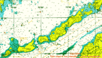
Monohansett Island is located in Dukes County, Massachusetts. This county is made up mostly of islands. The island sits just east of Naushon Island. It is also about 2 miles (3.2 kilometers) southwest of a town called Woods Hole. Woods Hole is a well-known place for marine science and ferries. The island is part of the Town of Gosnold, which is a very small town made up of the Elizabeth Islands.
Island Geography
Monohansett Island is quite low to the ground. Its highest point is only about 7 feet (2.1 meters) above sea level. This makes it a very flat island. Its exact location can be found using coordinates: 41.504 degrees north latitude and 70.703 degrees west longitude. These numbers help pinpoint its spot on a map.
What's in a Name?
The name "Monohansett" has a long history. It comes from an Indian language. The name has been used for this island since the late 1600s. Many places in Massachusetts have names that come from the Native American people who lived there first.


