Gosnold, Massachusetts facts for kids
Quick facts for kids
Gosnold, Massachusetts
|
|||
|---|---|---|---|
| Town of Gosnold | |||

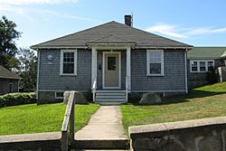
Gosnold Town Hall in the village of Cuttyhunk
|
|||
|
|||

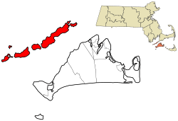
Location in Dukes County in Massachusetts
|
|||
| Country | United States | ||
| State | Massachusetts | ||
| County | Dukes | ||
| Settled | 1641 | ||
| Incorporated | March 17, 1864 | ||
| Government | |||
| • Type | Open town meeting | ||
| Area | |||
| • Total | 140.2 sq mi (363.0 km2) | ||
| • Land | 13.2 sq mi (34.2 km2) | ||
| • Water | 127.0 sq mi (328.9 km2) | ||
| Elevation | 85 ft (26 m) | ||
| Population
(2020)
|
|||
| • Total | 70 | ||
| • Density | 5/sq mi (2.0/km2) | ||
| Time zone | UTC-5 (Eastern) | ||
| • Summer (DST) | UTC-4 (Eastern) | ||
| ZIP code |
02713
|
||
| Area code(s) | 508 / 774 | ||
| FIPS code | 25-26325 | ||
| GNIS feature ID | 0618290 | ||
Gosnold is a small town in Massachusetts, United States. It includes a group of islands called the Elizabeth Islands in Dukes County. In 2020, only 70 people lived here, making it the least populated town in Massachusetts. Most residents live on Cuttyhunk Island, which is in the southwestern part of the town. The largest island, Naushon Island, is privately owned by the Forbes family.
Contents
History of Gosnold and the Elizabeth Islands
The first people to live on the Elizabeth Islands were the Wampanoag Native Americans. They did not live there all year. Instead, they used the islands in summer for hunting, fishing, and gardening. Sometimes, old arrowheads or stone tools are found on the islands. The names of the islands come from the Wampanoag language.
Early European Exploration
Bartholomew Gosnold was one of the first Europeans to explore the Elizabeth Islands in 1602. He and his crew tried to set up a trading post on Cuttyhunk Island. This was the first time Europeans tried to trade with Native Americans in this area. However, they left after only a few weeks and returned to England. When Gosnold returned, the British Crown claimed control over the island chain.
Becoming a Town
Gosnold was first settled in 1641. This was the year Thomas Mayhew, Sr. bought the islands. The Wampanoag tribe claimed the islands until 1658. Then, the Wampanoag leader officially transferred ownership to Mayhew.
The Elizabeth Islands, along with Martha's Vineyard and Nantucket, were part of Dukes County, New York starting in 1683. In 1691, these islands became part of the new Province of Massachusetts Bay. Gosnold officially became its own town in 1864. Before that, it was part of the town of Chilmark.
Geography of Gosnold
Gosnold covers a total area of about 363 square kilometers (140 square miles). Most of this area, about 329 square kilometers (127 square miles), is water. The land area is about 34 square kilometers (13 square miles).
Gosnold is made up of the Elizabeth Islands. These include Nonamesset Island, Uncatena Island, Naushon Island, Pasque Island, Nashawena Island, Penikese Island, and Cuttyhunk Island. There are also several smaller islands. These islands stretch southwest from the tip of Falmouth. The closest island, Nonamesset, is less than half a kilometer (one-third of a mile) away from Falmouth. More than half of Gosnold's population lives on Cuttyhunk. Most of the remaining people live on Naushon Island.
Getting Around Gosnold
Transportation to the island of Cuttyhunk is provided by the Cuttyhunk Ferry Company from New Bedford. The ferry runs every day during warmer months. In cooler months, it runs on Mondays and Fridays. There is also a water taxi service between New Bedford and Cuttyhunk.
Naushon Island has a private ferry that runs from Woods Hole. The islands of Nonamesset and Uncatena are connected to Naushon Island by bridges. You can cross these bridges on foot.
Penikese Island can be reached by a special boat for school trips focused on science, technology, engineering, and math (STEM).
Other islands in Gosnold do not have regular boat service. You need a private boat to visit them.
Population and People
| Historical population | ||
|---|---|---|
| Year | Pop. | ±% |
| 1870 | 99 | — |
| 1880 | 152 | +53.5% |
| 1890 | 135 | −11.2% |
| 1900 | 164 | +21.5% |
| 1910 | 152 | −7.3% |
| 1920 | 181 | +19.1% |
| 1930 | 120 | −33.7% |
| 1940 | 136 | +13.3% |
| 1950 | 56 | −58.8% |
| 1960 | 66 | +17.9% |
| 1970 | 83 | +25.8% |
| 1980 | 63 | −24.1% |
| 1990 | 98 | +55.6% |
| 2000 | 86 | −12.2% |
| 2010 | 75 | −12.8% |
| 2020 | 70 | −6.7% |
| 2022* | 64 | −8.6% |
| * = population estimate. Source: United States Census records and Population Estimates Program data. | ||
In 2020, there were 70 people living in Gosnold. There were 26 households. The population density was about 2 people per square kilometer (5.3 people per square mile).
Most of the people living in Gosnold are adults. About 36.7% of the population is 65 years old or older.
According to the 2010 Census, Gosnold has the lowest population density of any town in Massachusetts.
Education in Gosnold
Gosnold has one school building called Cuttyhunk Elementary School. As of 2020, the school does not have any students. However, the town hopes to use it as a STEM resource center. This center would be a place for schools from the mainland to visit and learn about science and technology.
Penikese Island is home to The Penikese School. This school used to be a private school for boys needing special support until 2011. Later, it became a place for educational field trips.
See also
 In Spanish: Gosnold (Massachusetts) para niños
 | James Van Der Zee |
 | Alma Thomas |
 | Ellis Wilson |
 | Margaret Taylor-Burroughs |


