Nomans Land (Massachusetts) facts for kids

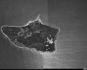
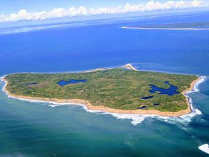
Nomans Land is a small, empty island near Martha's Vineyard in Massachusetts. It's about 612 acres (248 hectares) in size. The island is located about 3 miles (4.8 km) off the southwest coast of Martha's Vineyard.
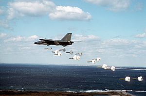
From 1943 to 1996, the United States Navy used Nomans Land as a place to practice dropping bombs. In 1998, the Navy gave the island to the United States Fish and Wildlife Service. Now, it's a special place for wildlife called the Nomans Land Island National Wildlife Refuge. People are not allowed to visit the island. This is because there are still dangerous unexploded bombs there. It also helps protect the animals that live there.
Contents
Exploring Nomans Land's Past
How the Island Got Its Name
In 1602, a British ship called Concord explored Cape Cod. Captain Bartholomew Gosnold was on this ship. He first named this island "Martha's Vineyard" after his oldest daughter, Martha. However, that name was later given to the much larger island we now know as Martha's Vineyard. This bigger island is located northeast of Nomans Land.
The island probably got its current name, "Nomans Land," from a Wampanoag leader. His name was Tequenoman. He was in charge of the island when English settlers arrived in the early 1600s. So, the name comes from "TequeNoman's Land."
The United States Navy built an airfield on the southern part of the island. This happened between November 1942 and May 1944. The island then became a practice area for bombing. This use started during World War II and continued for 53 years, until 1996. In 1952, the Crane family sold the island to the Navy. The airfield was no longer used by the Navy sometime between 1945 and 1954. However, the island kept being used as a bombing range until 1996.
Since 1975, the eastern part of the island has been looked after by the United States Fish and Wildlife Service. After a big effort to remove bombs in 1997 and 1998, the rest of the island was also given to the Fish and Wildlife Service. It is now a wildlife refuge, especially important for birds that travel long distances.
The Mystery of the Rune Stone
In 1926, a stone covered in special symbols called runes was reportedly found near the island's coast. People took a picture of it. The runes seemed to mention the Vikings and their explorer, Leif Erikson. He is thought to be the first European to visit North America. If the stone were real, it might mean Vikings traveled as far south as present-day Massachusetts. It could also suggest that this island was the true location of a Viking settlement called Vinland.
However, experts who study old things, called archaeologists, believe it is a trick or a hoax. The runes on the stone had strange grammar. They also included Roman numerals, which Vikings did not use. These things made people doubt if the stone was real. Because there are still unexploded bombs on and around the island, no one has been able to investigate the stone further.
 | Jackie Robinson |
 | Jack Johnson |
 | Althea Gibson |
 | Arthur Ashe |
 | Muhammad Ali |


