Kawela Bay, Hawaii facts for kids
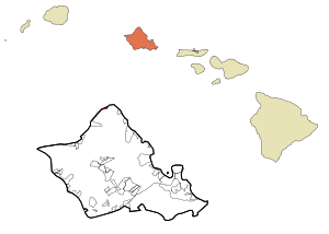
Kawela Bay is a small community located on the northern coast of Oʻahu island in Hawaii, United States. It's known as a census-designated place, which means it's a special area defined for gathering population information. In the Hawaiian language, the name ka wela means "the heat." According to the 2020 United States Census, about 325 people live in Kawela Bay.
Quick facts for kids
Kawela Bay
|
|
|---|---|

Location in Honolulu County and the state of Hawaii
|
|
| Country | United States |
| State | Hawaii |
| Area | |
| • Total | 1.98 sq mi (5.13 km2) |
| • Land | 0.58 sq mi (1.51 km2) |
| • Water | 1.40 sq mi (3.63 km2) |
| Elevation | 9 ft (3 m) |
| Population
(2020)
|
|
| • Total | 325 |
| • Density | 559.38/sq mi (215.80/km2) |
| Time zone | UTC-10 (Hawaii-Aleutian) |
| Area code(s) | 808 |
| FIPS code | 15-32700 |
| GNIS feature ID | 1867256 |
About Kawela Bay
Kawela Bay is located right next to the Turtle Bay Resort on the island of Oʻahu. While there were plans for a beach park at Kawela Bay, it hasn't been developed yet.
The beautiful coastlines and beaches, including Kawela Bay itself, are mostly hidden from view if you're driving along Kamehameha Highway. However, you can find ways to reach the shore at places like Waialeʻe Beach Park. This park is near Kukaimanini, a small island just offshore.
To the west of Kawela Bay is the famous North Shore of Oʻahu, known for its amazing surfing spots. If you travel east from Kawela, the road goes inland across the Kahuku Plain. Here, you'll find the James Campbell National Wildlife Refuge, which protects important wetland areas. The road then returns to the coast at Hukilau Beach in Lāʻie, which is on the windward side of Oʻahu.
The postal code for Kawela Bay, Turtle Bay, and nearby Kuilima is 96731.
Just a short distance inland from the bay is the Opana Radar Site. This site is a National Historic Landmark, but it is not open to the public.
Geography of Kawela Bay
Kawela Bay is found at these coordinates: 21°42'10" North and 158°0'40" West. It's located to the west of Turtle Bay and Kahuku. To its east are communities like Waialeʻe, Sunset Beach, and Pupukea, Hawaii, Pūpūkea along Kamehameha Highway (Route 83).
The United States Census Bureau reports that Kawela Bay and its surrounding area cover about 2.0 square miles (5.2 km2). Most of this area, about 1.4 square miles (3.6 km2), is water, which includes parts of the Pacific Ocean like Kawela and Turtle bays. The land area is about 0.6 square miles (1.6 km2).
Population Information
The population of Kawela Bay has changed over the years:
| Historical population | |||
|---|---|---|---|
| Census | Pop. | %± | |
| 1990 | 366 | — | |
| 2000 | 410 | 12.0% | |
| 2010 | 330 | −19.5% | |
| 2020 | 325 | −1.5% | |
| source: | |||
In 2000, there were 410 people living in Kawela Bay, spread across 189 households. About 21.7% of these households had children under 18 living with them. The average household had about 2.17 people.
The people living in Kawela Bay come from different backgrounds. In 2000, the population included:
- 73.90% White
- 8.78% Asian
- 2.20% Pacific Islander
- 0.98% Black or African American
- 1.22% from other races
- 12.93% from two or more races
- About 4.63% of the population identified as Hispanic or Latino.
The median age in Kawela Bay in 2000 was 42 years old. This means half the population was younger than 42 and half was older.
See also
 In Spanish: Kawela Bay para niños
 | Misty Copeland |
 | Raven Wilkinson |
 | Debra Austin |
 | Aesha Ash |

