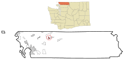
Kendall, Washington facts for kids
Quick facts for kids
Kendall, Washington
|
|
|---|---|

Location of Kendall, Washington
|
|
| Country | United States |
| State | Washington |
| County | Whatcom |
| Area | |
| • Total | 0.8 sq mi (2.2 km2) |
| • Land | 0.8 sq mi (2.1 km2) |
| • Water | 0.0 sq mi (0.1 km2) |
| Elevation | 443 ft (135 m) |
| Population
(2020)
|
|
| • Total | 769 |
| • Density | 191.6/sq mi (74.0/km2) |
| Time zone | UTC-8 (Pacific (PST)) |
| • Summer (DST) | UTC-7 (PDT) |
| ZIP code |
98244
|
| Area code | 360 |
| FIPS code | 53-35135 |
| GNIS feature ID | 1521606 |
Kendall is a small community in Whatcom County, Washington, in the United States. It is known as a census-designated place (CDP). This means it's a place that the government counts for population, but it's not an officially incorporated town or city. In 2020, about 769 people lived there.
History of Kendall
Kendall was started in 1887 by a person named F.B. Hardmen. It got its name from an early settler, Carthage Kendall.
For about 75 years, a lot of limestone was dug up here. Limestone is a type of rock used to make things like cement and for building. There was a special kind of high-quality limestone found in Sumas Mountain nearby.
A railroad track, called a spur, was built from Bellingham to help move these big blocks of limestone. You can still see where the old tracks crossed the highway near a place called the Pair-o-dice Tavern. This shows where the mine used to be.
Geography of Kendall
Kendall is located in Washington state. It covers an area of about 0.8 square miles (2.1 square kilometers) of land. A very small part, about 0.04 square miles (0.1 square kilometers), is water.
The community is at an important meeting point of two main roads. These are Washington State Route 542, also known as the Mount Baker Highway, and State Route 547. Route 547 goes over a low pass on Sumas Mountain. It connects Kendall to the town of Sumas and the border with Canada, near Abbotsford, British Columbia.
Just three miles east of Kendall, along the Mount Baker Highway, is the community of Maple Falls. The Mount Baker Highway continues on to the popular Mount Baker Ski Area, where people go for winter sports.
People of Kendall
In the year 2000, there were 158 people living in Kendall. By 2010, the population had grown to 191 people. The most recent count in 2020 showed about 769 people living there.
Many families live in Kendall. In 2000, about 42% of households had children under 18 living with them. The average household had about 3 people. The average family had almost 4 people.
The people living in Kendall are of different ages. In 2000, about 38% of the population was under 18 years old. About 6% were 65 years or older. The average age of people in Kendall was 28 years old.
See also
 In Spanish: Kendall (Washington) para niños
 | Jackie Robinson |
 | Jack Johnson |
 | Althea Gibson |
 | Arthur Ashe |
 | Muhammad Ali |

