
Kennedy Meadows (CDP), California facts for kids
Quick facts for kids
Kennedy Meadows (CDP)
|
|
|---|---|

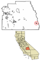
Location of Kennedy Meadows in Tulare County, California.
|
|

Kennedy Meadows (CDP), California
Location in California

Kennedy Meadows (CDP), California
Location in the United States
|
|
| Country | |
| State | |
| County | Tulare |
| Area | |
| • Total | 5.823 sq mi (15.081 km2) |
| • Land | 5.823 sq mi (15.081 km2) |
| • Water | 0 sq mi (0 km2) 0% |
| Elevation | 6,214 ft (1,894 m) |
| Population
(2020)
|
|
| • Total | 58 |
| • Density | 9.96/sq mi (3.85/km2) |
| Time zone | UTC-8 (Pacific (PST)) |
| • Summer (DST) | UTC-7 (PDT) |
| GNIS feature ID | 2585427 |
Kennedy Meadows is a small community in Tulare County, California. It is called a "census-designated place" (CDP). This means the U.S. government counts its population separately. The community is located southeast of the Kennedy Meadows Campground.
In 2020, 58 people lived here permanently. This was more than double the 28 residents counted in 2010. Sometimes, the official boundaries don't exactly match what locals consider Kennedy Meadows.
The area is about 6,200 feet (1,890 meters) above sea level. The main way to get there is by the steep Sherman Pass Road. This road connects to U.S. Route 395 near Pearsonville. Other routes are possible but take much longer.
Kennedy Meadows is an important spot on the Pacific Crest Trail. This famous hiking trail is 703 miles (1,131 km) from its start in the south. The Pacific Crest Trail Data Book uses Kennedy Meadows as a dividing point. It separates the dry Southern California section from the high mountain passes of the Sierra Nevada.
Location and Altitude
Kennedy Meadows is a "census-designated place" (CDP). It covers an area of about 5.8 square miles (15.0 square kilometers). The community is located at coordinates 36°00'28.0"N 118°06'36.0"W. It sits at an altitude of 6,214 feet (1,894 meters) above sea level.
Population Details
| Historical population | |||
|---|---|---|---|
| Census | Pop. | %± | |
| 2010 | 28 | — | |
| 2020 | 58 | 107.1% | |
| U.S. Decennial Census | |||
In 2010, Kennedy Meadows had 28 people living there. The population density was about 4.8 people per square mile. Most residents, 25 people (89.3%), were White. One person (3.6%) was Native American. Two people (7.1%) were from other races. Three people (10.7%) were of Hispanic or Latino background.
All residents lived in households. There were 15 households in total. One household (6.7%) had children under 18. Nine households (60.0%) were married couples. One household (6.7%) had a female head without a husband. Five households (33.3%) had one person living alone. Three of these single-person households had someone 65 or older. The average household size was 1.87 people.
The median age in Kennedy Meadows was 61.0 years. Three people (10.7%) were under 18 years old. Thirteen people (46.4%) were between 45 and 64 years old. Twelve people (42.9%) were 65 or older. For every 100 females, there were about 115 males.
There were 103 housing units in the area. Most occupied homes (80.0%) were owned by the people living in them. The rest (20.0%) were rented. About 71.4% of the population lived in homes they owned. The remaining 28.6% lived in rented homes.
Images for kids
-
Location of Kennedy Meadows in Tulare County, California.
See also
 In Spanish: Kennedy Meadows para niños
