Sherman Pass (California) facts for kids
Quick facts for kids Sherman Pass |
|
|---|---|
 |
|
| Elevation | 9,200 ft (2,804 m) |
| Traversed by | Sherman Pass Road (Forest Route 22S05) |
| Location | Tulare county, California, U.S. |
| Range | Sierra Nevada |
| Coordinates | 35°59′26″N 118°21′57″W / 35.99056°N 118.36583°W |
| Topo map |
|
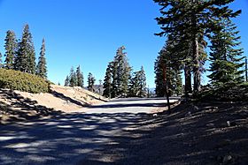
Sherman Pass is a mountain pass in California. It is located in the Sequoia National Forest. This forest is found near the southern part of the Sierra Nevada mountains. The pass is 9,200 feet (2,804 meters) high.
A road called Sherman Pass Road goes over the pass. This road is also known as Forest Route 22S05. It connects the Kern River Highway on the west side to Kennedy Meadow Road on the east side.
Contents
What is a Mountain Pass?
A mountain pass is like a low spot or a gap in a mountain range. It makes it easier to travel from one side of the mountains to the other. Imagine a big wall of mountains; a pass is like a door or a lower section that lets you cross.
Where is Sherman Pass Located?
Sherman Pass is in Tulare County, California. It is part of the Sierra Nevada mountain range. This area is known for its beautiful nature.
Getting to Sherman Pass
There are different ways to reach Sherman Pass.
From the East
You can get to the pass from the east using US 395. You would take 9-Mile Canyon Road. This road is north of a town called Pearsonville. From there, you follow Kennedy Meadow Road to Kennedy Meadows. Finally, you take Sherman Pass Road.
From the West
One way to reach the pass from the west is by using SR 99. You would turn onto Sierra Avenue in Earlimart. This road leads through Ducor and California Hot Springs. Then you take Parker Pass Road and Kern River Highway to Johnsondale. From Johnsondale, you can get onto Sherman Pass Road.
From the South
Another way from the south starts on SR 99 in Bakersfield. You would then take SR 58, SR 184, and SR 178 to Lake Isabella. After that, you follow SR 155 and other local roads to Kernville and Johnsondale. From Johnsondale, you can access Sherman Pass Road.
Winter Travel and Closures
Like many mountain roads in the Sierra Nevada, Sherman Pass Road often closes in winter. The exact times it closes and reopens depend on how much snow falls. It also depends on how quickly the roads can be cleared and repaired. This helps keep everyone safe during snowy conditions.
 | James Van Der Zee |
 | Alma Thomas |
 | Ellis Wilson |
 | Margaret Taylor-Burroughs |


