Kern Mountains facts for kids
Quick facts for kids Kern Mountains |
|
|---|---|
| Highest point | |
| Elevation | 2,627 m (8,619 ft) |
| Geography | |
| Country | United States |
| Range coordinates | 39°41′54.788″N 114°11′33.013″W / 39.69855222°N 114.19250361°W |
| Topo map | USGS Blue Mass Canyon |
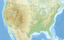
The Kern Mountains are a mountain range located mostly in Nevada, United States. A small part of this mountain range also reaches into Utah.
Where are the Kern Mountains?
The Kern Mountains are surrounded by several valleys and other mountain ranges. To the northwest, you'll find the Antelope Valley.
On the northeast side, there are the South Mountains and the Pleasant Valley.
To the east and south, the Snake Valley stretches out. The Snake Range is located to the south, and the Spring Valley is to the west.
Black History Month on Kiddle
Influential African-American Artists:
 | James Van Der Zee |
 | Alma Thomas |
 | Ellis Wilson |
 | Margaret Taylor-Burroughs |

All content from Kiddle encyclopedia articles (including the article images and facts) can be freely used under Attribution-ShareAlike license, unless stated otherwise. Cite this article:
Kern Mountains Facts for Kids. Kiddle Encyclopedia.


