Kerry, Powys facts for kids
Quick facts for kids Kerry
|
|
|---|---|
| Population | 794 (2021) |
| OS grid reference | SO146899 |
| Principal area | |
| Ceremonial county | |
| Country | Wales |
| Sovereign state | United Kingdom |
| Post town | NEWTOWN |
| Postcode district | SY16 |
| Dialling code | 01686 |
| Police | Dyfed-Powys |
| Fire | Mid and West Wales |
| Ambulance | Welsh |
| EU Parliament | Wales |
| UK Parliament |
|
| Welsh Assembly |
|
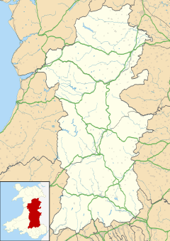
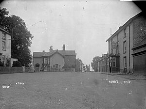
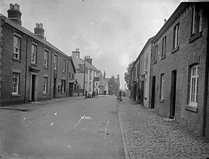
Kerry (which is called Ceri in Welsh) is a village in Powys, Wales. It's also a large area known as a 'community'.
Kerry is located about 4.5 kilometers (2.8 miles) southeast of Newtown. In the village, you'll find two pubs (the Herbert Arms and the Kerry Lamb), a village hall, a place to play bowls, a post office, a primary school, and a hairdresser.
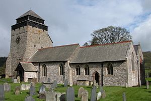
There's also an old church called St. Michael and All Angels, which was built a long time ago in the Norman style. Kerry also has a Baptist church. This village is famous for giving its name to the special Kerry Hill breed of sheep.
Contents
How Kerry is Governed
The large area known as the Kerry community includes the villages of Kerry, Glanmule, Dolfor, and Sarn. This community is split into three smaller areas called 'wards': Kerry, Dolfor, and Sarn.
For the Powys County Council, the entire Kerry community acts as one voting area. Kerry is part of the historic county of Montgomeryshire.
A Look Back at Kerry's History
The Battle of Kerry in 1228
An important event called the Battle of Kerry happened near the village in 1228. This battle was fought between a Welsh prince named Llywelyn Fawr and an English leader named Hubert de Burgh.
Old Rulers and Lands
The area around Kerry was once a Welsh 'commote' and a 'Lordship' called Ceri. It was part of a larger region known as Rhwng Gwy a Hafren. Originally, this land was ruled by the Princes of Maelienydd and their families.
Kerry's Railway Past
Kerry was once the end point for the Kerry Railway. This railway later became part of the Cambrian Railways. It connected Kerry to Abermule and helped transport goods. The railway stopped running in 1956. There was also a smaller, narrow gauge line called the Kerry Tramway. This tramway was used to bring timber (wood) from the nearby forests to the main railway station.
Kerry's Population Over Time
The table below shows how the number of people living in Kerry has changed over the years.
| Year | Population |
|---|---|
| 2001 | 745 |
| 2011 | 785 |
| 2021 | 794 |
St. Michael's Church: A Historic Place
St. Michael's Church in Kerry is a very old and special building. It was officially rededicated in 1176, but there was probably an even older church on the same spot before that. This church is part of the diocese of St. Asaph.
The church's parish (the area it serves) is very large. It stretches out to places like Mochdre, Dolfor, and Beguildy. One of the most interesting things about St. Michael's Church is that it has one of only three chained Bibles in all of Wales. It might even be one of the very few in the entire United Kingdom! This Bible was printed using William Morgan's Welsh translation.
Dolforgan Hall: A Grand Estate
Dolforgan Hall was a large house and estate located just outside Kerry. From 1868 to 1883, it was the home of a famous inventor and industrialist named James Walton.
Later, in 1894, a man named John William Willans bought the estate. He was the chief engineer for the Liverpool Overhead Railway. After him, his son, John Bancroft Willans, who was known for his generous charity work, took over the hall.
The Unique Kerry Hill Sheep
Kerry is well-known for its special local breed of sheep, called the Kerry Hill sheep. The village used to hold big sheep fairs where these animals were traded.
Kerry Hill sheep are easy to spot because of their unique look. They have a white face with clear black markings around their mouth, ears, and eyes. They are a very distinctive and popular breed!
 | Misty Copeland |
 | Raven Wilkinson |
 | Debra Austin |
 | Aesha Ash |


