Ketcherside Mountain facts for kids
Quick facts for kids Ketcherside Mountain |
|
|---|---|
| Highest point | |
| Elevation | 1,698 ft (518 m) |
| Geography | |
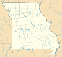
| Location | Iron County, Missouri, U.S. |
| Parent range | Saint Francois Mountains |
| Topo map | USGS Ironton |
Ketcherside Mountain is a mountain peak located in Iron County, Missouri, in the United States. It is part of the beautiful Saint Francois Mountains range. This mountain is a natural landmark in the area.
Contents
Where is Ketcherside Mountain Located?
Ketcherside Mountain is found in the southeastern part of Missouri. It is about 4.5 miles (7.2 kilometers) southeast of Taum Sauk Mountain. Taum Sauk Mountain is the highest point in Missouri. Ketcherside Mountain is also about 6.5 miles (10.5 kilometers) south-southwest of the town of Ironton. The towns of Hogan and Hogan Mountain are located to its west-southwest.
What is the Name's Origin?
Ketcherside Mountain gets its name from a local family. The Ketcherside family, sometimes spelled Catcherside, lived in the area for many years. It is common for natural features like mountains to be named after important local families or people.
How Tall is Ketcherside Mountain?
Ketcherside Mountain stands at an elevation of 1,698 feet (518 meters) above sea level. While it's not the tallest mountain in Missouri, it is a significant peak in the Saint Francois Mountains. These mountains are ancient and made of igneous rock.
Exploring the Saint Francois Mountains
Ketcherside Mountain is part of the Saint Francois Mountains. This range is one of the oldest mountain ranges in North America. They were formed by volcanic activity billions of years ago. The mountains are known for their unique geology. They also have beautiful forests and clear streams. Many people enjoy hiking and exploring this natural area.


