Ketchum, Oklahoma facts for kids
Quick facts for kids
Ketchum, Oklahoma
|
|
|---|---|

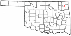
Location of Ketchum, Oklahoma
|
|
| Country | United States |
| State | Oklahoma |
| County | Craig |
| Area | |
| • Total | 2.07 sq mi (5.37 km2) |
| • Land | 2.07 sq mi (5.36 km2) |
| • Water | 0.00 sq mi (0.01 km2) |
| Elevation | 787 ft (240 m) |
| Population
(2020)
|
|
| • Total | 471 |
| • Density | 227.43/sq mi (87.80/km2) |
| Time zone | UTC-6 (Central (CST)) |
| • Summer (DST) | UTC-5 (CDT) |
| FIPS code | 40-39550 |
| GNIS feature ID | 2412829 |
Ketchum is a small town located in Craig and Mayes counties, in the state of Oklahoma, United States. In 2020, about 471 people lived there. The town has grown quite a bit, with its population increasing by 27% between 2000 and 2010.
Contents
History of Ketchum
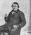
Ketchum was named after a very important person named James Ketchum. He was a leader of the Delaware tribe and also a Methodist minister. He helped start the town in 1899.
The town of Ketchum was first located in the northeastern part of Mayes County, right next to the Grand River. Around 1912, the town moved to southeastern Craig County. This happened because a new railroad, the Kansas, Oklahoma, and Gulf Railroad (KO&G), was being built. The original town area later became part of Grand Lake o' the Cherokees when a dam was built.
For a long time, Ketchum's economy was mostly about farming. But after the Pensacola Dam was built between 1937 and 1939, it created Grand Lake. Since then, the town's economy has mostly been about tourism and other businesses that serve people visiting the lake.
The town's airport, which used to be called the Craig County South Grand Lake Airport, is currently being improved. A group of private investors is paying for these upgrades. They are paving the runway, which used to be grass. When the work is finished, it will be a full-service airport for the region and will be named the South Grand Lake Regional Airport.
Geography and Location
Ketchum is found in the southeastern corner of Craig County. A small part of the town also reaches south into Mayes County. This area is next to a small arm of Grand Lake.
Oklahoma State Highway 85 goes through Ketchum. If you go about 2 miles (3 km) west on Highway 85, you'll reach Highway 82. By taking Highways 85, 82, and U.S. 60, you can get to Vinita, which is the main town of Craig County, about 14 miles (23 km) northwest. Highway 85 also goes northeast, following Grand Lake, for about 12 miles (19 km) to Bernice.
The United States Census Bureau says that the town of Ketchum covers a total area of about 1.3 square miles (3.3 km2), and all of it is land.
Population Information
| Historical population | |||
|---|---|---|---|
| Census | Pop. | %± | |
| 1940 | 611 | — | |
| 1950 | 254 | −58.4% | |
| 1960 | 255 | 0.4% | |
| 1970 | 238 | −6.7% | |
| 1980 | 326 | 37.0% | |
| 1990 | 263 | −19.3% | |
| 2000 | 286 | 8.7% | |
| 2010 | 442 | 54.5% | |
| 2020 | 471 | 6.6% | |
| U.S. Decennial Census | |||
In the year 2000, there were 286 people living in Ketchum. These people made up 120 households, and 78 of those were families. The town had about 153 housing units.
The average household in Ketchum had about 2.38 people, and the average family had about 2.97 people.
Looking at the ages of the people in 2000:
- About 29.4% were under 18 years old.
- About 7.3% were between 18 and 24 years old.
- About 26.9% were between 25 and 44 years old.
- About 23.4% were between 45 and 64 years old.
- About 12.9% were 65 years old or older.
The average age in Ketchum was 36 years.
Education in Ketchum
Students in Ketchum attend schools that are part of the Ketchum Public Schools school district.
See also
 In Spanish: Ketchum (Oklahoma) para niños
 | Bayard Rustin |
 | Jeannette Carter |
 | Jeremiah A. Brown |


