Kettle River (Blueberry River tributary) facts for kids
Quick facts for kids Kettle River |
|
|---|---|
|
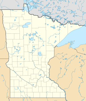
Location of the mouth of the Kettle River
|
|
| Country | United States |
| State | Minnesota |
| Physical characteristics | |
| Main source | Spruce Grove Township, Becker County 1,550 ft (470 m) 46°47′52″N 95°20′32″W / 46.79778°N 95.34222°W |
| River mouth | Blueberry River Blueberry Township, Wadena County 1,381 ft (421 m) 46°45′51″N 95°08′20″W / 46.76417°N 95.13889°W |
| Length | 17.2 mi (27.7 km) |
The Kettle River, also called Kettle Creek, is a small river in central Minnesota, United States. It flows for about 17 miles (28 km). This river is a branch, or tributary, of the Blueberry River.
The Kettle River is an important part of a larger watershed. This means that its water eventually flows into the Mississippi River. It joins the Blueberry River, which then flows into the Shell River, and then the Crow Wing River. All these rivers eventually lead to the mighty Mississippi River. The Kettle River helps drain water from a countryside area.
Contents
Where the Kettle River Starts
The Kettle River begins in Spruce Grove Township. This area is in southeastern Becker County. It starts about one mile (2 km) south of Wolf Lake.
Its Journey to the Blueberry River
From its start, the Kettle River generally flows towards the east. It travels through Runeberg Township. Then, it moves into the northwestern part of Wadena County. Finally, the Kettle River flows into the Blueberry River. This meeting point is in Blueberry Township, about two miles (3 km) west of Menahga.
Nature Around the Kettle River
The Kettle River flows through a special natural area called the Northern Lakes and Forests ecoregion. An ecoregion is a large area of land or water that has its own unique mix of plants, animals, and ecosystems.
Forests and Land Around the River
This ecoregion is known for its beautiful forests. You can find both conifer trees, like pine and spruce, and hardwood trees, like oak and maple. The land here is mostly flat or gently rolling. It was shaped by glaciers long ago, creating what are called till plains and outwash plains. These plains are made of soil and rocks left behind by melting glaciers.
 | James Van Der Zee |
 | Alma Thomas |
 | Ellis Wilson |
 | Margaret Taylor-Burroughs |


