Kiana, South Australia facts for kids
Quick facts for kids KianaSouth Australia |
|||||||||||||||
|---|---|---|---|---|---|---|---|---|---|---|---|---|---|---|---|
 |
|||||||||||||||
| Postcode(s) | 5607 | ||||||||||||||
| LGA(s) | District Council of Lower Eyre Peninsula | ||||||||||||||
| State electorate(s) | Flinders | ||||||||||||||
| Federal Division(s) | Grey | ||||||||||||||
|
|||||||||||||||
Kiana is a small coastal area in South Australia. It is located on the Eyre Peninsula. This area is part of the District Council of Lower Eyre Peninsula. Kiana got its official boundaries in October 2003. It was named after a land division called the Hundred of Kiana. The name "Hundred" is an old way to divide land. The original Hundred of Kiana was much bigger. Today, the Kiana area covers only the northern part of that old division. The southern part is now the area known as Mount Hope. The name "Kiana" comes from an Aboriginal word. It was chosen by Governor William Jervois in 1879.
Contents
Discovering Lake Hamilton
The western side of Kiana is mostly covered by a large natural lake. This lake is called Lake Hamilton. It is about seven miles (11 kilometers) long and one mile (1.6 kilometers) wide. The lake was named in 1840 by explorer Edward John Eyre. He named it after George Hamilton. George Hamilton was the Commissioner of Police at that time.
Exploring Kiana Beach
The Flinders Highway runs north to south. It is located between Lake Hamilton and the ocean. Kiana Beach is about 1.5 kilometers west of this highway. You can reach the beach by a vehicle track. This track goes to both the northern and southern ends of the beach.
Beach Safety
Surf Life Saving Australia has given some important safety advice for Kiana Beach. The southern end of the beach is considered "very hazardous." This means it can be dangerous due to strong currents called "rips." Rips are powerful currents that pull water away from the shore. The northern end of the beach is "safer." However, it can be hard to reach on foot. Kiana Beach is a popular spot for fishing.
Historic Lake Hamilton Homestead
Near the Flinders Highway, you can find the historic ruins of the Lake Hamilton Homestead. A homestead is a large farm or ranch house. This complex includes several old buildings. You can see the remains of the old drafting yards. These were used to sort animals. There is also a shearing shed, where sheep were shorn. Other ruins include a cemetery, outbuildings, a mess hut, and a store.
The Lake Hamilton Eating House
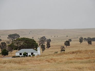
One special building that is still standing is the Lake Hamilton Eating House. This building dates back to the 1850s or 1860s. It was once a stopping point for coaches. Coaches were like old buses that carried people and mail. This eating house is the last building of its kind left on the Eyre Peninsula. The Port Lincoln Caledonian Society restored it in 1972. Both the homestead ruins and the eating house are important. They are listed on the South Australian Heritage Register. This means they are protected because of their historical value.
 | William M. Jackson |
 | Juan E. Gilbert |
 | Neil deGrasse Tyson |


