King's Hill, Hampshire facts for kids
Quick facts for kids King's Hill |
|
|---|---|
| Highest point | |
| Elevation | 218 m (715 ft) |
| Prominence | 46 m (151 ft) |
| Parent peak | Butser Hill |
| Listing | TuMP |
| Geography | |
| Location | Bentworth, Hampshire |
| Parent range | Hampshire Downs |
| OS grid | SU672375 |
| Topo map | OS Landranger |
King's Hill is a notable hill located in the county of Hampshire, England. It is one of the highest points in the area. This hill is part of the Hampshire Downs, a beautiful range of chalk hills. King's Hill reaches a height of 218 metres (about 715 feet) above sea level.
Its "prominence" is 46 metres. Prominence means how much a hill rises from the land around it. This measurement helps us understand how much a hill stands out from its surroundings. Because of its prominence, King's Hill is known as a "TuMP." This is a special term for hills that rise at least 30 metres (about 98 feet) from the land around them.
Where is King's Hill Located?
King's Hill is found in the parish of Bentworth. This is a small local area in Hampshire. The hill sits along Abbey Road, a route that connects the villages of Medstead and Beech.
Nearby Landmarks
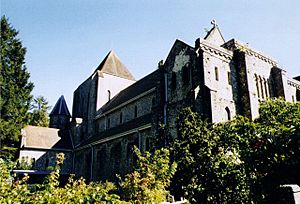
To the northeast of King's Hill, you can find Alton Abbey. This is a quiet and historic place. South of the open hilltop, there is a large wooded area called Chawton Park Wood. These nearby places add to the natural beauty of the King's Hill area.
 | Bessie Coleman |
 | Spann Watson |
 | Jill E. Brown |
 | Sherman W. White |


