Kismet, Kansas facts for kids
Quick facts for kids
Kismet, Kansas
|
|
|---|---|

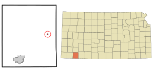
Location within Seward County and Kansas
|
|

|
|
| Country | United States |
| State | Kansas |
| County | Seward |
| Founded | 1880s |
| Incorporated | 1929 |
| Area | |
| • Total | 0.24 sq mi (0.61 km2) |
| • Land | 0.24 sq mi (0.61 km2) |
| • Water | 0.00 sq mi (0.00 km2) |
| Elevation | 2,779 ft (847 m) |
| Population
(2020)
|
|
| • Total | 340 |
| • Density | 1,420/sq mi (557/km2) |
| Time zone | UTC-6 (CST) |
| • Summer (DST) | UTC-5 (CDT) |
| ZIP code |
67859
|
| Area code | 620 |
| FIPS code | 20-37325 |
| GNIS ID | 2395552 |
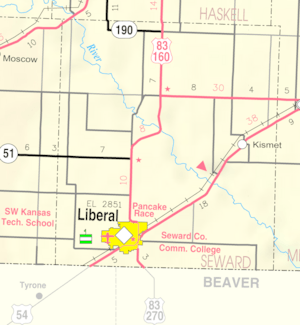
Kismet is a small city located in Seward County, Kansas, in the United States. It's found right along U.S. Route 54, a major highway. According to the 2020 census, about 340 people live in Kismet.
Contents
History of Kismet
Kismet began to grow in the 1880s. The first post office in Kismet opened its doors in November 1888. This was an important step for the community. The city officially became an incorporated city in 1929.
Geography and Area
Kismet is located in the state of Kansas. The United States Census Bureau reports that the city covers a total area of about 0.24 square miles (0.61 square kilometers). All of this area is land, meaning there are no large lakes or rivers within the city limits.
Population and People
The number of people living in Kismet has changed over the years. A census is a count of all the people in a place. Here's how Kismet's population has looked:
| Historical population | |||
|---|---|---|---|
| Census | Pop. | %± | |
| 1940 | 227 | — | |
| 1950 | 180 | −20.7% | |
| 1960 | 150 | −16.7% | |
| 1970 | 294 | 96.0% | |
| 1980 | 368 | 25.2% | |
| 1990 | 421 | 14.4% | |
| 2000 | 484 | 15.0% | |
| 2010 | 459 | −5.2% | |
| 2020 | 340 | −25.9% | |
| U.S. Decennial Census | |||
2020 Census Information
The 2020 United States census found 340 people living in Kismet. There were 124 households and 101 families. Most people, about 69%, were identified as white. About 33% of the population was Hispanic or Latino.
Many households, about 40%, had children under 18 living there. The average household had about 2.7 people. The average family had about 2.9 people. The median age in Kismet was 37.5 years old. This means half the people were younger and half were older than 37.5.
2010 Census Information
In the census of 2010, Kismet had 459 residents. There were 145 households in the city. The population density was about 1,912 people per square mile. Most residents, around 86%, were identified as White. About 35% of the population was Hispanic or Latino.
Many households, about 48%, included children under 18. The average household size was 3.17 people. The median age for people in Kismet was 29.1 years. This shows that Kismet had a younger population in 2010.
Education in Kismet
The students in Kismet attend schools in the Southwestern Heights USD 483 public school district. The main high school for the area is Southwestern Heights High School. This school is located between Kismet and Plains. It is also found along the U.S. Route 54 highway. The school's sports teams are known as the Southwestern Heights Mustangs.
Before this district was formed, Kismet had its own high school. Kismet High School was closed when schools were combined. Its mascot was the Kismet Pirates.
See also
 In Spanish: Kismet (Kansas) para niños
 | Jackie Robinson |
 | Jack Johnson |
 | Althea Gibson |
 | Arthur Ashe |
 | Muhammad Ali |

