
Kongorong, South Australia facts for kids
Quick facts for kids KongorongSouth Australia |
|||||||||||||||
|---|---|---|---|---|---|---|---|---|---|---|---|---|---|---|---|

Kongorong memorial gates
|
|||||||||||||||

Kongorong
Location in South Australia
|
|||||||||||||||
| Established | 30 March 1922 (town) 31 October 1996 (locality) |
||||||||||||||
| Postcode(s) | 5291 | ||||||||||||||
| LGA(s) | District Council of Grant | ||||||||||||||
| Region | Limestone Coast | ||||||||||||||
| County | Grey | ||||||||||||||
| State electorate(s) | Mount Gambier | ||||||||||||||
| Federal Division(s) | Barker | ||||||||||||||
|
|||||||||||||||
|
|||||||||||||||
| Footnotes | Adjoining localities | ||||||||||||||
Kongorong is a small community found in the beautiful state of South Australia. It's located southwest of a larger town called Mount Gambier. Even though it's a smaller place, Kongorong has its own active sports teams, including an Australian rules football team and a netball team. It also has a primary school where kids learn and grow.
Contents
History of Kongorong
Kongorong got its official name from the South Australian Government on March 30, 1922. The name comes from the area of land it's in, which is called the Hundred of Kongorong. People believe the word "Kongorong" means "the corner of it" in an old Indigenous language.
Kongorong's Economy and Farming
Kongorong is an important service town for the farms around it. Many people in the area work in dairy farming, which means raising cows for milk. There's also a lot of sheep farming for wool and meat. Timber plantations, where trees are grown for wood, are also a big part of the local economy. Plus, the area is known for growing grapes, which are used to make wine in the Mount Gambier wine region.
How Kongorong is Governed
Kongorong is part of different government areas that help manage the region.
Local Government
At the local level, Kongorong is part of the District Council of Grant. This council helps with things like local roads, parks, and community services.
State Government
For state-level decisions, Kongorong is in the electoral district of Mount Gambier. This means that when people vote for their state representatives, they vote for someone to represent this area in the South Australian Parliament.
Federal Government
At the national level, Kongorong is part of the federal division of Barker. This area elects a representative to the Australian Parliament in Canberra.
Images for kids
-
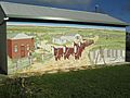
A colourful mural found in Kongorong.

