Korsholm facts for kids
Quick facts for kids
Korsholm
Korsholm – Mustasaari
|
||
|---|---|---|
|
Municipality
|
||
| Korsholms kommun Mustasaaren kunta |
||

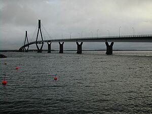
The Replot Bridge on a grey autumn day
|
||
|
||

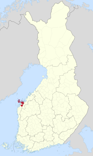
Location of Korsholm in Finland
|
||
| Country | ||
| Region | Ostrobothnia | |
| Sub-region | Vaasa sub-region | |
| Charter | 1348 | |
| Area
(2018-01-01)
|
||
| • Total | 3,178.59 km2 (1,227.26 sq mi) | |
| • Land | 849.49 km2 (327.99 sq mi) | |
| • Water | 2,330.49 km2 (899.81 sq mi) | |
| Area rank | 91st largest in Finland | |
| Population
(2023-12-31)
|
||
| • Total | 19,763 | |
| • Rank | 55th largest in Finland | |
| • Density | 23.26/km2 (60.2/sq mi) | |
| Population by native language | ||
| • Swedish | 68.2% (official) | |
| • Finnish | 28.4% | |
| • Others | 3.4% | |
| Population by age | ||
| • 0 to 14 | 19.7% | |
| • 15 to 64 | 58% | |
| • 65 or older | 22.3% | |
| Time zone | UTC+02:00 (EET) | |
| • Summer (DST) | UTC+03:00 (EEST) | |
Korsholm (also called Mustasaari in Finnish) is a cool place in Finland, located right on the country's west coast. It's part of the Ostrobothnia region, next to the big Gulf of Bothnia.
About 20,000 people live in Korsholm. This makes it one of the most populated municipalities in Finland! The city of Vaasa was actually started in Korsholm way back in 1606. Today, Korsholm completely surrounds Vaasa!
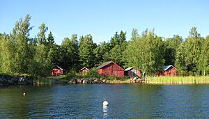
Korsholm is mostly countryside with a long coastline and lots of small islands, called an archipelago. The main town is Smedsby, which is only about 3 kilometers from Vaasa.
Korsholm is a bilingual municipality. This means it has two official languages: Finnish and Swedish. Most people here speak Swedish, but a good number also speak Finnish.
Contents
Exploring Korsholm's Nature and Places
Korsholm is located in the Western Finland province. It's a big area that includes central parts, a southern plain, and a huge group of islands. Some of these islands are so special that they are part of a UNESCO World Heritage Site called Kvarken.
One of the most famous landmarks in Korsholm is the Replot Bridge. This is the longest bridge in all of Finland! It connects the island of Replot to the mainland. You can also find Finland's second oldest stone bridge that's still used today in the village of Toby.
Some of the major islands in Korsholm's archipelago include Replot, Björkö, Köklot, Panike, and the Valsörarna islands.
Two rivers flow into the sea along Korsholm's coast. The Kyrönjoki river empties into Vassor bay, and the Laihianjoki river flows into Vanhankaupunginlahti bay, which is where the city of Vaasa is located.
Villages of Korsholm
Korsholm has many small villages. Most of them have only Swedish names. Here are some of them:
- Anixor
- Brändövik
- Böle
- Björköby
- Västerhankmo
- Österhankmo
- Helsingby
- Iskmo
- Jungsund
- Kalvholm
- Karkmo
- Karperö
- Köklot
- Kvevlax
- Koskö
- Kuni
- Martois
- Miekka
- Munsmo
- Norra Vallgrund
- Österhankmo
- Panike
- Petsmo
- Pundars (Puntainen)
- Replot
- Rimal
- Runsor
- Singsby
- Smedsby
- Solf
- Söderudden
- Södra Vallgrund
- Staversby
- Toby
- Tölby
- Vassor
- Veikars
- Vikby
- Vistan
- Voitby
A Look Back: Korsholm's History
Korsholm has a very long history, going all the way back to the year 1348! That's when it was first mentioned in a royal letter about trade. Because of this, Korsholm celebrated its 650th birthday in 1998.
How Korsholm Got Its Name
The original Finnish name for Korsholm was Mustasaari, which means "Black Island." It might have been an island that looked dark from the sea, or one that had been burned by a wildfire a long time ago. Because the land has slowly risen over hundreds of years, this "island" is now actually inland!
The area was first called Mustasaari parish in 1348. Over time, the Swedish pronunciation became Mussor. In 1611, the city of Vaasa was founded in this parish, so the parish became known as Vaasa. Later, in 1927, the municipality was officially named Korsholm in Swedish. This name comes from the medieval Korsholma castle.
Korsholm Castle and Old Vaasa
In the mid-1300s, Saint Mary's Church was built on Korsholm island. For hundreds of years, the entire Ostrobothnia region was governed from Korsholma Castle (also known as Chrysseborg). Today, you can find the ruins of Saint Mary's Church and Korsholm Castle in the old town of Vaasa (called Vanha Vaasa in Finnish or Gamla Vasa in Swedish).
Joining Together: The 1973 Merger
Today's Korsholm municipality is actually made up of five smaller municipalities that joined together in 1973. These were Korsholm itself, Replot and Björköby from the far islands, Solf from the southern plain, and Kvevlax from the eastern plain. To show that these five areas became one, the coat of arms for Korsholm has five golden threads woven together on a red background.
People and Languages in Korsholm
Korsholm has a population of 19,763 people. The land area is about 3,178.59 square kilometres (1,227.26 sq mi), with some of that being water.
As mentioned, Korsholm is a bilingual municipality. This means both Finnish and Swedish are official languages. Most people speak Swedish, but a good number speak Finnish. The Finnish speakers mostly live near the city of Vaasa, especially in Smedsby, and in the villages of Toby and Kvevlax. The rest of the municipality is mostly Swedish-speaking.
Korsholm's Sister City
Korsholm has a special connection with another city! It is twinned with:
 Oskarshamn, Sweden
Famous People from Korsholm
Many interesting people have come from Korsholm! Here are a few:
- Johannes Bengs (1877–1936)
- Herman Cederberg (1883–1969)
- Edvard Helenelund (1885–1976)
- Levi Jern (1893–1973)
- Alwar Sundell (1906–1990)
- Harry Järv (1921–2009)
- Stina Ekblad (born 1954)
- Mats Lillhannus (born 1972)
- Andreas Romar (born 1989)
 | Roy Wilkins |
 | John Lewis |
 | Linda Carol Brown |


