
Ostrobothnia (region) facts for kids
Quick facts for kids
Ostrobothnia
landskapet Österbotten
Pohjanmaan maakunta |
|||
|---|---|---|---|
|
|||

Ostrobothnia on a map of Finland
|
|||
| Country | Finland | ||
| Historical province | Ostrobothnia | ||
| Capital | Vaasa | ||
| Area | |||
| • Total | 7,932.36 km2 (3,062.70 sq mi) | ||
| Population
(2013)
|
|||
| • Total | 180,384 | ||
| • Density | 22.74027/km2 (58.89703/sq mi) | ||
| Time zone | UTC+2 (EET) | ||
| • Summer (DST) | UTC+3 (EEST) | ||
| ISO 3166 code | FI-12 | ||
| NUTS | 195 | ||
| Regional bird | Common swift (Apus apus) | ||
| Regional fish | Common whitefish (Coregonus lavaretus) | ||
| Regional flower | European meadowsweet (Filipendula ulmaria) | ||
| Website | osterbotten.fi | ||


Ostrobothnia is a region in Finland. It is located in the western part of the country. Ostrobothnia borders the regions of Central Ostrobothnia, South Ostrobothnia, and Satakunta. It is one of the four modern regions that were once part of the larger historical province of Ostrobothnia.
This region is special because it is one of only two Finnish regions where most people speak Swedish. About 51.2% of the people in Ostrobothnia speak Swedish. Some towns here use both Finnish and Swedish, while others only use Finnish.
Contents
Discovering Ostrobothnia's Landscape
Ostrobothnia has a very flat landscape. This is because much of the land used to be under the sea. Over time, the land has slowly risen due to something called post-glacial rebound. This happens after heavy glaciers melt away. Also, a lot of sediment has built up, making the area flat.
You can find large areas of cultivated fields, similar to those in Southern Ostrobothnia. The region also includes the beautiful archipelago of Kvarken, which is known as Merenkurkku in Finnish. You might also see many large rocks, called glacial erratics, which were left behind by glaciers.
Just like other parts of the historical Ostrobothnia province, rivers are a big part of the scenery. The main rivers that flow into the Gulf of Bothnia in this region are Kyrönjoki, Lapuanjoki, and Ähtävänjoki.
Symbols and Nickname of Ostrobothnia
Ostrobothnia has several special symbols that represent the region. The regional tree is the black alder. The regional mammal is the common elk, which is a type of moose. The regional stone is Vaasa granite. The regional song is called "The march of Vaasa" (Vasamarschen in Swedish and Vaasan marssi in Finnish).
Locally, people sometimes call Ostrobothnia "Pampas." This nickname comes from how flat the landscape is, which reminds them of the Pampas area in South America.
Cities and Towns in Ostrobothnia
Ostrobothnia is made up of 15 different municipalities. Six of these municipalities are considered cities. The cities are marked in bold below.
- Isokyrö
- Kaskinen
- Korsholm
- Korsnäs
- Kristinestad
- Kruunupyy
- Laihia
- Luoto
- Malax
- Närpes
- Pedersöre
- Jakobstad
- Nykarleby
- Vaasa
- Vörå
Images for kids
-
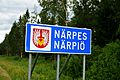
The municipal border sign of Närpes, showing the Swedish name first, followed by the Finnish name.

See also
 In Spanish: Región de Ostrobotnia para niños
