Kuntur Wayin (Recuay) facts for kids
Quick facts for kids Kuntur Wayin |
|
|---|---|
| Highest point | |
| Elevation | 4,200 m (13,800 ft) |
| Geography | |
| Location | Peru, Ancash Region |
| Parent range | Andes, Cordillera Negra |
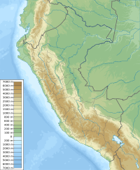
Kuntur Wayin is a mountain located in the country of Peru in South America. It is part of the huge Andes mountain range. This mountain is found in the Ancash Region, specifically in the Recuay Province and Catac District.
What's in a Name?
The name Kuntur Wayin comes from the local language, Quechua.
- Kuntur means "condor", which is a very large bird.
- Wayi means "house".
So, "Kuntur Wayin" means "Condor House"! You might also see its name spelled as Condorhuain.
Where is Kuntur Wayin?
Kuntur Wayin is part of a mountain range called the Cordillera Negra. This range is a section of the Andes mountains. The mountain stands at about 4,200 meters (or 13,780 feet) tall. That's really high up!
The Kuntur Wayin Stream
There is also a stream that shares the same name, Kuntur Wayin (or Condor Huain). This stream starts west of the mountain. It flows into the Santa River, which is an important river in Peru. The stream doesn't flow all the time; it's an "intermittent" stream, meaning it sometimes dries up.
See also

- Want to learn more in Spanish? Check out: Condorhuain para niños
 | William M. Jackson |
 | Juan E. Gilbert |
 | Neil deGrasse Tyson |


