La Junta Municipal Airport facts for kids
Quick facts for kids
La Junta Municipal Airport
(former La Junta Army Air Field)
|
|||||||||||||||
|---|---|---|---|---|---|---|---|---|---|---|---|---|---|---|---|
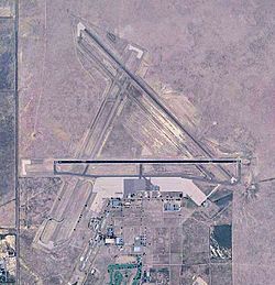
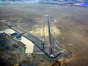
USGS 2006 orthophoto
|
|||||||||||||||
| Summary | |||||||||||||||
| Airport type | Public | ||||||||||||||
| Owner | City of La Junta | ||||||||||||||
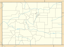
| Serves | La Junta, Colorado | ||||||||||||||
| Location | Otero County, Colorado | ||||||||||||||
| Elevation AMSL | 4,229 ft / 1,289 m | ||||||||||||||
| Coordinates | 38°03′00″N 103°30′35″W / 38.05000°N 103.50972°W | ||||||||||||||
| Map | |||||||||||||||
| Runway | |||||||||||||||
|
|||||||||||||||
| [[Helipad|]] | |||||||||||||||
|
|||||||||||||||
| Statistics (2010) | |||||||||||||||
|
|||||||||||||||
|
Source: Federal Aviation Administration
|
|||||||||||||||
La Junta Municipal Airport (ICAO: KLHX, FAA LID: LHX) is an airport located about three miles north of La Junta, Colorado. It is in Otero County, Colorado, in the United States. This airport is mainly used for general aviation, which means it's for smaller, private planes, not big passenger jets.
Airports have special codes to identify them. For example, the FAA, which manages air travel in the US, calls this airport LHX. However, it does not have an IATA code, which is usually used for larger international flights.
Airport History
The story of La Junta Municipal Airport began in 1935. It was first developed by the Civil Aeronautics Authority. In 1940, during World War II, the airport became very important. The War Department used it to train pilots from the British RAF and the Royal Canadian Air Force. These pilots learned to fly large four-engine aircraft.
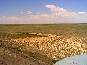
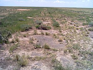
In 1942, the United States Army Air Forces took over the airport. They made it much bigger to handle many planes and training flights. Three asphalt runways were built in a triangle shape. Each runway was 8,000 feet long. They also added a large area for parking planes, taxiways, and big aircraft hangars. Four smaller auxiliary airfields were also built nearby. These were used for training and emergency landings. One of these was La Junta Aux #3 37°58′55″N 103°34′03″W / 37.98194°N 103.56750°W.
La Junta Army Airfield officially opened on November 2, 1942. It became an advanced flying school for planes with two engines. Pilots trained here using B-25 Mitchell bombers and other twin-engine planes like the Cessna AT-17 and Curtiss AT-9. They also used single-engine trainers like the BT-15 Valiant and BT-13 Valiant.
In March 1945, the airport's mission changed. It became a special school for pilots learning to fly heavy bombers. Pilots trained on AT-17 Flying Fortress planes. This prepared them to fly the famous B-17 Flying Fortress bombers.
The airport was very busy during the war. After the war ended, it was no longer needed for military training. La Junta Army Airfield closed on February 28, 1946. It was then given back to the local government for civilian use.
Past Airline Flights
From 1944 to 1957, Continental Airlines offered flights from La Junta. They used Douglas DC-3 aircraft. The airport was a stop on a route that connected Denver and Tulsa. This route also included stops in Colorado Springs, Pueblo, and Wichita.
If you want to learn more about the airport, city, and county history, you can visit the Otero Museum and the Otero County Historical Society.
The airport was also used as a place to film the 1973 movie Badlands, directed by Terrence Malick.
Airport Facilities
The airport covers a large area of 4,200 acres (about 1,700 hectares). It is located at an elevation of 4,229 feet (1,289 meters) above sea level.
It has two main runways:
- Runway 8/26 is 6,849 feet long and 75 feet wide.
- Runway 12/30 is 5,803 feet long and 60 feet wide.
The airport also has one helipad, called H1. It is 145 feet by 145 feet.
In 2010, the airport had about 6,900 aircraft operations. This means planes took off or landed about 18 times each day. Most of these flights (95%) were general aviation planes, and 5% were military aircraft. At that time, 15 single-engine aircraft were based at the airport.
 | Victor J. Glover |
 | Yvonne Cagle |
 | Jeanette Epps |
 | Bernard A. Harris Jr. |


