La Loche River (Saskatchewan) facts for kids
Quick facts for kids La Loche River |
|
|---|---|

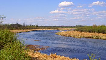
La Loche River by the Highway 956 bridge
|
|
|
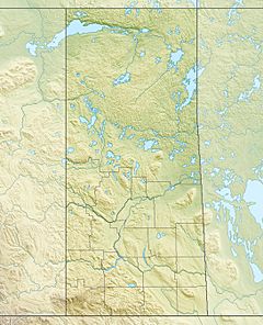
Location of the mouth of the La Loche River
|
|
| Country | Canada |
| Province | Saskatchewan |
| Physical characteristics | |
| Main source | Lac La Loche 56°24′24.06″N 109°25′47.18″W / 56.4066833°N 109.4297722°W |
| River mouth | Peter Pond Lake 56°8′51.55″N 109°7′13.81″W / 56.1476528°N 109.1205028°W |
| Length | 56 km (35 mi) |
| Basin features | |
| River system | Churchill River drainage basin |
| Tributaries |
|
The La Loche River is a small river in northwest Saskatchewan, Canada. It flows for about 56 kilometers (35 miles). The river starts at the southeast end of Lac La Loche. It then flows into the north end of Peter Pond Lake.
You can find the Highway 956 bridge crossing the river. This bridge is about 5 kilometers from where the river begins. Another river, the Kimowin River, joins the La Loche River from the west.
A Glimpse into the Past
About two kilometers from where the La Loche River meets Peter Pond Lake, there's an old spot called Bull's House. This place was once an important outpost for the Hudson's Bay Company. It was used during the time of the North American fur trade.
Bull's House might have started as a trading post around 1795. A century later, in 1895, six families lived there. By 1906, only 12 people remained. This area was important for keeping animals like oxen and horses. These animals were used to carry heavy loads at Methye Portage.
Sometimes, the fields at Bull's House would flood. When this happened, hay for the animals was cut a few miles away. This special spot was called Hay Point. It was located on the east side of Peter Pond Lake. Bull's House was also known as the Riviere La Loche Post.
A very important fishery was located at Bull's House. One year, when the fishery at Île-à-la-Crosse failed, Bull's House was able to provide fish. Today, all that remains of Bull's House is a cemetery on one side of the river. On the other side, you can find a few old cabins and a trail. This trail leads towards Peter Pond Lake.
Exploring Old Maps

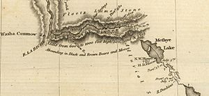
This part of John Franklin's map is from his 1819-20 expedition. It shows an important fur trade route. This route started at Peter Pond Lake. It went up the La Loche River, which was called the Methye River on old maps.
The route then crossed Lac La Loche, also known as Methye Lake. After that, traders would cross the Methye Portage. This portage led to the Clearwater River, which flows west. Finally, the route went north up the Athabasca River.
The map also shows early trading posts. These posts belonged to the North West Company and the Hudson's Bay Company. They were located on the southwest side of Lac La Loche. The map even shows how long the portages were, measured in yards. Two portages are shown along the La Loche River itself.
 | Leon Lynch |
 | Milton P. Webster |
 | Ferdinand Smith |


