Lac La Loche facts for kids
Quick facts for kids Lac La Loche |
|
|---|---|
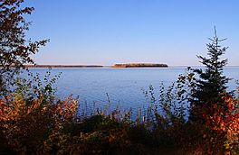
Lac La Loche with a view towards the Portage
|
|
| Location | Saskatchewan |
| Coordinates | 56°31′N 109°36′W / 56.517°N 109.600°W |
| Primary inflows | Saleski River |
| Primary outflows | La Loche River |
| Basin countries | Canada |
| Surface area | 206 km2 (80 sq mi) |
| Max. depth | 15.8 m (52 ft) |
| Surface elevation | 421 m (1,381 ft) |
| Islands | Dog Island |
| Settlements | La Loche, Saskatchewan, Clearwater River Dene Nation, Black Point, Saskatchewan |
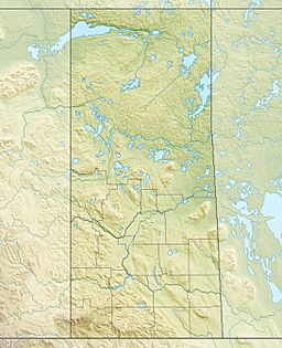
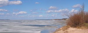
Lac La Loche is a beautiful lake located in the northwest part of Saskatchewan, Canada. It's very close to the Alberta border. This lake is an important part of the larger Churchill River system. The water from Lac La Loche eventually flows all the way to Hudson Bay.
The La Loche River flows out of the southern end of the lake. This river then connects to Peter Pond Lake, which is linked to Churchill Lake. Lac La Loche covers an area of about 206 square kilometers (79 square miles). Its deepest point is around 15.8 meters (52 feet).
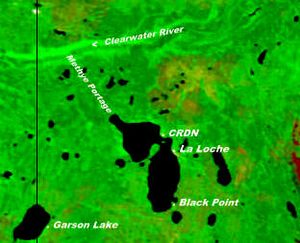
Several communities are located along the shores of Lac La Loche. These include the town of La Loche and the Clearwater River Dene Nation on the eastern side. On the southern shore, you'll find the community of Black Point. In 2012, about 3,500 people lived in these three settlements combined.
A very important historical path, called the Methye Portage or Portage La Loche, is found at the northern end of the lake. This portage is about 19 kilometers (12 miles) long. It connects Lac La Loche to the Clearwater River. The Methye Portage is so important that it's recognized as a National Historic Site. It's also part of the Clearwater River Provincial Park.
History of Lac La Loche
Lac La Loche played a big role in the early fur trade in Canada. Fur trading posts were built here not long after Peter Pond, a famous explorer, traveled through the Methye Portage in 1778. These posts were places where traders would meet with Indigenous people to exchange goods for furs.
We know that people were living near the lake quite early on. In 1822, a man named George Back wrote in his journal that he "touched at the houses on the borders of the lake." This shows that there were settlements around Lac La Loche even then.
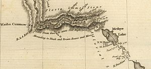
Maps from the past sometimes used different names for the lake and river. For example, John Franklin's map from his Coppermine expedition (1819-1820) called Lac La Loche "Methye Lake." The La Loche River was also sometimes called the "Methye River." Both names were used at the time. George Back, who was with Franklin, used "Lac La Loche" and "La Loche River" in his own writings. Another explorer, Alexander Mackenzie, used both "Portage la Loche" and "Mithy-Ouinigam Portage" in his book "Voyages from Montreal."
Fish Species in the Lake
Lac La Loche is home to many different kinds of fish. If you were to go fishing there, you might catch:
 | Madam C. J. Walker |
 | Janet Emerson Bashen |
 | Annie Turnbo Malone |
 | Maggie L. Walker |


