Clearwater River (Saskatchewan) facts for kids
Quick facts for kids Clearwater River |
|
|---|---|
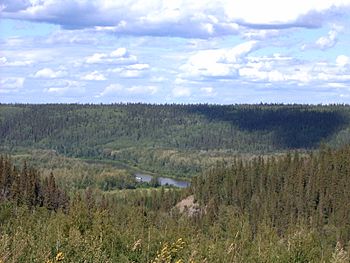
Clearwater River valley near Fort McMurray
|
|
|
Clearwater River is at red pin
|
|
|
Location of the mouth of the river in Alberta
|
|
| Country | Canada |
| Provinces | |
| Physical characteristics | |
| Main source | Broach Lake Saskatchewan 57°43′14″N 109°22′30″W / 57.72056°N 109.37500°W |
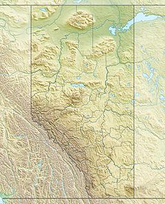
| River mouth | Athabasca River at Fort McMurray, Alberta 56°44′53″N 111°23′1.4″W / 56.74806°N 111.383722°W |
| Length | 295 km (183 mi) |
| Basin features | |
| River system | Athabasca River drainage basin |
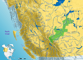
The Clearwater River is a cool river in Canada. It flows through two provinces: Saskatchewan and Alberta. It starts in the northern forests of Saskatchewan and then meets the Athabasca River in Alberta. Long ago, it was a very important path for trading furs. Today, it's even called a Canadian Heritage River because it's so special!
Contents
River's Journey
The Clearwater River is about 295 kilometres (183 mi) long. It begins at Broach Lake, which is its source. From there, it flows southeast. Then, it turns southwest near Careen Lake. This path takes it to the border between Alberta and Saskatchewan.
Once in Alberta, the river flows west for about 108 kilometres (67 mi). Finally, it joins the Athabasca River at Fort McMurray. People in Fort McMurray sometimes call this part of the river "The Chant."
The river starts high up, at about 460 metres (1,510 ft) above sea level. It drops about 150 metres (490 ft) by the time it reaches Fort McMurray. The water from the Clearwater River eventually flows into the Arctic Ocean. It gets there by first joining the Athabasca River, and then the Mackenzie River. Some smaller rivers that flow into the Clearwater River are the Descharme River and McLean River in Saskatchewan. The Christina River joins it in Alberta.
River's Rocks and Land
At its beginning, the Clearwater River flows over very old rocks. These rocks are part of the Canadian Shield, a huge area of ancient rock. In this part, the river is wild. It has fast-moving rapids, small waterfalls, and flows through a deep gorge.
As the river leaves the Canadian Shield near the Alberta border, it changes. It enters a flatter area called the Interior Plains. Here, the river becomes more curvy, with many sand bars and small islands. Along its sides, you can see different types of rocks. These include limestone, dolomite, and shale from the Devonian period. You can also see Cretaceous oil sands.
The Clearwater River flows through a very wide valley. Scientists think that its current flow isn't strong enough to have carved such a big valley. Instead, they believe a huge ancient flood created it. This "paleoflood" came from a giant Glacial Lake Agassiz long ago. The flood water rushed through the Clearwater and Athabasca river valleys on its way to the Arctic Ocean. This channel carved by the flood is known as the Clearwater Spillway.
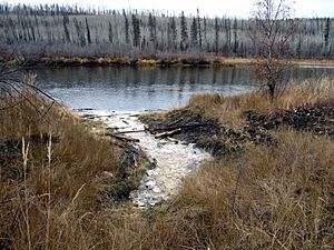
You can also find several salt springs along the river in Alberta. These springs release salty water from rocks deep underground. The water sometimes bubbles and smells like sulfur.
River's Past
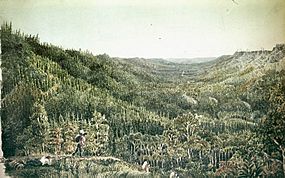
Paintings on rocks along the upper river show that people lived here 5,000 years ago. Before Europeans arrived, native groups lived in the Clearwater River area. These included the Beaver, Chipewyan, and Cree people.
In the 1700s, when Europeans explored Canada, the lower Clearwater River became very important. It was part of a major canoe route for the fur trade. This route connected places like Hudson Bay and Montreal in the east to the Athabasca region in the west.
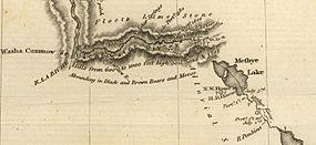
The rough, rocky part of the upper Clearwater River was a problem for traders. But in 1778, an explorer named Peter Pond found a way around it. He used the Methye Portage. This was a 19-kilometre (12 mi) land path between Lac La Loche and the Clearwater River. For almost 40 years, this was the only land connection for the fur trade in the area. It was used for most of the 1800s.
Fish in the River
The Clearwater River is home to many kinds of fish. Some of them are:
- walleye
- yellow perch
- northern pike
- lake trout
- Arctic grayling
- lake whitefish
- cisco
- white sucker
- longnose sucker
- burbot
Protecting the River
Provincial Park
Saskatchewan has created the Clearwater River Provincial Park. This park covers a huge area of 865 mi2 (2240 km2). Its purpose is to protect the river and its natural surroundings.
Canadian Heritage River
The part of the river in Saskatchewan has a special title. It is a Canadian Heritage River. This is because it is a "clear-water river in a pristine" and "isolated wilderness setting of spectacular beauty." It means the river is very clean, untouched, and beautiful.
Watching the River's Health
The Regional Aquatics Monitoring Program (RAMP) uses the Clearwater River as a "baseline river system." This means they study it to understand how natural river systems work. Even though some natural oil sands are found along the river, there aren't many big oil developments. This makes it a good place to learn about a river that hasn't been changed much by people.
See also
 In Spanish: Río Clearwater (Saskatchewan) para niños
 | Janet Taylor Pickett |
 | Synthia Saint James |
 | Howardena Pindell |
 | Faith Ringgold |


