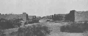
La Paz, Arizona facts for kids
Quick facts for kids
La Paz, Arizona
|
|
|---|---|
| Country | United States |
| State | Arizona |
| County | La Paz |
| Founded | 1862, before Arizona was officially declared a territory by President Abraham Lincoln |
| Abandoned | 1875 |
| Elevation | 300 ft (91 m) |
| Population
(2009)
|
|
| • Total | 0 |
| Time zone | UTC-7 (MST (no DST)) |
| Post Office opened | January 17, 1865 |
| Post Office closed | March 25, 1875 |
La Paz (which means peace in Spanish) was a gold mining town that didn't last very long. It was located in what is now La Paz County, Arizona. The town grew quickly after gold was found nearby in 1862. Its name, La Paz, was chosen to honor a special day called the feast day for Our Lady of Peace.
When it was first founded, La Paz was part of the New Mexico Territory. But in 1863, President Abraham Lincoln created the new Arizona Territory, and La Paz became part of it. Many years later, in 1983, a new county was formed and named La Paz County, even though the original town had already become a ghost town.
In 1863, La Paz was also the site of the La Paz Incident. This was the westernmost battle of the American Civil War.
History of La Paz
A mountain man named Pauline Weaver found gold on January 12, 1862. He discovered it in an area called Arroyo De La Teneja, near the Colorado River. This discovery started the Colorado River gold rush.
La Paz quickly grew in the spring of 1862. It became a town that served the miners who were looking for gold. The area produced about 50,000 troy ounces of gold each year in 1863 and 1864. At its peak, La Paz had about 1,500 people. It was also a stop for stagecoaches traveling between Fort Whipple, Arizona and San Bernardino, California.
From 1864 to 1870, La Paz was the main town, or county seat, for Yuma County. In 1863, it was the biggest town in the territory. Because of its size, people even thought it might become the capital of the Arizona Territory.
Why La Paz Became a Ghost Town
By 1863, most of the easy-to-find gold was gone. But La Paz continued to be important as a shipping port. Steamboats of the Colorado River used it to move goods and supplies. However, in 1866, the Colorado River changed its path. It moved westward, leaving La Paz far from the water.
A new river town called Ehrenberg took over the shipping business. Ehrenberg was located about six miles south of La Paz. By 1870, the number of people living in La Paz had dropped to only 254. In 1871, the county seat was moved to Arizona City. This town was later renamed Yuma in 1873.
The official county records were shipped to Yuma on a steamboat called the Nina Tilden. By 1875, La Paz was completely empty. It had become a true ghost town, as peaceful as its name suggested. Today, almost nothing is left of La Paz. You can only find a few old stone foundations and a historical marker.
Where La Paz Was Located
La Paz is located at 33°40′45″N 114°28′35″W / 33.67917°N 114.47639°W. It sits about 300 feet (91 m) (91 meters) above sea level.
 | Emma Amos |
 | Edward Mitchell Bannister |
 | Larry D. Alexander |
 | Ernie Barnes |


