La Unión, Huánuco facts for kids
Quick facts for kids
La Unión
|
|
|---|---|
|
Village
|
|
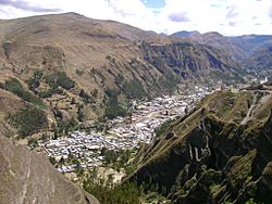
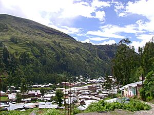
La Unión from Gangash.
|
|
| Country | |
| Region | Huánuco |
| Province | Dos de Mayo |
| District | La Unión |
| Elevation | 3,204 m (10,512 ft) |
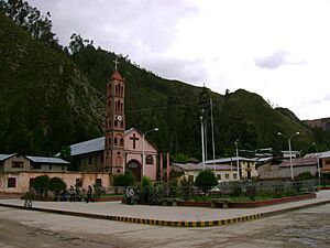
La Unión is a town in central Peru. It is the main town of the Dos de Mayo area in the Huánuco region.
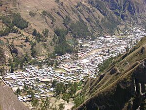
The town sits by the Vizcarra river. It has two parts: Aguamiro on one side and Ripán on the other. There is also a hospital for the region.
Near La Unión, on a high, flat area (about 3,650 meters above sea level), are the old Inca ruins of Wanuku Pampa. A big festival called "La Fiesta del Sol" happens here at the end of July.
Contents
Exploring La Unión's Location
Where is La Unión?
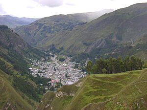
La Unión is located at coordinates 9°49′4.48″S 76°48′04.73″W / 9.8179111°S 76.8013139°W. It is in the Urqumayu valley, which also forms a border with the Ripán District. Two bridges connect La Unión to Ripán.
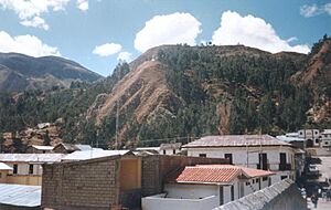
The town is about 3,204 meters (10,512 feet) above sea level. This altitude places it in the Quechua Region, as described by Javier Pulgar Vidal. The valley shape makes the town long from north to south. To the east are the Wanuku Pampa plateau and Pallqa hill. To the west are hills with villages like Anchacgrande, Quchapampa, and Liriopampa.
Because it is so close to Ripán, people often call both towns "La Unión" or "La Unión – Rípan."
How Do Bridges Connect the Town?
Two bridges cross the river in La Unión:
- The first bridge is called Cáceres. It is made of stone and only used by people walking or riding bicycles.
- The second bridge is called the Union bridge. It is made of steel and wood. This bridge is for cars, buses, trucks, and people.
La Unión is a central point for travel. It connects to other towns in the Dos de Mayo province. These include Llata, Chavinillo, Huánuco, and Rondos. It also connects to other districts like Sillapata and Pachas. You can even reach Wallanka, which leads to Huaraz or Chiquián in the Ancash region.
What Rivers Flow Through La Unión?
The Urqumayu river flows through La Unión from south to north. This river is a branch of the Marañón. So, La Unión is part of the Marañón river basin.
What is the Climate Like?
Because La Unión is high up, it has a mild climate.
- From November to April is the rainy season, which is like summer.
- From May to September is the dry season, or winter. This is the best time to visit.
During the rainy season, heavy rains are common. Sometimes, there are even hailstorms. In the dry season, the sun is strong during the day. Temperatures can change a lot between day and night. It can also be much warmer in sunny spots than in shady areas.
Services and How People Get Around
What Services Does La Unión Have?
The town has electricity, running water, and a sewer system. For phones and internet, there is service from Claro and Movistar.
How Do People Travel to La Unión?
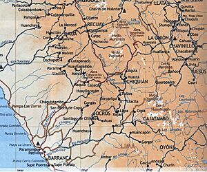
One way to reach La Unión is by taking the Panamericana highway north from Lima to Paramonga. From there, you turn northeast towards Chaskitampu and Wallanka. The road is paved only until Wallanka. From Wallanka to La Unión, the road is unpaved.
On this road, you will find a narrow tunnel called Huajtahuaro. It is also known as The cave cat because of a local story. This tunnel can be tricky for bus drivers.
During the day, you can also travel from Qunuqucha through Chiquián and Aquia to Wallanka. Part of this road is unpaved, but the rest is paved. To get to Wallanka from Pachapaki, you must cross the Wallanka mountain range through a pass called Yanashallash.
Which Transport Companies Serve La Unión?
- Tourism Cavassa
- Tourism Armonia
- Royal Bus
- Estrella Polar
The map shows the road to La Unión. It includes parts of the Ancash, Huanuco, and Lima regions.
What Do People Do for Work?
La Unión is the main town of the province. So, the most important work here is trade. People sell goods that cannot be made in the province, like fruits and appliances. These goods come from cities like Lima and Huanuco.
Other important jobs include agriculture (farming) and livestock (raising animals). People also make clothes and costumes for daily wear and holidays. Tourism is also growing in La Unión.
The town has a central market where people buy and sell goods.
Things to See and Do in La Unión
La Unión has places for visitors to stay and eat. Because of its high location in the valley, it has a mild, dry climate. This makes it a good place for people with breathing problems to visit. The quiet environment can help visitors relax and get away from busy city life.
La Unión is a great starting point to visit the Inca ruins of Wanuku Pampa. You can get there by a dirt road or by walking through the Markaraqra valley. You can also reach other places in nearby provinces like Lauricocha and Ambo.
Another interesting spot is the thermal baths of Quñuq. These hot springs are about 2 kilometers (1.2 miles) from La Unión in the Rípan district.
For amazing views, you can go to the viewpoint on Cerro San Cristobal. From here, you can see the whole town and part of the Vizcarra valley. You can also get great views from hill Gangash, which is near Wanuku Pampa.
Famous People from La Unión
- Augusto Cárdich
See also
 In Spanish: La Unión (Dos de Mayo) para niños
 | Toni Morrison |
 | Barack Obama |
 | Martin Luther King Jr. |
 | Ralph Bunche |


