Lago Ranco, Chile facts for kids
Quick facts for kids
Lago Ranco
|
|||||
|---|---|---|---|---|---|
|
Town and commune
|
|||||
 |
|||||
|
|||||
| Country | Chile | ||||
| Region | Los Ríos | ||||
| Province | Ranco | ||||
| Lago Ranco | 14 February 1941 | ||||
| Government | |||||
| • Type | Municipality | ||||
| Area | |||||
| • Total | 1,763.3 km2 (680.8 sq mi) | ||||
| Elevation | 64 m (210 ft) | ||||
| Population
(2012 Census)
|
|||||
| • Total | 9,575 | ||||
| • Density | 5.4302/km2 (14.0640/sq mi) | ||||
| • Urban | 2,205 | ||||
| • Rural | 7,893 | ||||
| Sex | |||||
| • Men | 5,295 | ||||
| • Women | 4,803 | ||||
| Time zone | UTC-4 (CLT) | ||||
| • Summer (DST) | UTC-3 (CLST) | ||||
| Area code(s) | 56 + 63 | ||||
| Website | Municipality of Lago Ranco | ||||
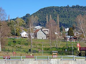
Lago Ranco is a town and commune located in southern Chile. It is part of Ranco Province in the Los Ríos Region. The town gets its name from Ranco Lake, which it shares with the nearby commune of Futrono. The local government, called the Municipality of Lago Ranco, manages the area.
Contents
History of Lago Ranco
Early Inhabitants: The Huilliche People
The area around Ranco Lake has been home to people for a very long time. The first known inhabitants were the Huilliche, which means "people of the south." They lived a peaceful life, closely connected to nature.
They got their food by gathering plants, hunting, fishing, and raising animals. They also started farming a little. These activities helped them stay in one place and develop their unique culture.
During the time of Spanish rule, not much changed in this area. It remained mostly outside the main colonization efforts. Jesuit missionaries sometimes visited from nearby forts to share their beliefs.
The Huilliche communities lived around the Maihue and Ranco lakes. These lakes are in the pre-Andean area and are connected by the Calcurrupe River. Many places in the area still have their original names, like Maihue, Curriñe, and Chabranco.
Settlers and Development
In the 1800s and 1900s, the Chilean government wanted to settle and connect all its territories. Lago Ranco, being in the pre-Andean area, was not a main focus at first. However, in 1846, a map of the Valdivia province was made, showing the region.
Later, in 1885, the area that would become Lago Ranco was part of the Maihue district. The first settlers arrived in the late 1800s. Many German families, like the Konust, Daniel, and Rettig families, settled in the western part of the lake. They were drawn by the beautiful nature and rich forests. These families helped develop the area.
Local families, like the Ancacura, Huaito, and Huenuman families, also lived here. Their descendants still represent the deep history of the Huilliche people in the region.
The Railroad Story
Building a railway line to Lago Ranco began in 1928. This project was started by the early settlers, who saw a business opportunity. The railway was finished in the 1930s. At first, it only went to Ignatieff, but it later expanded.
Once the railway was built, more people started to settle in the area. They mostly worked in logging, which was the main economic activity. The railway was important for moving timber.
The town was first called Punta de Rails (End of the Rails). It was later renamed Pérez Rosales and then TRINGL, honoring the German settlers. In 1935, the first plan for the town was made. In 1937, land was sold off in smaller plots, which helped the town grow.
Becoming a Commune
On February 14, 1941, Lago Ranco officially became a commune. This meant it had its own local government. The new commune's borders were set, and elections were held to form the first local council.
After 1941, the town slowly grew and developed. Local leaders and citizens worked together to improve the community. This also helped Lago Ranco connect more with neighboring towns like Río Bueno.
In 1947, lake travel became very popular. Many steamboats sailed on Ranco Lake, connecting different areas like Puerto Rettig, Riñinahue, Futrono, and Isla Huapi. These boats, like the Laja and the Saturn, carried people and goods across the lake.
A major project for the commune was building the Antonio Varas High School, finished in 1960. This school became very important for the town's education, social life, and culture.
Lago Ranco has also faced natural challenges. Two big events were the Cars volcano eruption in 1955 and the 1960 earthquake. The community worked to recover from these events. In 1974, Lago Ranco gained more independence as a commune. However, some eastern parts, like Llifén, became part of the Futrono commune.
Population and Area
According to the 2002 census, Lago Ranco covers an area of about 1,763 square kilometers (681 square miles). It had 10,098 people living there at that time.
Of these, 5,295 were men and 4,803 were women. About 2,205 people (21.8%) lived in urban areas, while 7,893 people (78.2%) lived in rural areas. Between 1992 and 2002, the population decreased slightly by 3.5%.
Water Systems
Lago Ranco commune has many rivers and streams. These are part of the Rio Bueno river system, which flows from the Andes mountains. The Rio Bueno is about 130 kilometers (81 miles) long and covers a large area. It gets a lot of water from rainfall and melting snow.
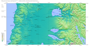
Ranco Lake is a major part of this system. It covers 443 square kilometers (171 square miles) and is up to 199 meters (653 feet) deep. It is the second-largest lake in Chile. Water from Lake Maihue and Lake Huishue also flows into Ranco Lake. The Riñinahue River, which starts near the Nevada Mountains, also drains into Ranco Lake.
Other rivers like the Buttress, Deer, and Nilahue rivers start near the Puyehue volcano. They join to form the Nilahue River, which flows into the eastern part of Ranco Lake. The Iculpe River flows into the southern shore of Ranco Lake, near the town.
Gray Lake is in the southwest of Lago Ranco, inside Puyehue National Park. It covers about 9 square kilometers (3.5 square miles). This lake gives rise to the White River, which joins the Chol Chol River. These rivers then flow into Lake Huishue.
Climate and Nature
Climate Types
Lago Ranco has three main types of climate:
- Rainy Temperate Climate: This is found in the areas around the lake. It rains throughout the year, but there's a bit less rain in the warmer months. Temperatures don't change much because of the lake's moderating effect. This also helps prevent frost near the lake shores.
- Mountain Climate: This climate is found in the Andes mountains and foothills, above 500 meters (1,640 feet). Here, temperatures are colder, and it's too cold for trees to grow in some parts.
- Icy Climate: This is in the very high mountain areas, above 3,000 meters (9,840 feet). Conditions here range from tundra (no trees) to areas with permanent snow and no plants at all.
Rainfall and Temperature
Lago Ranco is known for its rainfall all year. The average annual rainfall in Lago Ranco is about 2,020 millimeters (80 inches). In Lake Maihue, it's even higher, around 4,072 millimeters (160 inches). This shows that rainfall increases as you go higher up, especially in the eastern part of the commune.
Temperatures generally get colder as you go east. However, areas near the lake have milder temperatures because the lake helps keep the air warm. The warmest temperatures are in January, and the coldest are in July.
Temperatures in Lago Ranco usually range from 3 to 20°C (37 to 68°F). In Lake Maihue, they range from 0 to 18°C (32 to 64°F). There are no completely dry months, but February for Lago Ranco and December for Lake Maihue are the driest.
Winds
The main winds in Lago Ranco come from the northwest, southwest, and west. There are also special winds like the Puigua or Puelche. These winds can dry the air in summer and cause storms in winter.
Local Wildlife
The animals in Lago Ranco are closely linked to the "Valdivian rainforest" vegetation. This forest has many unique species found only in this region. Sadly, some of these animals are in danger because of human activities.
- Mammals: Common mammals include the winks (a type of small deer), the pudú (a very small deer that lives in forests), the puma (a wild cat), the gray fox, and the coypu (a large rodent found in wetlands). Wild cats and introduced species like hares are also present.
- Birds: Important birds include the Chucao, the Huet hued, the Pigeon, the Choroy, the Carpenter (woodpecker), and the Southern Great Partridge.
- Insects: You might see the Stag Beetle, the Moon Beetle, and the Mother of the Snake.
- Fish: Both native and introduced fish species live here, making it a great spot for sport fishing. Native fish include puye, carmetita, and zebra trout. Introduced species popular for fishing are rainbow trout, brook trout, brown trout, and European trout.
Local Government
Lago Ranco is an administrative division in Chile. It is managed by a municipal council led by an alcalde (mayor). The mayor is elected directly by the people every four years. The current mayor (from 2008-2012) is Santiago Rosas Lobos, from the Christian Democratic Party (PDC).
Lago Ranco is part of the 54th electoral district for the Chamber of Deputies. This district also includes other towns like Pangipulli and Futrono. For the Senate, Lago Ranco is part of the 16th senatorial constituency, which covers the Los Ríos Region.
Economy and Tourism
The main economic activities in Lago Ranco are farming, forestry, tourism, and services.
Farming and Forestry
Much of the land in Lago Ranco is not ideal for farming, except for the area directly around Ranco Lake. However, the climate allows for many different crops. Only about 4.2% of the commune's land is suitable for agriculture.
The area has a strong potential for forestry because of its soil and many native forests. There are also young plantations of non-native trees. Logging is done at a basic level, mainly extracting timber without much processing.
On a smaller scale, there is livestock farming and agriculture by small farmers. These farmers use simple methods and grow traditional crops like wheat and potatoes, mostly for their own families. Larger farms use more technology and labor.
Tourism
Lago Ranco has great potential for tourism. It is part of the Andean Lake Tourist Zone, which is becoming a popular travel destination. The commune offers beautiful natural attractions, along with a rich history and cultural identity.
It is also part of the "Ranco Lake Basin" destination, working with nearby municipalities like Río Bueno, Paillaco, Futrono, and La Unión to promote tourism in the entire lake area.
See also
 In Spanish: Lago Ranco (comuna) para niños
 | James Van Der Zee |
 | Alma Thomas |
 | Ellis Wilson |
 | Margaret Taylor-Burroughs |


