Lake Almanor facts for kids
Quick facts for kids Lake Almanor |
|
|---|---|

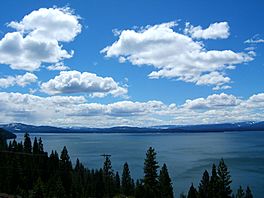
Lake Almanor from Johnson's Grade
|
|
| Location | Plumas County, California |
| Coordinates | 40°15′10″N 121°09′37″W / 40.252778°N 121.160278°W |
| Type | Reservoir |
| Primary inflows | North Fork of the Feather River, Hamilton Branch, Benner and Last Chance creeks |
| Primary outflows | North Fork of the Feather River |
| Basin countries | United States |
| Managing agency | Pacific Gas and Electric Company |
| Max. depth | 90 ft (27 m) |
| Surface elevation | 4,505 ft (1,373 m) |
Lake Almanor is a big reservoir located in Plumas County, in northeastern California, United States. It holds a lot of water, about 1.3 million acre-feet. The lake is about 90 feet (27 meters) deep at its deepest point. Its surface covers about 43.75 square miles.
Lake Almanor was created by Canyon Dam. This dam is built on the North Fork of the Feather River. Other smaller streams and natural springs also feed into the lake.
Contents
How Lake Almanor Was Made
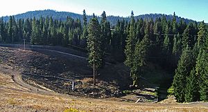
The dam that created Lake Almanor is 130 feet (40 m) tall. It is made from a special type of dirt and water mixture called hydraulic fill.

The first dam was finished in 1914 by a company called Great Western Power. It was part of a bigger project to use the Feather River for power. The dam flooded a large valley that was once a village site for the Yamani Maidu people. This area was known as Nakam Koyo or Big Meadows.
When the dam was built, Maidu families living nearby had to move. Parts of the town of Prattville also had to be moved to higher ground. Many buildings were left underwater.
The lake was named after the three daughters of Guy C. Earl. He was a Vice President at Great Western Power. Their names were Alice, Martha, and Eleanor. The current dam was built between 1926 and 1927. This new dam made the lake more than twice as big.
Today, the Pacific Gas and Electric Company (PG&E) owns the dam. They use the lake to make hydroelectricity. But Lake Almanor is also a very popular place for fun activities. People enjoy fishing, boating, water skiing, swimming, and camping there.
Exploring Lake Almanor's Geography
The areas around Lake Almanor are divided into different sections. Each section has its own name or is known for something special:
- North Shore: This is the northeastern part of the lake. It has a popular campground.
- The Peninsula: This is a large piece of land that sticks out into the lake on the east side. It includes the Lake Almanor Country Club and the community of Almanor.
- Hamilton Branch: This community is on the east side, just south of The Peninsula. It's named after a river that flows into the lake.
- East Shore: This area is between Hamilton Branch and the dam.
- Canyon Dam: This community is right next to the dam on the southeast side.
- South Shore: This is the southwest shoreline. It has campgrounds managed by PG&E.
- Prattville: This is a small resort community on the southwest shore. It has the same name as the old town that is now underwater.
- West Shore: This area is on the upper southwest shore. It's also known as Lake Almanor West.
- Western Shoreline: This runs from Lake Almanor West to the town of Chester.
- Northern Shoreline: This runs from Chester and includes where Benner and Last Chance creeks flow into the lake.
Much of the southern shore of the lake is part of the Lassen National Forest. This means that PG&E and the United States Forest Service work together to manage the area for recreation.
Wildlife Around the Lake
The northern shore of the lake has large areas of grass. These are used for cattle grazing in the summer and fall. In wet years, some of these grazing areas go underwater.
The wet areas at the north end of the lake are important for many birds. These include Canada geese and different kinds of ducks. You might see mallards, teal, and wigeons. Other big birds you can spot around the lake are herons, ospreys, and sometimes even bald eagles. Eagles build their nests on The Peninsula and West Shore.
Every year in late June and early July, many insects hatch on the lake around sunset. Fish eat these insects. This attracts local fly fishermen who use special fake flies to catch the fish.
Managing Water Temperature
PG&E has a special license to use the water from Lake Almanor. When this license was going to expire, people talked about putting a "thermal curtain" at the bottom of the lake. This curtain would help control the water temperature in the rivers downstream. The idea was to create a better home for trout fish up to 40 miles away.
However, people living near Lake Almanor were worried. They thought the curtain might make the shallow lake water warmer. This could harm the fish in Lake Almanor itself.
How Lake Almanor Helps Make Power
There is no power plant right at the dam. Instead, a long tunnel carries water from the lake to another place. This tunnel starts at a tower in the lake, between Prattville and Plumas Pines Resort. The water travels through this tunnel to the Butt Valley Powerhouse. This powerhouse is at the north end of Butt Valley Reservoir and can make 41 megawatts of power.
From there, the water goes through another tunnel to either the Caribou 1 or Caribou 2 powerhouses. Caribou 2 is often used because it is newer and works better. After making power, the water flows into Belden Reservoir. Some of this water then goes through the Oak Flat Powerhouse, which makes a small amount of power. The rest goes to the Belden Powerhouse through another tunnel. Finally, the water is released into Rock Creek Reservoir.
As of 2008, all these power facilities were owned and run by PG&E.
Earthquakes Near Lake Almanor
Lake Almanor experienced two earthquakes that were stronger than a magnitude 5 in May 2023. One of these was a 5.2 magnitude earthquake. It happened on May 12, 2023, at 3:18:41 AM Pacific Daylight Time. The earthquake was about 6.1 kilometers (3.8 miles) deep.
|


