Lake Darby, Ohio facts for kids
Quick facts for kids
Lake Darby, Ohio
|
|
|---|---|

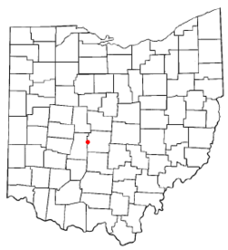
Location of Lake Darby, Ohio
|
|
| Country | United States |
| State | Ohio |
| County | Franklin |
| Townships | Prairie, Brown |
| Area | |
| • Total | 3.50 sq mi (9.06 km2) |
| • Land | 3.46 sq mi (8.97 km2) |
| • Water | 0.04 sq mi (0.10 km2) |
| Elevation | 929 ft (283 m) |
| Population
(2020)
|
|
| • Total | 4,731 |
| • Density | 1,366.95/sq mi (527.71/km2) |
| Time zone | UTC-5 (Eastern (EST)) |
| • Summer (DST) | UTC-4 (EDT) |
| FIPS code | 39-41363 |
| GNIS feature ID | 2393078 |
Lake Darby is a small community in Franklin County, Ohio, in the United States. It's not an official city or town, but it's a "census-designated place" (CDP). This means it's an area that the government counts as a community for census purposes.
Most of Lake Darby is in Prairie Township, with a smaller part in Brown Township. People who live there often call it Darby Estates. This is the name of the older neighborhood in the area. A newer part is known as "West Point." In 2020, about 4,731 people lived in Lake Darby.
Contents
Where is Lake Darby?
Lake Darby is located in the western part of Franklin County. Most of the community is in Prairie Township. Two smaller parts stretch north into Brown Township.
The Big Darby Creek forms the western edge of Lake Darby. This creek is a branch of the Scioto River. It also marks the border between Franklin County and Madison County. Right across the creek from Lake Darby is the village of West Jefferson.
A major road, U.S. Route 40, runs along the southern side of Lake Darby. This highway is four lanes wide. If you go east on this road, you'll reach downtown Columbus in about 13 miles. If you go west, you'll get to Springfield, Ohio in about 31 miles.
The total area of Lake Darby is about 3.5 square miles (9.1 square kilometers). Most of this area is land, about 3.46 square miles (9.0 square kilometers). A small part, about 0.04 square miles (0.1 square kilometers), is water.
Who Lives in Lake Darby?
| Historical population | |||
|---|---|---|---|
| Census | Pop. | %± | |
| 2020 | 4,731 | — | |
| U.S. Decennial Census | |||
In 2000, there were 3,727 people living in Lake Darby. They lived in 1,198 homes, and 1,041 of these were families. The community had about 1,094 people per square mile.
Many families in Lake Darby have children. In 2000, about 53.6% of homes had kids under 18 living there. Most homes, about 72.6%, were married couples living together.
The people in Lake Darby were of different ages:
- 33.9% were under 18 years old.
- 6.1% were between 18 and 24.
- 40.5% were between 25 and 44.
- 17.3% were between 45 and 64.
- 2.0% were 65 years or older.
The average age of people in Lake Darby was 30 years old.
Community Information
The water for Lake Darby comes from a company called Aqua Ohio. They get the water from an underground source called an aquifer using two wells.
Lake Darby is made up of three main neighborhoods or "subdivisions":
- Lake Darby Estates (the older area)
- Westpoint
- Westpoint North
Schools in Lake Darby
The community of Lake Darby is divided between two different school districts.
- The southern part of Lake Darby is in the South-Western City School District.
- The northern part is in the Hilliard City School District.
See also
 In Spanish: Lake Darby (Ohio) para niños
 | Percy Lavon Julian |
 | Katherine Johnson |
 | George Washington Carver |
 | Annie Easley |

