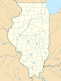
Lake Decatur facts for kids
Quick facts for kids Lake Decatur |
|
|---|---|
| Location | Decatur, Illinois |
| Coordinates | 39°49′N 88°56′W / 39.817°N 88.933°W |
| Lake type | Reservoir |
| Primary inflows | north Upper Sangamon watershed |
| Primary outflows | Sangamon River |
| Catchment area | 925 sq mi (2,396 km2) |
| Basin countries | United States |
| Surface area | 11 km2 (4.2 sq mi) |
| Average depth | 2.4 m (7.9 ft) |
| Water volume | 21,000 acre⋅ft (26,000,000 m3) |
| Shore length1 | 30 mi (48 km) (1922) |
| Surface elevation | 613 ft (187 m) |
| 1 Shore length is not a well-defined measure. | |
Lake Decatur is a large man-made lake, also called a reservoir, located in Decatur, Illinois. It sits just east of downtown Decatur. Both the city and the lake are named after U.S. Navy Commodore Stephen Decatur. The lake is about 613 feet (187 meters) above sea level. It collects water from a huge area of 925 square miles (2,396 km²), which includes parts of 7 different counties. Lake Decatur is the biggest lake on the Sangamon River and was created between 1920 and 1922.
History of Lake Decatur
The lake was built to provide water for the city of Decatur. It was especially important for the local corn refining industry. A corn refiner named A.E. Staley helped convince Decatur to borrow the money needed for the project. His company, and others like Tate & Lyle and Archer Daniels Midland, use a lot of water to process corn. This process is called wet-milling. Lake Decatur's water is also used to make ethanol from corn. In 2007, about 76 percent of the lake's water was used by businesses and factories.
When it was finished in 1922, Lake Decatur was the largest artificial lake in Illinois. It had a shoreline of about 30 miles (48 km). This made it a popular spot for fun activities in Mid-Illinois. People loved using the new gasoline-powered speedboats on the calm lake waters.
Lake Decatur Today
Over the years, Lake Decatur has faced challenges, mainly from too much siltation. This means mud and dirt from farm fields in the surrounding area have washed into the lake. This has made the lake shallower over time. From 1923 to 1983, Lake Decatur lost about 35% of the water it could hold.
Even though the city has been dredging (removing the mud and dirt), the lake is still quite shallow. In 2004, its average depth was only about 8 feet (2.4 meters). In 2008, heavy rains helped fill the lake back up. City officials thought about building another reservoir for water storage, but they decided not to.
Lake Decatur is next to two of Decatur's biggest parks, Faries Park and Nelson Park. It's also near Scovill Zoo. The Decatur Park District was started in 1924 because of all the new opportunities the lake created.
You can see Lake Decatur from U.S. Highway 36, which crosses the lake on a bridge on Decatur's southeast side. U.S. Route 51 also crosses the lake on the south side of the city.
If you want to boat on the lake, you need to register with the city. As of April 2010, you can buy day passes at the Lake Patrol office in Nelson Park. The Lake Patrol office can also give you maps, rules, and fishing information. It's open Monday through Friday during regular business hours in cooler months, but it's open 24/7 during the busy summer months. Many people enjoy fishing here and catch fish like bass, crappie, and walleye. There are 5 public boat ramps at Nelson Park, Faries Park, the Sportsman's Club, and on Lost Bridge and Country Club Roads.
Currently, five roads cross the lake: Reas Bridge Road, William Street (Illinois 105), US 36/Illinois 121, Lost Bridge Road, and US 51/Illinois 105.
 | William M. Jackson |
 | Juan E. Gilbert |
 | Neil deGrasse Tyson |


