Lake Edgar facts for kids
Quick facts for kids Lake Edgar |
|
|---|---|

Map
|
|
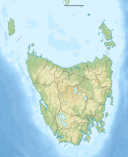
| Location | South West Tasmania |
| Coordinates | 43°01′15″S 146°20′28″E / 43.02083°S 146.34111°E |
| Type | former lake, Fault scarp pond |
| Primary inflows | Huon River |
| Primary outflows | Huon River |
| Basin countries | Australia |
| Surface area | 1.4 square kilometres (0.54 sq mi) |
| Max. depth | 3 metres (9.8 ft) |
| Surface elevation | 289 metres (948 ft) |
Lake Edgar was a natural pond in Tasmania, Australia. It was located on the upper part of the Huon River in South West Tasmania. This lake was special because it formed due to a geological feature called a fault scarp.
What Was Lake Edgar?
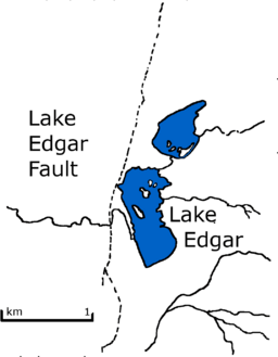
Lake Edgar was actually made up of two smaller lakes. They formed because of something called the Edgar Fault. This fault caused the ground near Mount Anne to move upwards by a little more than 6 metres (20 ft). This movement created a natural dam, which made the Huon River change its path and flow north around Scotts Peak.
Sadly, Lake Edgar no longer exists. It was covered by water in 1972 when a much larger lake, Lake Pedder, was flooded. This flooding was part of a big project to create hydroelectric power (electricity made from water). It's important not to confuse Lake Edgar with the Edgar pond, which was created when the Edgar Dam was built across a smaller stream that fed into Lake Edgar.
The Edgar Fault
The Edgar Fault is a very old crack in the Earth's crust. It first formed during the Cambrian period, which was about 540 to 485 million years ago! Back then, it was a "wrench fault," meaning the land on either side slid past each other sideways. This sliding caused a huge shift of about 12 kilometres (7.5 mi).
The fault became active again much more recently, during the Quaternary period (the last 2.6 million years). This fault is about 25–33 kilometres (16–21 mi) long. It slopes downwards to the west at an angle of 60 to 70 degrees.
Scientists believe the fault moved twice in the Quaternary period. The first time was around 25,000 years ago, and the last time was less than 10,000 years ago, after the last ice age. Each time it moved, the land on the western side was lifted up by about 2.5 metres (8 ft 2 in). This is the only fault known to have moved twice in such a recent geological time.
Discovery and Impact
The Edgar Fault was discovered in 1960 by two scientists, Carey and Newstead. It cuts through very old rocks called Precambrian rocks. When the fault moved, it created a natural barrier that trapped water, forming Lake Edgar. Later, some of the water drained away, splitting the original lake into two smaller ones, with Lake Edgar being the southern one.
The area around Lake Edgar gets a lot of rain, about 2,500 millimetres (98 in) each year. If the lake had been very old, it would have filled up quickly with mud and sand carried by the water. The movements of the fault that created the uplifts would have caused strong earthquakes, possibly as powerful as magnitude 6.6 to 7.
When the Edgar Dam was being built, the Hydro Electric Commission (the company in charge of the power project) dug trenches and pits. They wanted to make sure that water wouldn't leak through the fault once the dam was finished.


