Lake Nosbonsing facts for kids
Quick facts for kids Lake Nosbonsing |
|
|---|---|

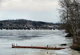
Astorville at the western end of the lake
|
|
| Location | Nipissing District, Ontario |
| Coordinates | 46°12′09″N 79°12′31″W / 46.20250°N 79.20861°W |
| Type | Lake |
| Part of | Saint Lawrence River drainage basin |
| Primary inflows | Depot Creek |
| Primary outflows | Kaibuskong River |
| Basin countries | Canada |
| Max. length | 11 kilometres (6.8 mi) |
| Max. width | 5 kilometres (3.1 mi) |
| Surface elevation | 237 metres (778 ft) |
| Islands | Perron Island |
| Settlements | Astorville, Bonfield, Nosbonsing |
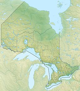
Lake Nosbonsing (which is Lac Nosbonsing in French) is a lovely lake found in Ontario, Canada. It's located in the Nipissing District in Northeastern Ontario, close to the city of North Bay. This lake is important because it's where the Kaibuskong River begins. It's also part of a much larger water system called the Saint Lawrence River drainage basin.
Contents
About Lake Nosbonsing
Lake Nosbonsing is a freshwater lake that stretches about 11 kilometers (7 miles) long and 5 kilometers (3 miles) wide. It sits at an elevation of 237 meters (778 feet) above sea level. The lake is a popular spot for fishing and enjoying nature.
Where is Lake Nosbonsing?
This lake is shared by three different local areas, called municipalities. The middle and western parts of the lake are in a place called East Ferris. The eastern side of the lake is in Bonfield. A small part of the very south-central area of the lake is in Chisholm.
How Water Flows Through the Lake
Water flows into Lake Nosbonsing from a stream called Depot Creek. This creek enters the lake from the south. The main way water leaves the lake is through the Kaibuskong River, which starts at the northeast side. The Kaibuskong River then flows into the Mattawa River, which joins the Ottawa River, and finally, all this water reaches the huge Saint Lawrence River.
Towns and Features Around the Lake
There are three main communities located right on the shores of Lake Nosbonsing.
- Astorville is found at the very western end of the lake.
- Nosbonsing is located on the northern shore.
Both Astorville and Nosbonsing are part of the East Ferris municipality.
- Bonfield is at the northeast end of the lake, right where the Kaibuskong River begins. This community is in the Bonfield municipality.
You can also find some interesting natural features on the lake. There is one named island called Perron Island in the western part of the lake. On the northern shore, there are two points of land that stick out into the water: Shields Point and McConnell Point.
A historic railway line, the original Canadian Pacific Railway transcontinental main line, runs along the northeast shore of the lake. It connects the communities of Bonfield and Nosbonsing.


