Lake Pátzcuaro facts for kids
Quick facts for kids Lake PátzcuaroPátzcuaro Lake Lago de Pátzcuaro |
|
|---|---|

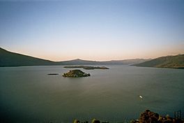
View from Janitzio Island
|
|
| Location | Pátzcuaro, Michoacán |
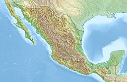
| Coordinates | 19°38′N 101°38′W / 19.633°N 101.633°W |
| Basin countries | Mexico |
| Islands | Jaracuaro, Uranden, Janitzio, Pacanda, Yunuen, Tecuena |
| Settlements | Pátzcuaro, Erongarícuaro, Quiroga, Tzintzuntzan |
| Official name: Humedales del Lago de Pátzcuaro | |
| Designated: | 2 February 2005 |
| Reference #: | 1447 |
Lake Pátzcuaro (Spanish: Lago de Pátzcuaro) is a beautiful lake located in the state of Michoacán, Mexico. It is a very important place for the local people and for nature. The lake is found in the municipality of Pátzcuaro.
This lake is special because it is in an endorheic basin. This means its water does not flow out to the sea. The area that drains into the lake is about 929 square kilometers. The lake itself covers about 126.4 square kilometers. Lake Pátzcuaro is located high up, at 1,920 meters above sea level. It is surrounded by volcanic mountains. The lake is about 5 meters deep on average, but can be as deep as 11 meters. It holds about 580 million cubic meters of water.
The Lake Pátzcuaro basin was formed by volcanoes. Long ago, it was connected to other lakes like Lake Cuitzeo and Lake Zirahuén. These lakes used to drain into the Lerma River. Today, Lake Pátzcuaro is a closed basin, just like Cuitzeo and Zirahuén.
Contents
Wetlands Around the Lake
The lake is surrounded by large wetland areas. These wetlands are very important and have been recognized as a Ramsar site since 2005. Ramsar sites are special places for wetlands around the world.
Plants of the Wetlands
The wetlands are full of tall plants like cattails. These plants can grow over 2 meters tall. Other common wetland plants include Typha, Scirpus, Eleocharis, and Cyperus. You can also find aquatic plants like Potamogeton illinoensis, Scirpus pectinatus, Typha latifolia, T. domingensis, and Nymphaea mexicana (a type of water lily).
Animals of the Wetlands
The wetlands are a vital home for many birds. Nearly 200 different bird species live here all year or visit during migration. Some birds, like the black-polled yellowthroat (Geothlypis speciosa), are found only in this area. Sadly, some native birds have not been seen recently. The yellow rail (Coturnicops noveboracensis) has not been seen since 1964 and might be gone from the area. The slender-billed grackle (Quiscalus palustris), which was only found here, is thought to be extinct.
The Lake Pátzcuaro salamander (Ambystoma dumerilii) is a unique animal found only in this lake basin. Other aquatic animals that live mostly or entirely in the Lake Pátzcuaro system include a type of rough-footed mud turtle (tarascense), a harmless Mexican garter snake (patzcuaroensis), and fish like the Pátzcuaro chub (Algansea lacustris) and Pátzcuaro allotoca (Allotoca diazi). There is also a small dwarf crayfish called Cambarellus patzcuarensis.
Challenges Facing the Lake
Over the past 50 years, the lake and its wetlands have changed a lot. Trees being cut down and farming in the surrounding area have caused a lot of soil to wash into the lake. This makes the lake shallower by about 1 centimeter each year. Also, water is taken from the lake for farming and cities, which has made the lake smaller. It has shrunk by 40 square kilometers and is 2.6 meters shallower. Other problems include dirty water from sewage, new species that don't belong there, and chemical pollution.
In 2021, local indigenous leaders shared their concerns. They noted that efforts to clean up the lake have faced challenges. They mentioned that a lot of money has been spent since 2006, and many studies have been done since 1934. Despite this, many people living around the lake still face economic hardship.
The Lake's Watershed
The watershed is the land area that drains water into the lake. Around the wetlands, the natural plant life changes with height. At lower elevations (1,920-2,100 meters), you find dry scrub plants. Higher up (2,100-2,400 meters), there are pine and oak forests mixed with scrub. At the highest peaks (2,400-2,900 meters), you find pure pine-oak forests. These forests are part of the Trans-Mexican Volcanic Belt pine-oak forests ecoregion.
In the last fifty years, more people have been living and working in the watershed. Farming and raising animals have increased a lot. Over 10,000 hectares of forest have been lost. This is due to logging, fires, people gathering wood for fuel, and clearing land for farms and ranches.
History of the Lake Pátzcuaro Area
The Lake Pátzcuaro basin is the homeland of the Purépecha people. Purépecha leaders made this basin the center of their powerful Tarascan state. This state was a rival to the Aztec Empire before the Spanish arrived. Important Purépecha centers in the area included the towns of Ihuatzio, Tzintzuntzan, and Pátzcuaro.
Islands in Lake Pátzcuaro
- Jaracuaro
- Uranden - A small island.
- Janitzio - A popular island with places for tourists to visit.
- Pacanda - This is the largest and flattest island. You can rent cabins here.
- Yunuen - Another small island.
- Tecuena - An island with very few people living on it.
Major Towns Along the Lake Shore
- Pátzcuaro - Located on the southeastern shore of Lake Pátzcuaro.
- Erongarícuaro - An old Purépecha site with a lot of history.
- Quiroga - A busy market town.
- Tzintzuntzan - A market town with ancient ruins nearby. It used to be the capital of the P'urhépechas.
Minor Towns Along the Lake Shore
- Tocuaro - Known for woodworking and mask-making.
- Opongio - Has a mezcal distillery.
- Puacuaro
- Arocutin
- Ihuatzio - Home to ancient temple ruins called yacatas.
- Santa Fe La Laguna - Known for its crafts.
- Cucuchuchu
- Uricho
- Napizaro
- Erongarícuaro
Nearby Areas to Explore
See also
 In Spanish: Lago de Pátzcuaro para niños
 | Aaron Henry |
 | T. R. M. Howard |
 | Jesse Jackson |


