
Lake Tillery facts for kids
Quick facts for kids Lake Tillery |
|
|---|---|
 |
|

Lake Tillery
Location in North Carolina

Lake Tillery
Location in the United States
|
|
| Location | Montgomery / Stanly counties, North Carolina, United States |
| Coordinates | 35°12′24″N 80°03′58″W / 35.20667°N 80.06611°W |
| Primary inflows | Yadkin River Uwharrie River |
| Primary outflows | Pee Dee River |
| Basin countries | United States |
| Max. depth | 200 ft (61 m) |
| Shore length1 | 117.8 mi (189.6 km) |
| Surface elevation | 278 ft (85 m) |
| 1 Shore length is not a well-defined measure. | |
Lake Tillery is a large man-made lake in North Carolina. It is a reservoir, which means it's a lake created by building a dam across a river. Lake Tillery is located between Falls Reservoir and Blewett Falls Lake. You can find it in both Stanly County and Montgomery County.
The lake was formed when a dam was built on the Pee Dee River. The Pee Dee River itself starts when the Yadkin River and the Uwharrie River join together. The town of Norwood in Stanly County is often called the "Gateway to Lake Tillery."
Contents
Crossing Lake Tillery: James B. Garrison Bridge
The James B. Garrison Bridge is a very important bridge. It's the only way to cross the Pee-Dee-Yadkin River in this area. This bridge carries traffic from Stanly County to Montgomery County. It's part of three major highways: North Carolina Highway 24, North Carolina Highway 27, and North Carolina Highway 73.
The Old Swift Island Bridge
Next to the newer James B. Garrison Bridge, you can still see an older bridge. This old bridge is called Swift Island Bridge. It's a narrow, one-lane concrete arch bridge that was built way back in 1922.
When Lake Tillery was being planned in the 1920s, engineers realized the new lake would cover this old bridge. The company building the dam, Carolina Power & Light (now Duke Energy), decided to give the bridge to the U.S. military. The military wanted to use it for training.
First, engineers tried to break the bridge by putting a lot of weight on it. But it wouldn't collapse! Then, the Army Air Corp tried dropping bombs on it. Still, the bridge stood strong. Later, an artillery group shot at it with cannons. Even that didn't work. Finally, it took a whole ton of TNT to bring the old bridge down. It was a very strong bridge!
Tillery Dam: Making Electricity
Tillery Dam was built in 1928. Its main job is to create electricity using the power of water. This is called a hydroelectric facility. It was first owned by Carolina Power and is now owned by Duke Energy.
The dam is 86 feet tall and stretches 2800 feet long. It has four generators that make electricity. The dam helps another power plant downstream, called the Blewett Hydroelectric Plant, work more efficiently.
Protecting Water and Wildlife
In 2008, there was a discussion about how much water should flow from Tillery Dam. An environmental group, the Southern Environmental Law Center, was concerned. They believed that the amount of water Duke Energy planned to release might not be enough. They worried it could harm the water quality and the animals living in the river. They also thought it might make boating difficult.
Gallery
-
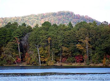
Lake Tillery seen from Morrow Mountain State Park.
-
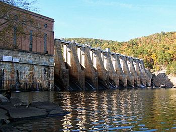
Falls Dam separates Falls Reservoir and Lake Tillery.
-
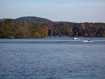
Northern portion of Lake Tillery.
-
Lake Tillery where Uwharrie River and Yadkin River converge.
-
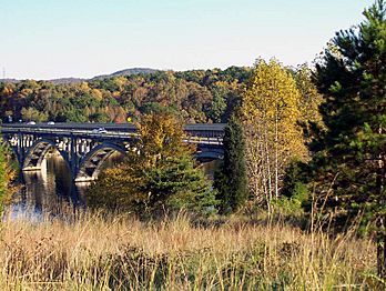
James B. Garrison Bridge over Lake Tillery.


