Uwharrie River facts for kids
Quick facts for kids Uwharrie River |
|
|---|---|

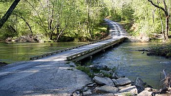
The Coggins Low-water Bridge over the Uwharrie River.
|
|
|
Location of Uwharrie River mouth
|
|
| Other name(s) | Tributary to Pee Dee River |
| Country | United States |
| State | North Carolina |
| County | Montgomery Randolph |
| Physical characteristics | |
| Main source | divide between Uwharrie River and Abbotts Creek pond in High Point, North Carolina 855 ft (261 m) 35°55′15″N 080°01′14″W / 35.92083°N 80.02056°W |
| River mouth | Pee Dee River across river from Morrow Mountain State Park 272 ft (83 m) 35°22′51″N 080°03′29″W / 35.38083°N 80.05806°W |
| Length | 61.84 mi (99.52 km) |
| Basin features | |
| Progression | generally south |
| River system | Pee Dee |
| Basin size | 387.94 square miles (1,004.8 km2) |
| Tributaries |
|
| Bridges | Old Mendenhall Road, Sunset View Drive Ext., Mendenhall Road, Surrett Drive, NC 62, I-85, Meadowbrook Drive, Millers Mill Road, Kennedy Road, Thayer Road, Snyder Country Road, Covered Bridge Road, US 64, Jackson Creek Road, Old NC 49, NC 49, Waynick Meadow Road, High Pine Church Road, Burney Mill Road, Low Water Bridge Road, NC 109, |
The Uwharrie River is a river in central North Carolina, United States. It is about 61.84 mi (99.52 km) long. This river is a tributary of the Pee Dee River. A tributary is a smaller stream or river that flows into a larger one. The Pee Dee River eventually flows into the Atlantic Ocean.
Contents
Where Does the Uwharrie River Flow?
The Uwharrie River starts in the northwestern part of Randolph County. This is just south of the city of High Point. From there, it flows mostly south into Montgomery County.
Journey Through Mountains and Forests
As the river travels, it passes through the low Uwharrie Mountains. It also goes through the Uwharrie National Forest. This forest is a protected area with lots of trees and wildlife.
Meeting the Pee Dee River
The Uwharrie River joins the Pee Dee River about 8 mi (13 km) east of the city of Albemarle. This meeting point is part of a large lake called Lake Tillery. It's located across the Pee Dee River from Morrow Mountain State Park. Before the Uwharrie River joins it, the Pee Dee River is known as the Yadkin River.
The Little Uwharrie River
Near its beginning, the Uwharrie River is joined by a smaller stream called the Little Uwharrie River. This small tributary also flows through northwestern Randolph County.
What Are the Other Names for the Uwharrie River?
Rivers sometimes have different names over time. The United States Board on Geographic Names is a group that decides the official names for places. In 1895, they officially named the river "Uharie River." Later, in 1940, they changed it to "Uwharrie River."
The Uwharrie River has been known by many other names throughout history. Here are some of them:
- Huwaree River
- Uahra River
- Uaree River
- Uharie River
- Uhary River
- Uhwarri River
- Uoharee River
- Uwaree River
- Uwarry River
- Uwharee River
- Uwherrie River
- Voharee River
- Wharee Creek
- Wharie River
- Wharre River
 | Calvin Brent |
 | Walter T. Bailey |
 | Martha Cassell Thompson |
 | Alberta Jeannette Cassell |


