Lake Tugalo facts for kids
Quick facts for kids Lake Tugalo |
|
|---|---|
| Location | Georgia/South Carolina |
| Coordinates | 34°43′48″N 83°21′07″W / 34.730°N 83.352°W |
| Basin countries | United States |
| Surface area | 597 acres (2.42 km2) |
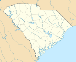
Lake Tugalo is a beautiful lake located right on the border of Georgia and South Carolina. It's not a natural lake, but a large reservoir that was created by people. This lake covers about 597 acres (2.4 square kilometers) and has 18 miles (29 kilometers) of shoreline. It's a popular spot for many outdoor activities!
Creating Lake Tugalo
Lake Tugalo is a man-made lake, also known as a reservoir. It was created to help produce hydroelectricity. This is a special type of electricity made using the powerful force of moving water. The lake is located in northeastern Georgia, touching Habersham and Rabun counties. It also extends into Oconee County, South Carolina.
Part of a Lake Chain
Lake Tugalo is the fifth lake in a series of six lakes. These lakes were all created by hydroelectric dams built by a company called Georgia Power. The dams follow the original path of the Tallulah River.
The series of lakes starts upstream with Lake Burton. After that comes Lake Seed, then Lake Rabun, and Lake Tallulah Falls. Lake Tugalo is next in line, and the series ends with Lake Yonah. The Tallulah River fills the western part of Lake Tugalo. The Chattooga River fills the eastern part. Georgia Power considers the lake full when its surface is about 891.5 feet (271.7 meters) above sea level.
Building the Tugalo Dam
Lake Tugalo began to fill with water in 1923. This happened after the Tugalo Dam was completed. The dam is made of concrete and masonry. It stands about 155 feet (47 meters) high and stretches 740 feet (226 meters) across. The Tugalo Hydroelectric Plant, which is part of the dam, can produce 45 megawatts of electricity. This is enough power for many homes and businesses!
 | DeHart Hubbard |
 | Wilma Rudolph |
 | Jesse Owens |
 | Jackie Joyner-Kersee |
 | Major Taylor |


