Chattooga River facts for kids
Quick facts for kids Chattooga River |
|
|---|---|

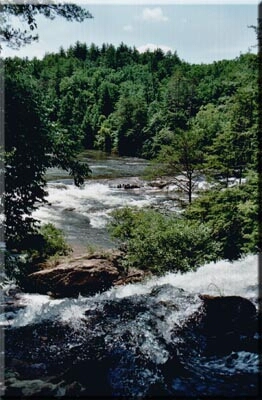
Chattooga River near Dick's Creek Falls
|
|
| Native name | Chatuga |
| Type: | Wild, Scenic, Recreational |
| Designated: | May 10, 1974 |
The Chattooga River is a famous river in the southeastern United States. It is a main branch, or tributary, of the Tugaloo River. The Chattooga River is also known by other spellings like Chatooga or Chatuga.
Contents
Journey of the Chattooga River
The Chattooga River starts high up in the mountains. Its very beginning, called the headwaters, is found southwest of Cashiers, North Carolina. From there, it flows for about 57 miles (92 km).
The river ends where it meets the Tallulah River. This meeting point, called a confluence, is inside Lake Tugalo. This lake was formed by the Tugalo Dam. The Chattooga starts in southern Jackson County, North Carolina. It then flows southwest, forming a natural border. This border is between northwestern Oconee County, South Carolina, and eastern Rabun County, Georgia. The name "Chattooga" was officially approved in 1897.
When the Chattooga and Tallulah rivers join, they create the Tugaloo River. This river then flows into the Seneca River. After that, it becomes the Savannah River below Lake Hartwell. Finally, the water from the Chattooga River reaches the Atlantic Ocean near Savannah, Georgia.
You might have heard of the Chattooga River from a famous story! It was the inspiration for the fictional 'Cahulawassee River' in James Dickey's novel, Deliverance (1970). Parts of the 1972 movie based on the book were also filmed right on the Chattooga River.
River's Ancient History
The Chattooga River forms part of the boundary between Georgia and South Carolina. This border is near the 35th parallel north. The river wasn't always the boundary. In 1816, a treaty moved South Carolina's border to where it is today. Before that, the Chattooga River flowed through the ancient lands of the Cherokee Indian Nation. A Cherokee town called Chattooga was located along the upper part of the river. Sadly, the Cherokee people were later forced to give this land to the United States.
The Blue Ridge Mountains, where the Chattooga begins, are very old mountains. The rocks there are mostly granite. Scientists think the Chattooga River might have changed its direction a long time ago. It probably used to flow southwest into the Chattahoochee River. From there, its water would have gone to the Gulf of Mexico. But at some point, the Savannah River grew and "captured" the Chattooga. This made the Chattooga's water flow towards the Atlantic Ocean instead.
The rocks in the riverbed often fall from the hills above. But they don't always stay put! During heavy rains and strong currents, rocks can move downstream. They can even carry other rocks and debris with them. For example, during Hurricane Ivan in 2004, the strong winds and water pushed huge boulders from the riverbanks. The hurricane brought so much rain that the river's flow was incredibly high. It was similar to the typical flow of the Colorado River in the Grand Canyon!
A Wild and Scenic Treasure
Since May 10, 1974, the Chattooga River has been specially protected. It is part of the national Wild and Scenic River system. This means it has a protected area of about 15,432 acres (6,245 hectares) along its banks.
About 39.8 miles (64.1 km) of the river are called “wild.” This means they are kept as natural as possible. About 2.5 miles (4.0 km) are “scenic,” offering beautiful views. And about 14.6 miles (23.5 km) are “recreational,” meaning they are good for fun activities. In total, about 57 miles (92 km) of the river are protected.
On the parts of the river where people go rafting, there's a protected corridor. This area is about a quarter-mile wide on both sides of the river. No roads or buildings are allowed here. This helps keep the river wild and beautiful. The Chattooga also flows through the Ellicott Rock Wilderness. This special wilderness area stretches across three states: Georgia, North Carolina, and South Carolina. It also covers parts of three National Forests.
The Chattooga is often called the "Crown Jewel" of the Southeast. It was the first river east of the Mississippi River to get the Wild & Scenic designation. It's also still the only one in the East where commercial rafting trips are allowed.
River Branches
The Chattooga River has three main branches, or forks. The main Chattooga River flows along the state line.
- The East Fork Chattooga River flows in from Jackson County, North Carolina, and then Oconee County, South Carolina. It is about 7.4 miles (11.9 km) long.
- The West Fork Chattooga River flows about 6.0 miles (9.7 km) from Rabun County, Georgia. It is sometimes called Gumekoloke Creek.
One of the largest streams that flows into the Chattooga is Stekoa Creek. This creek flows mostly through private lands. It travels about 18 miles (29 km) from its start in Mountain City, Georgia, through Clayton, Georgia. It then joins the Chattooga River. Stekoa Creek has been identified as a major concern for the Chattooga's water quality. This is mainly due to issues like sewage leaks, polluted runoff, and other problems. Groups like the Chattooga Conservancy are working hard to improve the water quality in Stekoa Creek.
Fun on the River
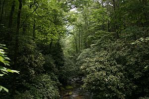
In late spring, the riverbanks are beautiful with blooming pink and white mountain laurel flowers. Early spring is also a great time for rafting, kayaking, or canoeing. This is because the water levels are higher and the temperatures are cooler. The Chattooga is a free-flowing river. This means there are no dams upstream to control its flow. So, its water level changes quickly depending on rainfall or drought.
The Chattooga is a "drop-pool" style river. This means exciting rapids are followed by calm pools. These pools are perfect for swimming and relaxing.
The Chattooga's headwaters are near Cashiers, North Carolina. The upper parts of the river (Sections 00, 0, and 1) are excellent for trout fishing. These sections are sometimes too shallow for boating or have restrictions. Section 1, starting at Burrell's Ford, can be very dangerous. Boating there is only allowed during certain months and water levels. The West Fork is great for tubing and easier float trips.
The river is divided into sections for boating:
- Section 2, starting at Highway 28, is a Class II float. This means it has easy rapids.
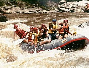
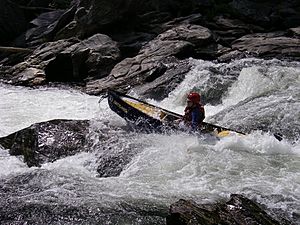
- Section 3 has Class II-IV rapids. These are popular for rafters and kayakers. The last big rapid in Section 3 is called Bull Sluice.
- Section 4 includes Class II-V rapids. This section has the famous Five Falls. These are five challenging rapids (Class III-V) packed into about a quarter-mile stretch.
To raft Section 3, you must be at least eight years old. For Section 4, the minimum age is twelve. Many of the famous rapids on this river were shown in the movie Deliverance.
The United States Forest Service (USFS) has rules for the river. In 2004, they made a plan that limited motorized boats and closed many roads. It also stopped boating on the upper 21 miles (34 km) of the river. This plan was changed after some groups disagreed. In 2012, the USFS allowed some boating on parts of the upper Chattooga, including Section 1. However, there are many rules about when, where, and at what water levels boating is allowed. Boating is still not allowed above Greens Creek and below Licklog Creek.
 | Sharif Bey |
 | Hale Woodruff |
 | Richmond Barthé |
 | Purvis Young |


