Lake Waikare facts for kids
Quick facts for kids Lake Waikare |
|
|---|---|

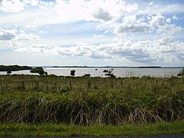
View from the south-eastern side of the lake
|
|

Lake Waikare
|
|
| Location | Waikato District, Waikato region, North Island |
| Coordinates | 37°26′28.93″S 175°11′55.76″E / 37.4413694°S 175.1988222°E |
| Basin countries | New Zealand |
| Surface area | 34 km2 (13 sq mi) |
Lake Waikare is the biggest of several shallow lakes in the Waikato River area of New Zealand's North Island. It is a special type of lake connected to a river.
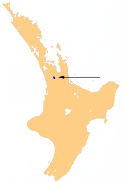
This lake is found east of Te Kauwhata. It is also about 40 kilometres north of Hamilton. Lake Waikare covers a large area of 34 square kilometres.
Contents
Discovering Lake Waikare
Lake Waikare is part of the Waikato River system. It is one of many lakes that formed in the river's wide valley. These lakes are often shallow and connected to the main river.
Where is Lake Waikare?
You can find Lake Waikare in the Waikato District. This district is part of the Waikato region on the North Island of New Zealand. It's easy to spot on a map, just north of Hamilton.
Why is Lake Waikare Important?
Lakes like Waikare are important parts of the environment. They provide homes for many plants and animals. They also help manage water flow in the river system.
What's Happening to the Lake's Water?
The water in Lake Waikare is not in good condition. This is because the lake is very shallow, never deeper than two metres. Also, a lot of fertiliser is used on farms around the lake. This fertiliser can wash into the water.
Understanding Water Quality
A report from 2010 showed that Lake Waikare had the highest "trophic level index" among many lakes. This index is a way to measure how much pollution is in the water. A high number means there are many pollutants.
Pollution also comes from the sewage treatment plant in Te Kauwhata. This plant has been told by the Regional Council to stop releasing too much waste into the lake. This waste includes things like nitrogen and phosphorus.
Health Warnings
In 2020, a health warning was put out for Lake Waikare. This was because of something called cyanobacteria. These are tiny living things, sometimes called blue-green algae, that can grow in polluted water. They can be harmful to people and animals.
 | Stephanie Wilson |
 | Charles Bolden |
 | Ronald McNair |
 | Frederick D. Gregory |


