Waikato River facts for kids
Quick facts for kids Waikato River |
|
|---|---|
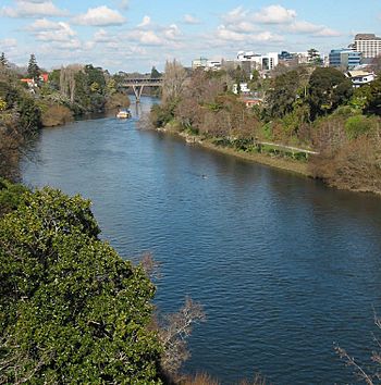
The Waikato River passing through Hamilton
|
|
| Country | New Zealand |
| Physical characteristics | |
| Main source | Lake Taupō |
| River mouth | Port Waikato 0.0 metres (0 ft) |
| Length | 425 kilometres (264 mi) |
| Basin features | |
| Basin size | 13,701 km2 (5,290 sq mi) to Mercer |
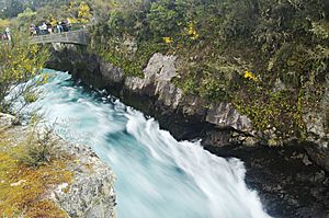
The Waikato River is the longest river in New Zealand, stretching for 425 kilometres (264 miles) across the North Island. It begins on the eastern slopes of Mount Ruapehu, flowing into the Tongariro River system and then through Lake Taupō, which is New Zealand's largest lake. The river leaves Lake Taupō at its northeastern edge, creating the amazing Huka Falls, and then flows northwest through the Waikato Plains. Finally, it empties into the Tasman Sea near Port Waikato, south of Auckland. The river gives its name to the Waikato region, which is the area around the Waikato Plains.
The name Waikato comes from the Māori language and means flowing water. The Waikato River holds deep spiritual meaning for many local Māori tribes, especially the large Tainui tribe. They see it as a source of their mana, which means their pride and importance. The respected marae (Māori meeting place) of Tūrangawaewae is located close to the riverbanks at Ngāruawāhia.
For a long time, the Tainui tribe worked to reconnect with the river after historical events in the 1860s. They talked with the New Zealand government about their claims. In August 2008, an agreement was reached between the government and Waikato-Tainui. This agreement helped the tribe regain a special connection and shared management of the river. Today, Waikato-Tainui shares the responsibility of managing the river with the Waikato Regional Council.
Contents
How the Waikato River Began
The ancient Waikato River once flowed from an old lake in the middle of the North Island. It carved its way through deep valleys made of volcanic rock, heading north through the Hinuera Valley and into the Thames Estuary. About 27,000 years ago, a huge volcanic eruption, called the Oruanui eruption, covered much of the North Island with volcanic ash and rock. This event created a new, much larger lake: Lake Taupō.
Water filled this new lake until it found a new way out, forming a river outlet much higher than the lake's current level. Over thousands of years, the riverbed was raised by lots of volcanic debris. Then, the blocked outlet suddenly broke open. A massive flood of water and debris poured out, causing the river to change its path near Piarere. The Hinuera Gap and Waitoa River are reminders of where the river used to flow. The water level dropped quickly, and the river settled into its new path through the Maungatautari gorge and Hamilton Basin. Evidence shows that the Waikato River has been in the Waikato Basin for at least 21,800 years.
The River's Journey
The Waikato River begins as many small streams on the eastern slopes of Mount Ruapehu. One of its main starting points is the Mangatoetoenui Glacier. The southernmost stream that feeds it is called the Upper Waikato Stream. The Waipakihi River joins the Waikato from the Kaimanawa Mountains. From where it meets the Waihohonu Stream down to Lake Taupō, the river is known as the Tongariro River since 1945.
The Poutu Stream flows from Lake Rotoaira and joins the Tongariro. The Tongariro then flows north, passing through the town of Tūrangi, and into the southern part of Lake Taupō. Many lakes, tunnels, and canals have been built here to create hydroelectric power as part of the Tongariro Power Scheme.
The Waikato River flows out of Lake Taupō at the town of Taupō, from Tapuaeharuru Bay. It travels northeast past the town to the famous Huka Falls. About 40 kilometres (25 miles) from the lake, the river turns west and flows into the southern end of Lake Ohakuri. It then leaves Lake Ohakuri and continues west through the smaller Lake Atiamuri and into the long Lake Whakamaru. The river then passes northwest through Lake Maraetai and Lake Waipapa, where the Waipapa River joins it. Finally, it flows north through Lake Arapuni and into Lake Karapiro.
Between Taupō and Karapiro, there are nine hydroelectric power stations at eight dams that use the river's energy to make electricity. All the lakes in this part of the river, except for Lake Taupō, are man-made.
The river leaves the Volcanic Plateau at Karapiro. It then flows northwest into the Waikato Basin, passing through towns like Cambridge, Hamilton, and Ngāruawāhia. At Ngāruawāhia, it is joined by its largest tributary, the Waipā River. The Waikato River then flows north through the Taupiri Gorge into the lower Waikato region. Further north, it passes Huntly and Meremere, where the Whangamarino and Maramarua Rivers join it.
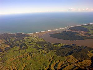
From Mercer, where the Mangatawhiri River joins, the Waikato flows west and southwest. Just before it reaches the Tasman Sea at Port Waikato, the Araroa River joins from the north. Many small islands are found in the river's delta as it flows through low-lying, swampy land between Meremere and the coast. The largest of these is Motutieke Island.
In the past, the Waikato River sometimes changed its path. It used to flow north through the Hinuera Gap into the Firth of Thames and then into the Hauraki Gulf / Tīkapa Moana. The last time this happened was about 20,000 years ago. The river's current path was largely formed after a huge eruption of the Taupō Volcano around 180 AD.
How People Use the River
The Waikato River is a valuable resource for water and recreation. Historically, it was also a very important way for communities along its banks to travel and communicate. It once took about three days to paddle a waka (Māori canoe) from Waiuku to the Cambridge/Te Awamutu area. Many towns are located on or near the river, including Taupō, Hamilton, and Huntly. In Hamilton, the Waikato River is often used by rowers, kayakers, and people enjoying boat rides. Water-skiers and jet skis have special areas outside the city where they can be used.
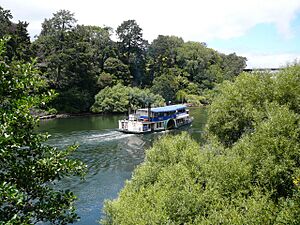
The river was also important during historical events in the 1860s. It was used to transport people and supplies. New Zealand even created its first "navy," called the Waikato Flotilla, to operate on the river. The remains of an old paddle steamer, the Rangiriri, can still be seen in Hamilton. A cemetery with graves from these historical events is located at Rangiriri.
Generating Electricity
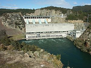
The Waikato River is a major source of electricity for New Zealand. Its first hydro-electric power station was Horahora, which is now underwater beneath Lake Karapiro. Horahora was built to provide electricity for the gold mines at Waihi.
Today, the river has a series of eight dams and nine hydroelectric power stations. These were built between 1929 and 1971 to meet the country's growing need for electricity. The power system starts at Lake Taupō, where special gates control how much water flows into the river. It takes over 18 hours for the water to travel from Lake Taupō to the last power station at Karapiro. Along its journey, the water passes through power stations at Aratiatia, Ohakuri, Atiamuri, Whakamaru, Maraetai, Waipapa, Arapuni, and Karapiro.
These power stations generate about 4000 gigawatt hours of electricity each year. This is about 13% of all the electricity produced in New Zealand!
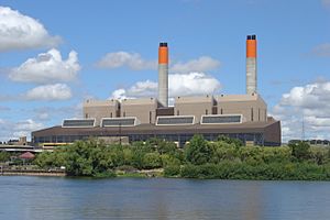
The river also provides cooling water for the Huntly Power Station, which burns coal and natural gas to make electricity. This station uses river water to cool its old steam units, and then returns warm water to the river. To protect the environment, there are rules about how much water can be used and how warm the water can be when it goes back into the river (no more than 25°C or 77°F). In 2006, a cooling tower was added to the Huntly Power Station. This helps one of its units run at full power even on very hot days.
Drinking Water Supply
After a big drought in 1994, people started thinking about using the Waikato River to supply drinking water for Auckland. In July 2002, a water treatment plant opened at Tuakau. This plant was made bigger in 2021 after more droughts in 2020.
Since 2002, about 75 million litres (20 million US gallons) of water each day have been taken from the river at Tuakau. This water is treated and then pumped through a 38-kilometre (24-mile) pipe north to Auckland, where it is mixed with local water. In 2010/11, this supply met 8% of Auckland's water needs. The amount of water taken was increased to 125 million litres (33 million US gallons) in December 2012, and work began in 2013 to increase it to 150 million litres (40 million US gallons). The treatment plant makes sure the water meets New Zealand's drinking water standards.
Fun and Recreation
The lower part of the Waikato River is a popular spot for waterfowl hunting.
Boating and Water Sports
The Waikato River is famous among whitewater kayaking fans, especially for the "Full James" rapid north of Taupō. This rapid was even the location for the 1999 World Whitewater Championships!
Lake Karapiro (a man-made lake) is considered one of New Zealand's best places for rowing. It hosted the World Rowing Championships in 1978 and 2010, and the 1950 British Empire Games.
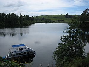
The part of the river that flows through Hamilton is very busy with different kinds of boats. Many schools and clubs use rowing boats. Rowing races are also held here. Jet skis are usually kept to areas outside the city because of their noise. Power boats are often seen on the river, especially in summer, as manufacturers test and show off new boats. You can also spot many kayaks and traditional waka.
There are many public boat ramps along the river, managed by local councils. These ramps allow people to easily launch their boats for fun on the water.
River Cruises
For many years, a ferry service operated along parts of the river. Caesar Roose was a well-known person who ran these services. He brought the 400-passenger steamer Manuwai from the Whanganui in 1920. In 1924, trips from Cambridge to Port Waikato were offered a few times a year, taking 12 to 14 hours downstream. The Manuwai sank in 1938 but was later repaired and turned into a barge. Some old steamers, like the Manuwai, Rawhiti, and Freetrader, can still be found under or beside the river near Mercer. To make it easier for boats to travel, rocks in the Narrows at Tamahere were removed in 1919.
Today, public cruises run from Aratiatia to Huka Falls, and across the river to Orakei Korako. You can also take cruises from Hamilton Gardens to Mystery Creek and Fairfield Bridge. Since 2009, cruises have also operated from Tuakau to Port Waikato. A ferry service started in Hamilton in July 2021, connecting different parts of the city, but it stopped operating in September 2022.
Cycle and Walk Trails
Three popular trails follow parts of the Waikato River, perfect for walking or cycling.
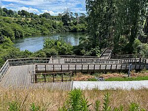
The Waikato River Trails are a 100-kilometre (62-mile) series of connected trails in the South Waikato. These trails are open to both walkers and cyclists and run between Lake Karapiro and Aratiatia. They first opened in 2011.
The Te Awa River Ride stretches for 65 kilometres (40 miles) along the river. It starts near Horahora, close to the end of the Waikato River Trails, and goes through Cambridge and Hamilton to Ngāruawāhia. The section between Cambridge and Hamilton opened on 9 December 2022. North of AFFCO at Horotiu, the route includes a 140-metre (150-yard) long cable arch bridge, which opened in November 2017.
Te Araroa, which is a long walkway that runs the entire length of New Zealand, follows the Waikato River for most of its 80-kilometre (50-mile) journey between Mercer and Hamilton.
River Life and Environment
Species Living in the River
The Waikato River and its man-made lakes are home to at least 19 types of native fish and 10 types of fish that have been introduced by people. The introduced fish include rainbow and brown trout, which make the river a famous spot for fly-fishing. However, some other introduced species, like the carp and mosquitofish, have become pests.
Environmental Challenges
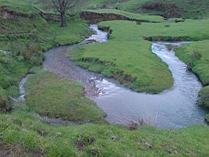
The large area that drains into the Waikato River is very fertile farmland, so there is a lot of farming activity. Because of this farming, some pollution from farms washes into the ground and the river. The way nitrogen fertilizer and farm waste are managed on dairy farms is a main cause of this pollution. Since 2000, Environment Waikato has worked with farmers to use fertilizers more efficiently and scientifically.
When native plants were removed to create more farmland, it caused soil to wash into the river, making it silty. However, most of the silting today is due to the many dams built for hydroelectric power. Before the 1930s, when the river was wilder, floods each winter would naturally clear out the silt.
Arsenic, a natural chemical, is found in some parts of the river. It can reach levels that are too high for drinking water without special treatment. Most of the arsenic in the Waikato River comes from the Wairakei Geothermal Power Station. The amount of arsenic slowly decreases as the river flows north.
Treated human waste from several towns is also released into the river. Hamilton city has very modern water treatment systems. After a report in 2003, $22 million was spent to upgrade the city's water intake station. New rules were put in place to stop harmful substances from factories and landfills from entering the river system.
See also
 In Spanish: Río Waikato para niños
 | Delilah Pierce |
 | Gordon Parks |
 | Augusta Savage |
 | Charles Ethan Porter |


