Lake Rotoaira facts for kids
Quick facts for kids Lake Rotoaira |
|
|---|---|
 |
|
| Location | South of Lake Taupo on the North Island Volcanic Plateau, Taupo District, Waikato region |
| Coordinates | 39°03′16″S 175°42′51″E / 39.0545°S 175.7143°E |
| Lake type | natural lake |
| Primary outflows | Poutu Stream |
| Basin countries | New Zealand |
| Surface area | 13 km2 (5.0 sq mi) |
| Max. depth | ca. 14 m (46 ft) |
| Surface elevation | 564 m (1,850 ft) |
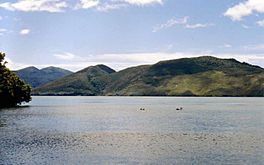
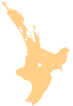
Lake Rotoaira is a small lake in New Zealand. You can find it south of Lake Taupo on the North Island Volcanic Plateau. This lake covers an area of about 13 square kilometers.
Discovering Lake Rotoaira
Lake Rotoaira is quite special. It is one of the few lakes in New Zealand that is privately owned. The Lake Rotoaira Trust looks after the lake for its owners. If you want to fish or do other activities on the lake, you need to get a special permit first.
How the Lake Was Formed
The lake sits in a special type of valley called a graben. This valley is located between two large volcanoes. To the south is the wide Mount Tongariro. To the northwest is the smaller volcano called Pihanga. Normally, water flows out of Lake Rotoaira through a stream called the Poutu Stream. This stream then flows into the Tongariro River.
Powering New Zealand
Lake Rotoaira is also an important part of the Tongariro Power Scheme. This project uses the lake to store water. The water is then used to create electricity at the Tokaanu Hydropower Station. Engineers did a lot of work to make this happen. They changed the paths of several streams, including the Whanganui River. These streams now flow into Lake Rotoaira through another lake called Otamangakau Hydro Lake.
They also built a long tunnel through the Pihanga volcano. This tunnel carries water from Lake Rotoaira to the Tokaanu Power Station. Because of these changes, the Poutu Stream outlet was dammed. This created Motuopuhi island, which used to be a part of the land connected to the shore.
 | Misty Copeland |
 | Raven Wilkinson |
 | Debra Austin |
 | Aesha Ash |


