
Lamothe-Landerron facts for kids
Quick facts for kids
Lamothe-Landerron
|
|
|---|---|
 |
|

Lamothe-Landerron
Location in France

Lamothe-Landerron
Location in Nouvelle-Aquitaine
|
|
| Country | France |
| Region | Nouvelle-Aquitaine |
| Department | Gironde |
| Arrondissement | Langon |
| Canton | Le Réolais et Les Bastides |
| Intercommunality | Réolais |
| Area
1
|
9.18 km2 (3.54 sq mi) |
| Population
(Jan. 2019)
|
1,166 |
| • Density | 127.02/km2 (329.0/sq mi) |
| Time zone | UTC+01:00 (CET) |
| • Summer (DST) | UTC+02:00 (CEST) |
| INSEE/Postal code |
33221 /33190
|
| Elevation | 15–106 m (49–348 ft) (avg. 21 m or 69 ft) |
| 1 French Land Register data, which excludes lakes, ponds, glaciers > 1 km2 (0.386 sq mi or 247 acres) and river estuaries. | |
Lamothe-Landerron is a small town, also called a commune, located in the southwest of France. It is part of the Gironde department within the Aquitaine region.
Contents
About Lamothe-Landerron
Lamothe-Landerron is a typical French commune. A commune is the smallest local government area in France. Think of it like a town or a village with its own local council.
Location and Size
This commune is found in the Langon area. It is also part of the Le Réolais et Les Bastides canton. A canton is a group of communes. Lamothe-Landerron covers an area of about 9.18 square kilometers. That's roughly 3.5 square miles.
Population Details
As of January 2019, Lamothe-Landerron had a population of 1,166 people. This number helps us understand how many people live in the commune. The population information is collected by the National Institute of Statistics and Economic Studies.
Local Government
Like all communes in France, Lamothe-Landerron has a mayor. The mayor is the head of the local government. They are responsible for managing the town's daily life. This includes things like public services and local projects. Michel Despujol served as mayor from 2008 to 2014. The town also works with other nearby communes. This is called intercommunality. Lamothe-Landerron is part of the Réolais intercommunality.
Geography and Landscape
The land in Lamothe-Landerron varies in height. The lowest point is 15 meters above sea level. The highest point reaches 106 meters. The average height of the commune is 21 meters. This shows that the area has some gentle hills.
Images for kids
-
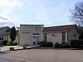
The Mairie (town hall) of Lamothe-Landerron.
See also
 In Spanish: Lamothe-Landerron para niños
