Langston, Alabama facts for kids
Quick facts for kids
Langston, Alabama
|
|
|---|---|

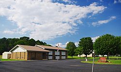
Langston Town Hall
|
|

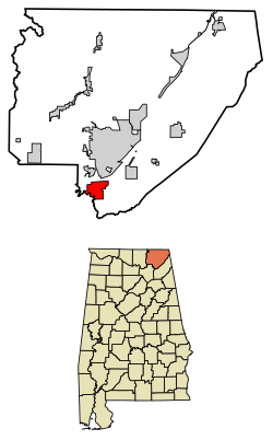
Location of Langston in Jackson County, Alabama.
|
|
| Country | United States |
| State | Alabama |
| County | Jackson |
| Area | |
| • Total | 8.24 sq mi (21.35 km2) |
| • Land | 4.92 sq mi (12.76 km2) |
| • Water | 3.32 sq mi (8.60 km2) |
| Elevation | 630 ft (192 m) |
| Population
(2020)
|
|
| • Total | 265 |
| • Density | 53.81/sq mi (20.77/km2) |
| Time zone | UTC-6 (Central (CST)) |
| • Summer (DST) | UTC-5 (CDT) |
| ZIP code |
35755
|
| Area code(s) | 256 |
| FIPS code | 01-41368 |
| GNIS feature ID | 0151989 |
Langston is a small town located in Jackson County, Alabama, in the United States. It is part of a larger area that includes cities like Chattanooga. In 2020, about 265 people lived here.
Langston first became an official town in 1899. After 1920, it stopped being an official town for a while. Then, in 1980, it became an official town again. Its largest population was 500 people in 1920.
Contents
Discover Langston's Past
Langston was first settled in the 1810s. It was originally called "Coffeetown." This name came from the Coffee brothers, who were some of the first people to settle there.
How Langston Got Its Name
In 1845, a post office was opened in Coffeetown. The first postmaster was a man named Langston Coffee. Later, in 1869, many people from Coffeetown moved to Texas. The next year, a man named James Morgan sold land to create a new town. This new town was named "Langston" in honor of Langston Coffee.
Langston's River Port Days
Langston used to be a very busy place. It was a river port along the Tennessee River. This meant boats could easily bring goods in and out. The town grew to have nine stores and even a blacksmith shop.
Changes Over Time
Over time, things changed. Trains became more popular for moving goods, and then cars came along. This meant people didn't rely on river travel as much. Langston started to become less busy. In the late 1930s, the Tennessee Valley Authority built the Guntersville Dam. This dam caused a large part of Langston to be flooded, which made its population even smaller.
Exploring Langston's Location
Langston is found right on the eastern side of the Tennessee River. This part of the river is actually a big lake called Guntersville Lake. This lake was formed by the Guntersville Dam, which is about 30 miles (48 km) downstream.
Nearby Natural Features
Right to the east of Langston, you can see Sand Mountain rising up. Across the river to the north is the town of Scottsboro. If you go up Sand Mountain to the northeast, you'll find the town of Section.
Size of the Town
The town of Langston covers a total area of about 8.3 square miles (21.35 square kilometers). About 5.0 square miles (12.76 square kilometers) of this is land. The rest, about 3.2 square miles (8.60 square kilometers), is water. This means a good portion of the town's area is covered by water from the Tennessee River.
Population of Langston
The population of Langston has changed over the years. Here's a quick look at how many people have lived there:
| Historical population | |||
|---|---|---|---|
| Census | Pop. | %± | |
| 1900 | 270 | — | |
| 1910 | 314 | 16.3% | |
| 1920 | 500 | 59.2% | |
| 1990 | 207 | — | |
| 2000 | 254 | 22.7% | |
| 2010 | 270 | 6.3% | |
| 2020 | 265 | −1.9% | |
| U.S. Decennial Census | |||
In 2000, there were 254 people living in Langston. Most of the people living in Langston were White (94.09%). There were also some Black or African American residents (3.15%) and Native American residents (2.76%).
The average age of people in Langston in 2000 was 46 years old. About 19.3% of the population was under 18 years old. About 16.9% of the population was 65 years or older.
See Also
- Langston (Alabama) para niños (Langston (Alabama) for children in Spanish)
 | Aaron Henry |
 | T. R. M. Howard |
 | Jesse Jackson |

