Jackson County, Alabama facts for kids
Quick facts for kids
Jackson County
|
|||
|---|---|---|---|
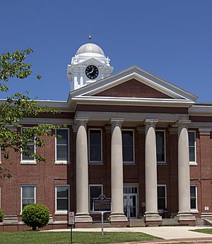
Jackson County Courthouse in Scottsboro
|
|||
|
|||
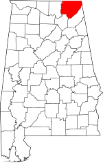
Location within the U.S. state of Alabama
|
|||
 Alabama's location within the U.S. |
|||
| Country | |||
| State | |||
| Founded | December 13, 1819 | ||
| Named for | Andrew Jackson | ||
| Seat | Scottsboro | ||
| Largest city | Scottsboro | ||
| Area | |||
| • Total | 1,127 sq mi (2,920 km2) | ||
| • Land | 1,078 sq mi (2,790 km2) | ||
| • Water | 49 sq mi (130 km2) 4.3% | ||
| Population
(2020)
|
|||
| • Total | 52,579 | ||
| • Estimate
(2023)
|
53,467 |
||
| • Density | 46.654/sq mi (18.013/km2) | ||
| Time zone | UTC−6 (Central) | ||
| • Summer (DST) | UTC−5 (CDT) | ||
| Congressional district | 5th | ||
|
|||
Jackson County is a county located in the northeastern part of Alabama, a state in the United States. As of the 2020 census, about 52,579 people lived there. The main city and county seat is Scottsboro.
The county was named after Andrew Jackson, who was a famous general in the United States Army and later became a U.S. President. Jackson County is known for being a "dry county," which means alcohol sales are generally not allowed. However, three cities within the county – Bridgeport, Scottsboro, and Stevenson – are "wet," meaning they do allow alcohol sales.
Jackson County is part of the Scottsboro, AL Micropolitan Statistical Area. It's also included in the larger Chattanooga–Cleveland–Dalton combined statistical area. A very important place in the county is Russell Cave National Monument. This is an archaeological site that shows people lived there for about 8,000 years!
Contents
History
Jackson County was created on December 13, 1819. This happened after the U.S. government made a treaty with the Cherokee people. The treaty meant the Cherokee moved from the area, and their land claims were settled.
The county has many hills and mountains, which are part of the Appalachians. This kind of land was not good for large farms called plantations, which were common in other parts of Alabama. Because of this, most families in Jackson County had smaller farms to grow food for themselves. Few families owned enslaved people. For example, in 1860, the county seat, Bellefonte, Alabama, had no enslaved people recorded.
Many rivers and waterways flow through Jackson County. The most important one is the Tennessee River, which drains much of the county. The current county seat, Scottsboro, grew up along this river. It also became a railroad stop when trains came to the area.
In the early 1900s, people started using water power to create electricity for factories. By the middle of the 1900s, factories and other industries became more important than farming for the county's economy.
Geography
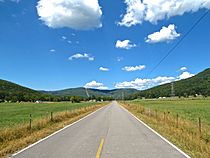
Jackson County covers about 1,127 square miles. Most of this area, about 1,078 square miles, is land. The rest, about 49 square miles, is water. It is the fifth-largest county in Alabama by total area. A big part of the county is located in the Appalachians mountain range.
One very special place is Russell Cave National Monument. It's located near the town of Bridgeport. Experts believe it has "one of the most complete records of prehistoric culture in the southeast United States." President John F. Kennedy made Russell Cave a National Monument in May 1961. The land, about 310 acres, was given by the National Geographic Society.
The cave is an important place for archaeologists, who study human history through digging up old things. The Smithsonian Institution and the National Geographic Society explored it in 1956. The National Geographic Magazine even wrote an article about it, titled "Life 8,000 Years Ago Uncovered in an Alabama Cave." They found proof that people lived in the cave from about 6200 B.C. to A.D. 1650.
Adjacent counties
Jackson County shares borders with several other counties:
- Marion County, Tennessee – to the northeast
- Dade County, Georgia – to the east
- DeKalb County – to the southeast
- Marshall County – to the southwest
- Madison County – to the west
- Franklin County, Tennessee – to the northwest
National protected areas
These are special areas in Jackson County that are protected by the government:
- Fern Cave National Wildlife Refuge
- Russell Cave National Monument
- Sauta Cave National Wildlife Refuge
Demographics
Jackson County's population has changed over time. In 1820, there were about 8,751 people. By 2020, the population had grown to 52,579 people. The most recent estimate for 2023 suggests the population is around 53,467.
Most people in Jackson County are White. In 2020, about 85.82% of the population was White (not Hispanic or Latino). Other groups include Black or African American (3.09%), Native American (1.29%), and Asian (0.41%). About 5.98% of people identified as having mixed races. People of Hispanic or Latino background made up about 3.20% of the population.
In 2020, there were 20,695 households and 14,456 families living in the county.
Transportation
Jackson County has several important roads and railways that help people and goods move around.
Major highways
Rail
Trains also run through Jackson County on these railway lines:
- CSX Transportation
- Norfolk Southern Railway
- Sequatchie Valley Railroad
Communities
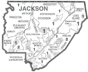
Jackson County has several cities, towns, and smaller communities.
Cities
- Bridgeport
- Scottsboro (this is the county seat)
- Stevenson
Towns
Unincorporated communities
These are smaller communities that are not officially organized as cities or towns:
Ghost towns
These are towns that used to exist but are now abandoned:
See also
 In Spanish: Condado de Jackson (Alabama) para niños
 | George Robert Carruthers |
 | Patricia Bath |
 | Jan Ernst Matzeliger |
 | Alexander Miles |


