Langston, Oklahoma facts for kids
Quick facts for kids
Langston, Oklahoma
|
|
|---|---|

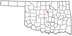
Location of Langston, Oklahoma
|
|
| Country | United States |
| State | Oklahoma |
| County | Logan |
| Area | |
| • Total | 12.40 sq mi (32.12 km2) |
| • Land | 11.99 sq mi (31.06 km2) |
| • Water | 0.41 sq mi (1.06 km2) |
| Elevation | 955 ft (291 m) |
| Population
(2020)
|
|
| • Total | 1,619 |
| • Density | 135.00/sq mi (52.12/km2) |
| Time zone | UTC-6 (Central (CST)) |
| • Summer (DST) | UTC-5 (CDT) |
| ZIP code |
73050
|
| Area code(s) | 405/572 |
| FIPS code | 40-41550 |
| GNIS feature ID | 2412877 |
Langston is a small town in Logan County, Oklahoma, in the United States. It is part of the larger Oklahoma City area. In 2020, about 1,619 people lived there. Langston is famous for being home to Langston University. This is the only historically black college in Oklahoma.
Contents
History of Langston
Langston was started on April 22, 1890. It was founded by Edward P. McCabe, a Black American leader from Kansas. McCabe helped many Black settlers move from southern U.S. states. They hoped to escape unfair treatment by creating a mostly Black state in what was then the Oklahoma Territory.
He named the town after John Mercer Langston. John Langston was a Black member of the U.S. Congress from Virginia. McCabe used traveling salespeople and African-American newspapers to sell land in Langston. The rules for buying land said that it could only be sold again to other African Americans.
Langston was one of about 50 "all-black towns" created in Oklahoma. These towns were formed between 1865 and 1920.
Early Growth of the Town
By 1891, Langston had about 200 people. This included a preacher, a doctor, and a schoolteacher. By 1892, the town had 25 businesses, a bank, and a public school. A Roman Catholic church was built in 1893. The town even had a telephone system by 1895.
In 1897, the Oklahoma government created the Colored Agricultural and Normal University at Langston. This school later became Langston University.
Where is Langston?
Langston is about 11 miles (18 km) northeast of Guthrie. Guthrie is the main city in Logan County. Langston is located right on State Highway 33.
The United States Census Bureau says the town covers about 1.9 square miles (4.9 km2). All of this area is land.
People of Langston
| Historical population | |||
|---|---|---|---|
| Census | Pop. | %± | |
| 1900 | 251 | — | |
| 1910 | 339 | 35.1% | |
| 1920 | 259 | −23.6% | |
| 1930 | 351 | 35.5% | |
| 1940 | 514 | 46.4% | |
| 1950 | 685 | 33.3% | |
| 1960 | 136 | −80.1% | |
| 1970 | 486 | 257.4% | |
| 1980 | 443 | −8.8% | |
| 1990 | 1,471 | 232.1% | |
| 2000 | 1,670 | 13.5% | |
| 2010 | 1,724 | 3.2% | |
| 2020 | 1,619 | −6.1% | |
| U.S. Decennial Census | |||
Population in 2020
The table below shows the different groups of people living in Langston in 2010 and 2020. The U.S. Census counts Hispanic/Latino people separately. This means they can be of any race.
| Race / Ethnicity (NH = Non-Hispanic) | Pop 2010 | Pop 2020 | % 2010 | % 2020 |
|---|---|---|---|---|
| White alone (NH) | 44 | 154 | 2.55% | 9.51% |
| Black or African American alone (NH) | 1,592 | 1,259 | 92.34% | 77.76% |
| Native American or Alaska Native alone (NH) | 13 | 81 | 0.75% | 5.00% |
| Asian alone (NH) | 7 | 12 | 0.41% | 0.74% |
| Pacific Islander alone (NH) | 2 | 2 | 0.12% | 0.12% |
| Other race alone (NH) | 1 | 2 | 0.06% | 0.12% |
| Mixed race or Multiracial (NH) | 30 | 67 | 1.74% | 4.14% |
| Hispanic or Latino (any race) | 35 | 42 | 2.03% | 2.59% |
| Total | 1,724 | 1,619 | 100.00% | 100.00% |
Historic Places to See
Langston has three places listed on the National Register of Historic Places. These are important sites that are protected.
- The Langston University Cottage Row Historic District: This area is on the southwest side of the Langston University campus.
- The Morris House: You can find this house at 221 Tolson Blvd.
- The Ozark Trails-Indian Meridian Obelisk: This monument is where Logan and East Washington avenues meet.
See also
 In Spanish: Langston (Oklahoma) para niños
 | Bessie Coleman |
 | Spann Watson |
 | Jill E. Brown |
 | Sherman W. White |

