Larder Lake facts for kids
Quick facts for kids Larder Lake |
|
|---|---|
 |
|
| Location | Timiskaming District, Ontario |
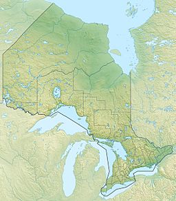
| Coordinates | 48°05′07″N 79°38′32″W / 48.08528°N 79.64222°W |
| Type | Lake |
| Part of | Saint Lawrence River drainage basin |
| Primary outflows | Larder River |
| Basin countries | Canada |
| Max. length | 12.5 kilometres (7.8 mi) |
| Max. width | 6.3 kilometres (3.9 mi) |
| Surface elevation | 274 metres (899 ft) |
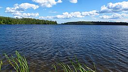
Larder Lake is a freshwater lake located in the Timiskaming District of Ontario, Canada. It's in the northeastern part of Ontario. This lake is special because it sits across two townships: Larder Lake and McGarry. It's also the starting point for the Larder River. All its water eventually flows into the Saint Lawrence River.
Contents
Exploring Larder Lake's Geography
Larder Lake has a unique shape, almost like a hand with fingers. It has two large "arms" called Southwest Arm and Northeast Arm. There are also four smaller areas known as bays. These bays are Fitzpatrick Bay, Dublin Bay, Northwest Bay, and Spoon Bay.
Islands and Peninsulas
A long piece of land, called a peninsula, stretches about 5.5 kilometers into the middle of the lake. This peninsula helps divide the lake into two main parts. You can also find a few islands in Larder Lake. The biggest ones are Big Pete Island, Island CC, and Island U.
Water Flow: Inflows and Outflows
Larder Lake gets its water from five main streams. These are Sharp Creek, Benson Creek, Pancake Creek, Bear Creek, and Milky Creek. The water then flows out of the lake through the Larder River. This river connects to the Blanche River, which then flows into Lake Timiskaming. From there, the water travels down the Ottawa River and finally reaches the Saint Lawrence River.
Nearby Communities
Several communities are located around Larder Lake. The town of Larder Lake sits on the northwest side of Spoon Bay. Other communities, like Virginiatown and Kearns, are found near the northeast end of the Northeast Arm. These are part of the McGarry township.
Roads Around the Lake
You can easily reach Larder Lake by car. Ontario Highway 66 runs along the north side of the lake, going from east to west. Ontario Highway 624 travels along the west side of the lake, going from north to south.
Economy and Activities
The main activities around Larder Lake are related to nature. People work in forestry, which means managing forests and cutting trees. Tourism is also very important. Many visitors come to the lake for fun activities like fishing, boating, and enjoying the outdoors.
Climate and Seasons
Larder Lake experiences cold winters. The surface of the lake usually freezes over from the middle of November until the end of April. However, it's generally safe to walk or play on the ice from mid-December to mid-April.
 | Georgia Louise Harris Brown |
 | Julian Abele |
 | Norma Merrick Sklarek |
 | William Sidney Pittman |


