Las Lajas, Neuquén facts for kids
Quick facts for kids
Las Lajas
|
|
|---|---|
|
Town
|
|
| Country | |
| Province | Neuquén Province |
| Department | Picunches Department |
| Founded | 8 February 1987 |
| Elevation | 703 m (2,306 ft) |
| Population
(2001 census [INDEC])
|
|
| • Total | 4,078 |
| Time zone | UTC−3 (ART) |
| CPA Base |
B 8347
|
| Area code(s) | +54 02942 |
| Website | www.laslajas.gov.ar |
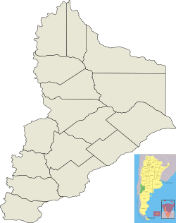
Las Lajas means "The Flagstones" in Spanish. It is a town in Neuquén Province, Argentina. It is also the main town of the Picunches Department.
The town is located at the foot of the Andes mountains, next to the Agrio River. It sits about 703 metres (2,306 ft) above sea level. Two important roads, National Routes 22 and 40, meet here. Close by, about 10 kilometres (6.2 mi) away, is the Cuchillo Curá mountain range. This area has the most important underground cave system in Argentina.
Long ago, before the Araucanization of Patagonia, the Pehuenche and Picunche native people lived in this area. The first explorers arrived in 1788. Later, in 1882, the Argentinian Army built a fort here. The town of Las Lajas was officially started on February 8, 1897. It was named after a nearby creek, Las Lajitas, which has many flat stones (flagstones) in its bed.
Today, growing animal feed, like alfalfa, is the biggest farming activity in Las Lajas. The town is also home to a part of the Argentinian Army. The opening of the Pino Hachado Pass, a route to Chile, has brought more visitors and trade to the town.
Contents
History of Las Lajas
The area around Las Lajas has been lived in for a very long time. Archeologists have found signs that people were here about 4,500 years ago. Before the Araucanization of Patagonia, the Picunche and Pehuenches native groups lived in this part of Neuquén Province.
In 1788, the first group of explorers came to the Las Lajas area. They traveled 2,000 kilometres (1,243 mi) from Mendoza. Around 1882, the Argentinian army built its first fort here. A postal office opened in 1886, and the telegraph arrived a year later.
On February 8, 1897, General Enrique Godoy officially started the town. It became the base for two cavalry regiments of the Argentinian Army. These soldiers were there to protect the new settlers and control the region. The town was named Las Lajas because of the many flat stones found in the nearby Las Lajitas creek.
Two years later, a big flood from the Agrio River destroyed the town. It had to be rebuilt on higher ground. In 1903, some people wanted to make Las Lajas the capital of the National Territory. They thought it was easier to reach than the old capital, Chos Malal. However, the capital was moved to Neuquén City instead.
In 1967, Las Lajas became a second-category municipality. This means it gained more local government power. In the late 1990s, the local army base closed, which hurt the town's economy. But it reopened in 2004, helping businesses recover.
Geography and Location
Las Lajas is located on the right side of the Agrio River, near the Andes mountains. It's where National Route 22 and National Route 40 meet. The Pino Hachado Pass, a route connecting Argentina and Chile, is about 52 kilometres (32 mi) west of the town.
Las Lajas is 58 kilometres (36 mi) from Zapala, 242 kilometres (150 mi) from Neuquén City, and 1,455 kilometres (904 mi) from Buenos Aires. The town is about 703 metres (2,306 ft) above sea level. The soil in the area is not very rich. Besides the Agrio River, the Las Lajitas and Liu Cullín Creeks also flow nearby.
Climate and Weather
Las Lajas has a dry climate. It gets about 311 millimetres (12 in) of rain each year, with more rain in the winter. The air is usually more humid in winter and drier in summer.
Even though it's at the same latitude as Neuquén City, Las Lajas is higher up and colder. Average temperatures range from 14 °C (57 °F) in January to 0 °C (32 °F) in July. The temperature can change a lot between day and night, especially in summer. The highest temperature ever recorded was around 40 °C (104 °F) in summer, and the lowest was about −16 °C (3 °F) in winter.
Winds in Las Lajas can be moderate to strong, mainly coming from the west, northwest, and southwest. The sky is often cloudy in winter (up to 60%) and clearer in summer (about 30%).
| Climate data for Las Lajas, Neuquén (1901–1970) | |||||||||||||
|---|---|---|---|---|---|---|---|---|---|---|---|---|---|
| Month | Jan | Feb | Mar | Apr | May | Jun | Jul | Aug | Sep | Oct | Nov | Dec | Year |
| Record high °C (°F) | 39.2 (102.6) |
40.0 (104.0) |
37.0 (98.6) |
33.0 (91.4) |
30.5 (86.9) |
25.6 (78.1) |
24.2 (75.6) |
29.5 (85.1) |
32.4 (90.3) |
33.1 (91.6) |
37.6 (99.7) |
39.7 (103.5) |
40.0 (104.0) |
| Mean daily maximum °C (°F) | 28.9 (84.0) |
28.3 (82.9) |
25.2 (77.4) |
20.8 (69.4) |
15.7 (60.3) |
11.8 (53.2) |
11.8 (53.2) |
13.6 (56.5) |
16.7 (62.1) |
20.7 (69.3) |
24.2 (75.6) |
26.8 (80.2) |
20.4 (68.7) |
| Daily mean °C (°F) | 19.7 (67.5) |
18.5 (65.3) |
15.6 (60.1) |
11.4 (52.5) |
7.8 (46.0) |
5.0 (41.0) |
4.8 (40.6) |
4.7 (40.5) |
7.0 (44.6) |
12.0 (53.6) |
15.5 (59.9) |
18.1 (64.6) |
11.7 (53.1) |
| Mean daily minimum °C (°F) | 10.5 (50.9) |
9.0 (48.2) |
6.7 (44.1) |
3.2 (37.8) |
1.2 (34.2) |
−0.5 (31.1) |
−1.3 (29.7) |
−0.6 (30.9) |
1.1 (34.0) |
3.6 (38.5) |
6.6 (43.9) |
9.0 (48.2) |
4.0 (39.2) |
| Record low °C (°F) | −2.4 (27.7) |
−1.3 (29.7) |
−6.9 (19.6) |
−10.2 (13.6) |
−11.5 (11.3) |
−16.0 (3.2) |
−15.8 (3.6) |
−13.2 (8.2) |
−11.6 (11.1) |
−7.3 (18.9) |
−4.5 (23.9) |
−3.0 (26.6) |
−16.0 (3.2) |
| Average precipitation mm (inches) | 9.2 (0.36) |
8.1 (0.32) |
9.9 (0.39) |
16.6 (0.65) |
34.5 (1.36) |
37.8 (1.49) |
30.6 (1.20) |
26.0 (1.02) |
15.9 (0.63) |
12.1 (0.48) |
8.9 (0.35) |
7.4 (0.29) |
217.0 (8.54) |
| Average rainy days | 0.8 | 1.0 | 1.5 | 2.5 | 4.0 | 4.5 | 4.0 | 3.0 | 2.0 | 1.5 | 1.5 | 0.6 | 26.9 |
| Average snowy days | 0 | 0 | 0 | 0 | 0.4 | 0.6 | 0.2 | 0.3 | 0.2 | 0 | 0 | 0 | 1.7 |
| Average relative humidity (%) | 46.3 | 47.8 | 50.8 | 59.3 | 66.5 | 71.5 | 71.5 | 68.8 | 61.0 | 54.5 | 49.5 | 47.0 | 57.9 |
| Mean monthly sunshine hours | 330 | 284 | 254 | 220 | 152 | 133 | 162 | 194 | 205 | 255 | 283 | 333 | 2,804 |
| Percent possible sunshine | 73 | 75 | 66 | 66 | 49 | 47 | 54 | 59 | 58 | 63 | 66 | 72 | 62 |
| Source 1: Instituto Nacional de Tecnología Agropecuaria, Secretaria de Mineria (humidity 1901–1970) | |||||||||||||
| Source 2: FAO (sun only), UNLP (snowfall data) | |||||||||||||
Amazing Cave Systems
The Cuchillo Curá mountain range is about 10 kilometres (6 mi) from Las Lajas. It's about 900 metres (2,953 ft) above sea level. This area has the most important underground cave system in Argentina. The system includes caves like El Gendarme, El Templo, El Arenal, and Los Cabritos. Together, their passages cover an area of 4,800 square metres (52,000 sq ft).
Another important cave is the Cueva del León, located about 15 kilometres (9 mi) from town. It formed in plaster rock during the Late Jurassic period. This cave is 631 metres (2,070 ft) long and has two main rooms: the "Great Chamber" and the "Chamber of the Lake."
Population of Las Lajas
In 1991, about 3,428 people lived in Las Lajas. By 2001, the population grew to 4,673. In 2010, it was estimated that about 4,673 people lived in the town permanently. If you include people who don't live there all the time, the number could go up to 7,000.
Economy and Jobs
The biggest farming activity in Las Lajas is growing fodder, which is food for animals. The area is known for its high-quality grass, especially alfalfa.
In the late 1990s, the Argentinian Army's 21 Mountain Infantry base closed. This caused many businesses to shut down and people to move away. But in 2004, the base reopened. This brought more people and money back to the town. Even though the base now has fewer soldiers (about 250 in 2011 compared to 1,000 before), it still helps the local economy.
The opening of the Pino Hachado Pass, a road to Chile, has also helped the economy. More vehicles and people now travel through Las Lajas.
The soil in this area hasn't been fully explored for oil and natural gas. Because of this, big oil and gas companies often choose to invest in places they know better, like Loma de La Lata.
The town's economy has also benefited from the CNSA Espacio Lejano deep space station. This station is about 60 km away. Over 300 local people worked to build it. Even though the Chinese staff don't visit the town often, the mayor in 2019, María Espinosa, said the station has been good for the local economy.
Fun Things to Do and See
Las Lajas is a great stop for travelers heading to other tourist spots in the province. Many people pass through on their way to the hot springs in Caviahue-Copahue or to Chile through the Pino Hachado Pass.
The area offers many activities all year round:
- Hiking: Explore the beautiful natural surroundings.
- Fishing: The Agrio River and the Las Lajitas and Liu Cullín creeks are popular spots.
- Camping: You can camp along the river and creek banks.
- Skiing: In winter, you can ski at a nearby snowpark.
The natural areas include an Araucaria forest and the Cuchillo Curá cave system. Las Lajas also has places to stay, like hotels, and services for tourists, such as bars and restaurants.
There are several attractions in Las Lajas itself:
- Local Museum: Located where National Route 22 meets Avenida del Trabajador Street. It shows historical items and old archaeological pieces. Since Las Lajas is a center for speleology (the study of caves), the museum also has photos of the Cuchillo Curá and Cueva del León cave systems.
- Cultural Meetings: In October and November, musicians, poets, painters, and other artists gather for cultural events.
- Grass Festival: Every April, the town holds the Grass Festival. This event celebrates the farmers who grow fodder. You can find local foods and artwork for sale, and enjoy folk music shows at night.
See also
 In Spanish: Las Lajas (Neuquén) para niños


