Lavergne River facts for kids
Quick facts for kids Lavergne |
|
|---|---|

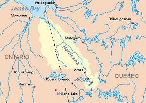
Harricana River basin in yellow
|
|
| Country | Canada |
| Province | Quebec |
| Region | Nord-du-Québec |
| Physical characteristics | |
| Main source | Eeyou Istchee Baie-James (municipality), Quebec 310 m (1,020 ft) 48°57′21″N 79°04′05″W / 48.95583°N 79.06806°W |
| River mouth | Turgeon River (Harricana River) Eeyou Istchee Baie-James (municipality), Nord-du-Québec, Quebec 259 m (850 ft) 49°00′50″N 79°03′53″W / 49.01389°N 79.06472°W |
| Length | 9.9 km (6.2 mi) |
The Lavergne River is a small river in Quebec, Canada. It flows into Lake Turgeon, which is part of the Turgeon River system. The river is located in the Nord-du-Québec region, specifically in the Eeyou Istchee Baie-James municipality.
The main activity in the area around the river is forestry, which means cutting down trees for wood. Tourism, like visiting for fun, is also important.
The Lavergne River usually freezes over from late November until the end of April. It's generally safe to walk or play on the ice from early December to mid-April.
Contents
Where is the Lavergne River?
The Lavergne River is surrounded by other rivers and lakes. Here are some of the nearby water bodies:
- North side: Lake Turgeon, Turgeon River
- East side: Ojima River, Deception Creek
- South side: La Sarre River, Macamic Lake
- West side: Brodeur Creek, Turgeon River, Des Méloizes River
The River's Beginning
The Lavergne River starts from a small forest stream. This source is about 310 meters (1,017 feet) above sea level. It is located:
- About 45.4 kilometers (28.2 miles) east of the border between Ontario and Quebec.
- About 6.5 kilometers (4 miles) south of where it flows into Lake Turgeon.
- About 32.1 kilometers (19.9 miles) north of the town of La Sarre.
How the River Flows
The Lavergne River is about 9.9 kilometers (6.15 miles) long. It flows entirely through a forest area.
- For about 8.7 kilometers (5.4 miles), it flows north.
- Then, for about 1.2 kilometers (0.75 miles), it turns northeast until it reaches its end.
Where the River Ends
The Lavergne River flows into the southern part of Lake Turgeon. This spot is also in a forest area. It is located:
- About 3.3 kilometers (2 miles) south of the main outlet of Lake Turgeon.
- About 39.7 kilometers (24.7 miles) east of the Ontario-Quebec border.
- About 62.2 kilometers (38.6 miles) southwest of the village of Joutel, Quebec.
What's in a Name?
The name "Lavergne" comes from a French family name.
The name "Lavergne River" was officially recognized on December 5, 1968. This was when the Commission de toponymie du Québec (Quebec's place name commission) was created.
 | Charles R. Drew |
 | Benjamin Banneker |
 | Jane C. Wright |
 | Roger Arliner Young |

